
| Memorials | : | 0 |
| Location | : | Trotton, Chichester District, England |
| Coordinate | : | 50.9958840, -0.8096410 |
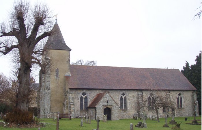
| Description | : | St. George's Church is an Anglican church in Trotton, a village in the district of Chichester The church is dedicated to St. George, patron saint of England.St George's Church was listed at Grade I by English Heritage on 18 June 1959 |
frequently asked questions (FAQ):
-
Where is St. George's Churchyard?
St. George's Churchyard is located at Trotton, Chichester District ,West Sussex ,England.
-
St. George's Churchyard cemetery's updated grave count on graveviews.com?
0 memorials
-
Where are the coordinates of the St. George's Churchyard?
Latitude: 50.9958840
Longitude: -0.8096410


Nearby Cemetories:
1. St. Mary's Churchyard
Chithurst, Chichester District, England
Coordinate: 51.0010121, -0.8007006
2. St. Mary's Churchyard
Iping, Chichester District, England
Coordinate: 51.0000351, -0.7865786
3. St Peters Churchyard Terwick
Rogate, Chichester District, England
Coordinate: 51.0051950, -0.8357230
4. St. James Churchyard
Stedham, Chichester District, England
Coordinate: 50.9962590, -0.7703560
5. St. Bartholomew's Churchyard
Rogate, Chichester District, England
Coordinate: 51.0079500, -0.8503200
6. Dureford Abbey
Rogate, Chichester District, England
Coordinate: 51.0080000, -0.8510000
7. St. Paul's Churchyard
Elsted, Chichester District, England
Coordinate: 50.9720678, -0.8403674
8. Carron Lane Cemetery
Midhurst, Chichester District, England
Coordinate: 50.9857040, -0.7513620
9. St. Andrew's Churchyard
Didling, Chichester District, England
Coordinate: 50.9564810, -0.8126515
10. St Mary Churchyard
Bepton, Chichester District, England
Coordinate: 50.9576460, -0.7837500
11. St. Luke's Churchyard
Linch, Chichester District, England
Coordinate: 51.0404840, -0.7720810
12. St Luke Churchyard
Milland, Chichester District, England
Coordinate: 51.0476460, -0.8243960
13. Easebourne Priory
Easebourne, Chichester District, England
Coordinate: 50.9950335, -0.7258487
14. St Mary Magdelene Churchyard
West Lavington, Chichester District, England
Coordinate: 50.9773640, -0.7311840
15. St Mary and St Gabriel Churchyard
Harting, Chichester District, England
Coordinate: 50.9687680, -0.8845690
16. St Mary and St Gabriel Churchyard
South Harting, Chichester District, England
Coordinate: 50.9687500, -0.8848000
17. St James Churchyard
Heyshott, Chichester District, England
Coordinate: 50.9556210, -0.7238880
18. St Mary Churchyard
Liss, East Hampshire District, England
Coordinate: 51.0453200, -0.8953100
19. Fernhurst Burial Ground
Fernhurst, Chichester District, England
Coordinate: 51.0486080, -0.7220610
20. Petersfield Cemetery
Petersfield, East Hampshire District, England
Coordinate: 51.0096893, -0.9325990
21. St Peter Churchyard
Petersfield, East Hampshire District, England
Coordinate: 51.0031000, -0.9372700
22. West Liss Cemetery
Liss, East Hampshire District, England
Coordinate: 51.0518102, -0.9022678
23. St. Peter's Churchyard
Liss, East Hampshire District, England
Coordinate: 51.0521900, -0.9021700
24. St Lawrence Roman Catholic Church
Petersfield, East Hampshire District, England
Coordinate: 51.0069170, -0.9395500