
| Memorials | : | 0 |
| Location | : | Midhurst, Chichester District, England |
| Coordinate | : | 50.9857040, -0.7513620 |
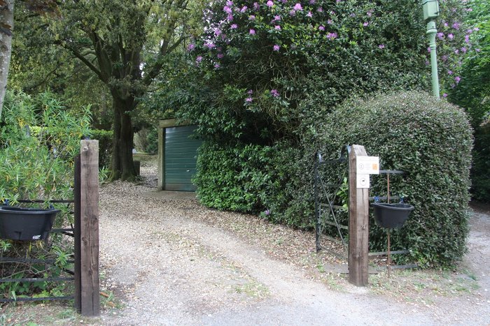
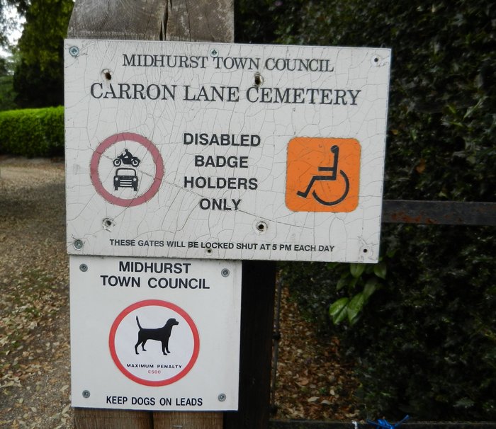
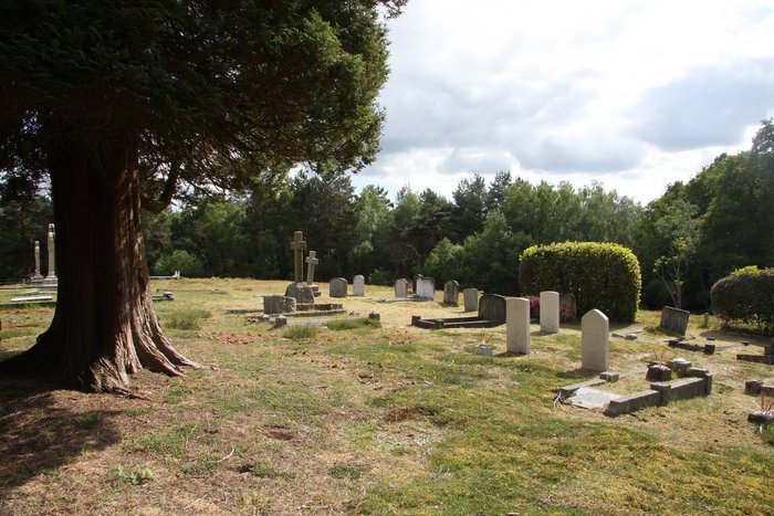
| Description | : | Set in a quiet leafy green area at the top of Carron Lane, adjacent to Midhurst Common, the Cemetery has been used for burials since 1878 and there are now about three and a half thousand recorded burials. Earlier burials in the town will have been in the Parish Churchyard and details of these are held by the West Sussex Record Office. The Cemetery is non denominational and primarily serves the parishioners of Midhurst though non parishioners may apply for an Exclusive Right of Burial. This is on Midhurst Common, it was opened in 1877,formerly Belonged to the Parish Council The Cemetery... Read More |
frequently asked questions (FAQ):
-
Where is Carron Lane Cemetery?
Carron Lane Cemetery is located at Carron Lane Midhurst, Chichester District ,West Sussex ,England.
-
Carron Lane Cemetery cemetery's updated grave count on graveviews.com?
0 memorials
-
Where are the coordinates of the Carron Lane Cemetery?
Latitude: 50.9857040
Longitude: -0.7513620

Nearby Cemetories:
1. St Mary Magdelene Churchyard
West Lavington, Chichester District, England
Coordinate: 50.9773640, -0.7311840
2. St. James Churchyard
Stedham, Chichester District, England
Coordinate: 50.9962590, -0.7703560
3. Easebourne Priory
Easebourne, Chichester District, England
Coordinate: 50.9950335, -0.7258487
4. St. Mary's Churchyard
Iping, Chichester District, England
Coordinate: 51.0000351, -0.7865786
5. St. Mary's Churchyard
Chithurst, Chichester District, England
Coordinate: 51.0010121, -0.8007006
6. St Mary Churchyard
Bepton, Chichester District, England
Coordinate: 50.9576460, -0.7837500
7. St James Churchyard
Heyshott, Chichester District, England
Coordinate: 50.9556210, -0.7238880
8. St. George's Churchyard
Trotton, Chichester District, England
Coordinate: 50.9958840, -0.8096410
9. St. Andrew's Churchyard
Didling, Chichester District, England
Coordinate: 50.9564810, -0.8126515
10. St Peter Churchyard
Lodsworth, Chichester District, England
Coordinate: 50.9968230, -0.6746850
11. St. Luke's Churchyard
Linch, Chichester District, England
Coordinate: 51.0404840, -0.7720810
12. St Peters Churchyard Terwick
Rogate, Chichester District, England
Coordinate: 51.0051950, -0.8357230
13. St. Paul's Churchyard
Elsted, Chichester District, England
Coordinate: 50.9720678, -0.8403674
14. Fernhurst Burial Ground
Fernhurst, Chichester District, England
Coordinate: 51.0486080, -0.7220610
15. St. Bartholomew's Churchyard
Rogate, Chichester District, England
Coordinate: 51.0079500, -0.8503200
16. Dureford Abbey
Rogate, Chichester District, England
Coordinate: 51.0080000, -0.8510000
17. Pitshill Garden of Rest
Tillington, Chichester District, England
Coordinate: 50.9893710, -0.6320950
18. All Hallows Churchyard Extension
Tillington, Chichester District, England
Coordinate: 50.9893231, -0.6313783
19. St Laurence Churchyard
Lurgashall, Chichester District, England
Coordinate: 51.0372620, -0.6634070
20. All Hallows Churchyard
Tillington, Chichester District, England
Coordinate: 50.9893180, -0.6291640
21. St Luke Churchyard
Milland, Chichester District, England
Coordinate: 51.0476460, -0.8243960
22. St Peters Churchyard
East Lavington, Chichester District, England
Coordinate: 50.9379250, -0.6550920
23. All Saints Churchyard
East Dean, Chichester District, England
Coordinate: 50.9111110, -0.7136340
24. St Andrews Churchyard
West Dean, Chichester District, England
Coordinate: 50.9065650, -0.7762740