
| Memorials | : | 0 |
| Location | : | Iping, Chichester District, England |
| Coordinate | : | 51.0000351, -0.7865786 |
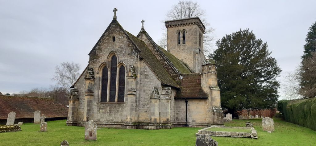
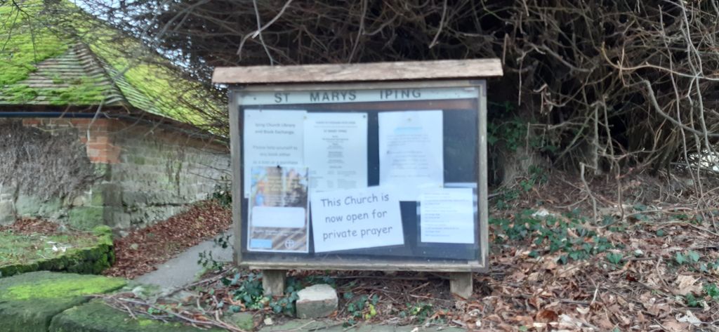
| Description | : | Iping is a particularly fine example of a small Victorian village church, seating 120. It is Grade 2 listed, and is built on the site of an earlier Saxon Church. We have a small enthusiastic congregation, and we should be delighted if you joined us for worship. Most of our services use the Book of Common Prayer. Our church is usually open for private prayer during daylight hours. The Parish of Stedham with Iping now forms part of a Group which includes Milland and Linch together with Iping Marsh. |
frequently asked questions (FAQ):
-
Where is St. Mary's Churchyard?
St. Mary's Churchyard is located at Iping Lane Off A272 Iping, Chichester District ,West Sussex , GU29 0PFEngland.
-
St. Mary's Churchyard cemetery's updated grave count on graveviews.com?
0 memorials
-
Where are the coordinates of the St. Mary's Churchyard?
Latitude: 51.0000351
Longitude: -0.7865786

Nearby Cemetories:
1. St. Mary's Churchyard
Chithurst, Chichester District, England
Coordinate: 51.0010121, -0.8007006
2. St. James Churchyard
Stedham, Chichester District, England
Coordinate: 50.9962590, -0.7703560
3. St. George's Churchyard
Trotton, Chichester District, England
Coordinate: 50.9958840, -0.8096410
4. Carron Lane Cemetery
Midhurst, Chichester District, England
Coordinate: 50.9857040, -0.7513620
5. St Peters Churchyard Terwick
Rogate, Chichester District, England
Coordinate: 51.0051950, -0.8357230
6. Easebourne Priory
Easebourne, Chichester District, England
Coordinate: 50.9950335, -0.7258487
7. St. Bartholomew's Churchyard
Rogate, Chichester District, England
Coordinate: 51.0079500, -0.8503200
8. Dureford Abbey
Rogate, Chichester District, England
Coordinate: 51.0080000, -0.8510000
9. St. Luke's Churchyard
Linch, Chichester District, England
Coordinate: 51.0404840, -0.7720810
10. St Mary Magdelene Churchyard
West Lavington, Chichester District, England
Coordinate: 50.9773640, -0.7311840
11. St Mary Churchyard
Bepton, Chichester District, England
Coordinate: 50.9576460, -0.7837500
12. St. Paul's Churchyard
Elsted, Chichester District, England
Coordinate: 50.9720678, -0.8403674
13. St. Andrew's Churchyard
Didling, Chichester District, England
Coordinate: 50.9564810, -0.8126515
14. St Luke Churchyard
Milland, Chichester District, England
Coordinate: 51.0476460, -0.8243960
15. St James Churchyard
Heyshott, Chichester District, England
Coordinate: 50.9556210, -0.7238880
16. Fernhurst Burial Ground
Fernhurst, Chichester District, England
Coordinate: 51.0486080, -0.7220610
17. St Mary and St Gabriel Churchyard
Harting, Chichester District, England
Coordinate: 50.9687680, -0.8845690
18. St Mary and St Gabriel Churchyard
South Harting, Chichester District, England
Coordinate: 50.9687500, -0.8848000
19. St Peter Churchyard
Lodsworth, Chichester District, England
Coordinate: 50.9968230, -0.6746850
20. St Mary Churchyard
Liss, East Hampshire District, England
Coordinate: 51.0453200, -0.8953100
21. St Laurence Churchyard
Lurgashall, Chichester District, England
Coordinate: 51.0372620, -0.6634070
22. Lynchmere Burial Ground
Linchmere, Chichester District, England
Coordinate: 51.0832644, -0.7513318
23. West Liss Cemetery
Liss, East Hampshire District, England
Coordinate: 51.0518102, -0.9022678
24. St Mary the Virgin Churchyard
Bramshott, East Hampshire District, England
Coordinate: 51.0891410, -0.7982870