
| Memorials | : | 0 |
| Location | : | Wolverton, Milton Keynes Borough, England |
| Coordinate | : | 52.0622410, -0.8075220 |
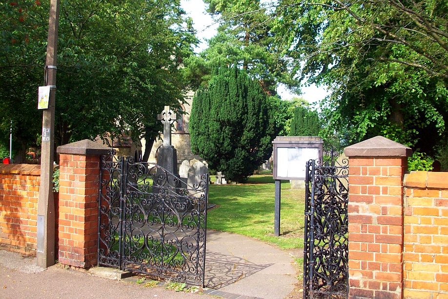
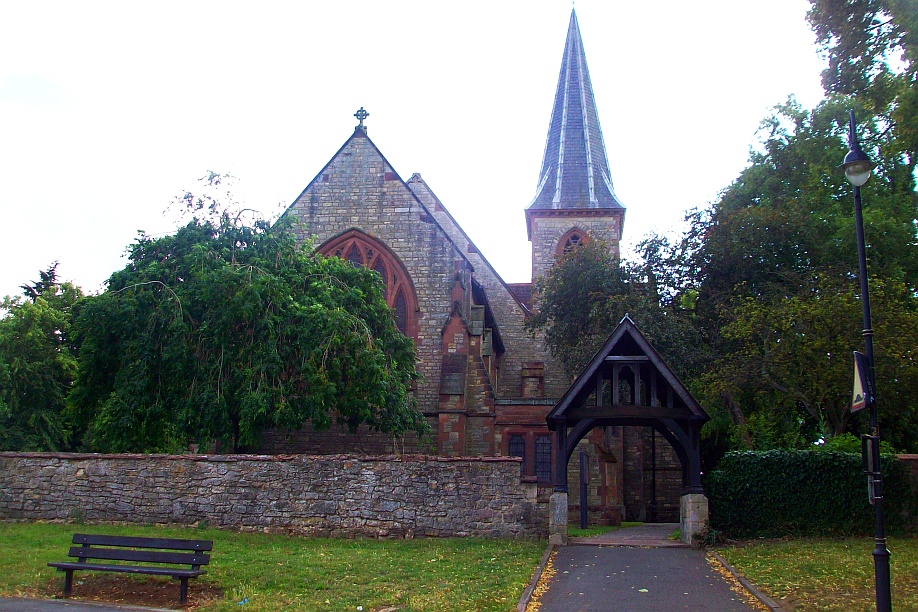
| Description | : | St. George the Martyr was built in 1843 by the London & Birmingham Railway Company and consecrated on May 26th 1844. It was the first church in Britain built by a railway company for its employees. Although burials in the churchyard continued into the early 20th century, it has been closed to further interments for many decades. |
frequently asked questions (FAQ):
-
Where is St George the Martyr Churchyard?
St George the Martyr Churchyard is located at St. George's Way Wolverton, Milton Keynes Borough ,Buckinghamshire , MK12 5EXEngland.
-
St George the Martyr Churchyard cemetery's updated grave count on graveviews.com?
0 memorials
-
Where are the coordinates of the St George the Martyr Churchyard?
Latitude: 52.0622410
Longitude: -0.8075220
Nearby Cemetories:
1. Wolverton Cemetery
Wolverton, Milton Keynes Borough, England
Coordinate: 52.0578540, -0.8184220
2. St. James Ecumenical Churchyard
New Bradwell, Milton Keynes Borough, England
Coordinate: 52.0651300, -0.7935050
3. Holy Trinity Churchyard
Wolverton, Milton Keynes Borough, England
Coordinate: 52.0642500, -0.8297700
4. St. Mary's Churchyard
Milton Keynes Borough, England
Coordinate: 52.0769923, -0.7933094
5. St Lawrence's Churchyard
Bradwell, Milton Keynes Borough, England
Coordinate: 52.0474500, -0.7891000
6. St Peter's Churchyard
Milton Keynes, Milton Keynes Borough, England
Coordinate: 52.0767000, -0.7821000
7. St Peter's Church
Stantonbury, Milton Keynes Borough, England
Coordinate: 52.0766920, -0.7820570
8. New Bradwell Cemetery
Stantonbury, Milton Keynes Borough, England
Coordinate: 52.0684700, -0.7743500
9. London Road Cemetery
Stony Stratford, Milton Keynes Borough, England
Coordinate: 52.0529290, -0.8439400
10. St. Peter & St. Paul's Parish Churchyard
Cosgrove, South Northamptonshire Borough, England
Coordinate: 52.0748600, -0.8474600
11. Calverton Road Cemetery
Stony Stratford, Milton Keynes Borough, England
Coordinate: 52.0534300, -0.8511800
12. St. Mary and St. Giles Churchyard
Stony Stratford, Milton Keynes Borough, England
Coordinate: 52.0569580, -0.8535910
13. St Mary Magdalen Churchyard
Stony Stratford, Milton Keynes Borough, England
Coordinate: 52.0587470, -0.8550560
14. Crownhill Cemetery and Crematorium
Milton Keynes, Milton Keynes Borough, England
Coordinate: 52.0321870, -0.8054640
15. St. Andrew's Churchyard
Great Linford, Milton Keynes Borough, England
Coordinate: 52.0728600, -0.7597100
16. All Saints Churchyard
Calverton, Milton Keynes Borough, England
Coordinate: 52.0439000, -0.8492000
17. All Saints Churchyard
Loughton, Milton Keynes Borough, England
Coordinate: 52.0326533, -0.7797109
18. St. Simon & St. Jude Churchyard
Castlethorpe, Milton Keynes Borough, England
Coordinate: 52.0931117, -0.8349450
19. St. Guthlac's Churchyard
Milton Keynes Borough, England
Coordinate: 52.0483770, -0.8634780
20. St Guthlac's Church Passenham
Old Stratford, South Northamptonshire Borough, England
Coordinate: 52.0481170, -0.8634000
21. St. Mary Churchyard
Milton Keynes Borough, England
Coordinate: 52.0222200, -0.7885200
22. St James the Great Churchyard
Hanslope, Milton Keynes Borough, England
Coordinate: 52.1129940, -0.8274720
23. St. Peter's Churchyard
Gayhurst, Milton Keynes Borough, England
Coordinate: 52.1081810, -0.7652570
24. Holy Trinity Churchyard
Deanshanger, South Northamptonshire Borough, England
Coordinate: 52.0493600, -0.8907600