
| Memorials | : | 0 |
| Location | : | Milton Keynes, Milton Keynes Borough, England |
| Phone | : | 01908 568112 |
| Coordinate | : | 52.0321870, -0.8054640 |
frequently asked questions (FAQ):
-
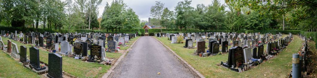
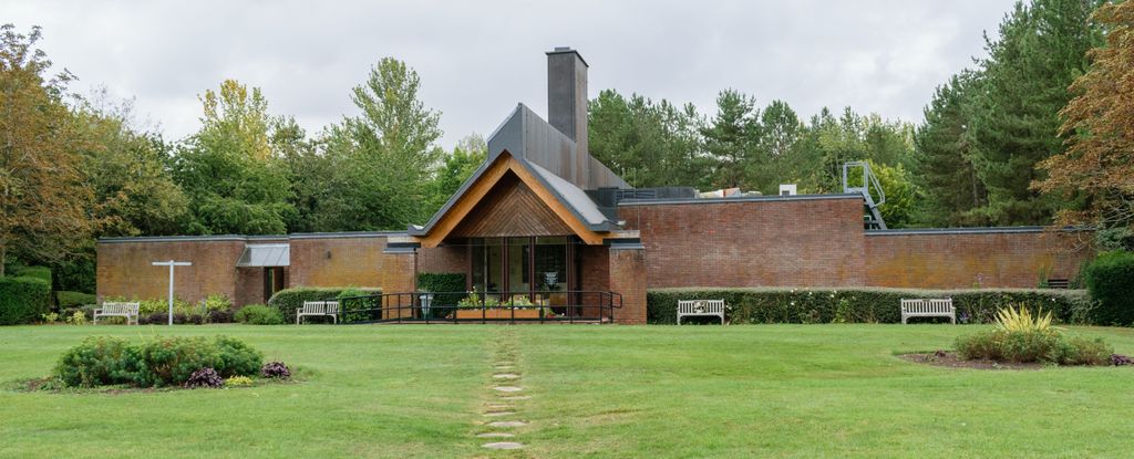
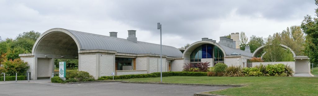
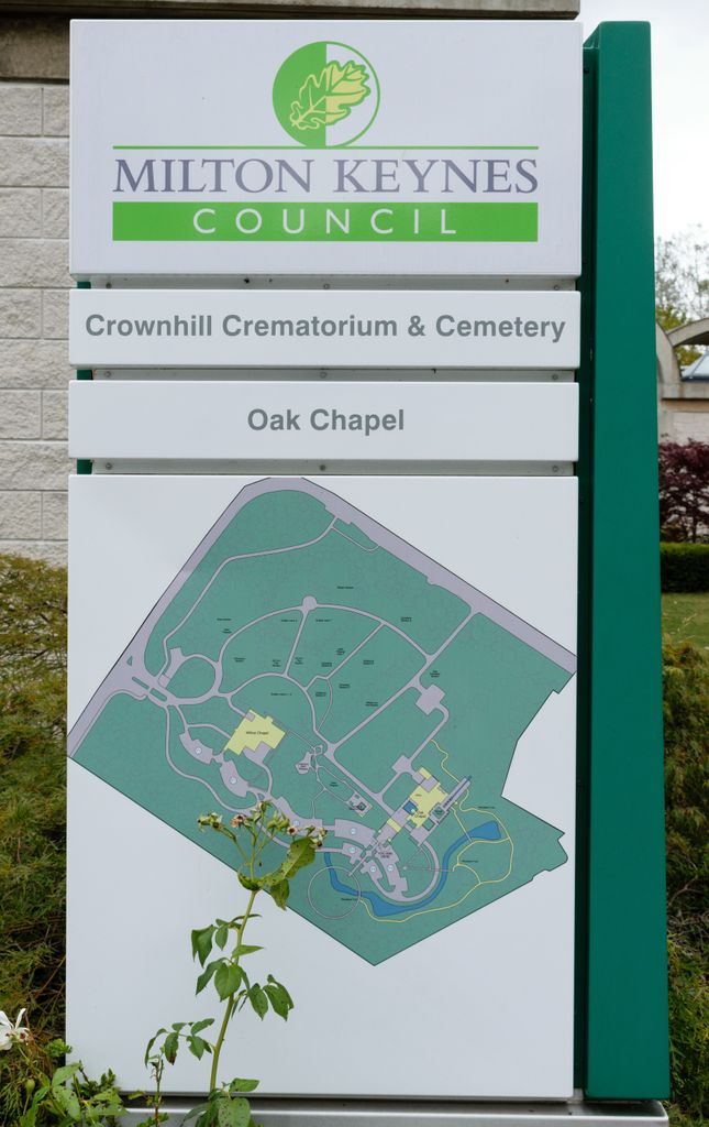
Where is Crownhill Cemetery and Crematorium?
Crownhill Cemetery and Crematorium is located at Dansteed Way Milton Keynes, Milton Keynes Borough ,Buckinghamshire , MK8 0AHEngland.
-
Crownhill Cemetery and Crematorium cemetery's updated grave count on graveviews.com?
0 memorials
-
Where are the coordinates of the Crownhill Cemetery and Crematorium?
Latitude: 52.0321870
Longitude: -0.8054640
Nearby Cemetories:
1. St. Mary Churchyard
Milton Keynes Borough, England
Coordinate: 52.0222200, -0.7885200
2. All Saints Churchyard
Loughton, Milton Keynes Borough, England
Coordinate: 52.0326533, -0.7797109
3. St Lawrence's Churchyard
Bradwell, Milton Keynes Borough, England
Coordinate: 52.0474500, -0.7891000
4. Wolverton Cemetery
Wolverton, Milton Keynes Borough, England
Coordinate: 52.0578540, -0.8184220
5. All Saints Churchyard
Calverton, Milton Keynes Borough, England
Coordinate: 52.0439000, -0.8492000
6. St George the Martyr Churchyard
Wolverton, Milton Keynes Borough, England
Coordinate: 52.0622410, -0.8075220
7. London Road Cemetery
Stony Stratford, Milton Keynes Borough, England
Coordinate: 52.0529290, -0.8439400
8. St. James Ecumenical Churchyard
New Bradwell, Milton Keynes Borough, England
Coordinate: 52.0651300, -0.7935050
9. Calverton Road Cemetery
Stony Stratford, Milton Keynes Borough, England
Coordinate: 52.0534300, -0.8511800
10. Holy Trinity Churchyard
Wolverton, Milton Keynes Borough, England
Coordinate: 52.0642500, -0.8297700
11. St Mary Churchyard
Whaddon, Aylesbury Vale District, England
Coordinate: 51.9993190, -0.8283310
12. St. Mary and St. Giles Churchyard
Stony Stratford, Milton Keynes Borough, England
Coordinate: 52.0569580, -0.8535910
13. St Guthlac's Church Passenham
Old Stratford, South Northamptonshire Borough, England
Coordinate: 52.0481170, -0.8634000
14. St. Guthlac's Churchyard
Milton Keynes Borough, England
Coordinate: 52.0483770, -0.8634780
15. St Mary Magdalen Churchyard
Stony Stratford, Milton Keynes Borough, England
Coordinate: 52.0587470, -0.8550560
16. New Bradwell Cemetery
Stantonbury, Milton Keynes Borough, England
Coordinate: 52.0684700, -0.7743500
17. Assumption of the Blessed Virgin Mary Church
Beachampton, Aylesbury Vale District, England
Coordinate: 52.0267000, -0.8784000
18. St. Mary's Churchyard
Milton Keynes Borough, England
Coordinate: 52.0769923, -0.7933094
19. St Peter's Churchyard
Milton Keynes, Milton Keynes Borough, England
Coordinate: 52.0767000, -0.7821000
20. St Peter's Church
Stantonbury, Milton Keynes Borough, England
Coordinate: 52.0766920, -0.7820570
21. All Saints Churchyard
Nash, Aylesbury Vale District, England
Coordinate: 51.9990300, -0.8634000
22. St. Andrew's Churchyard
Great Linford, Milton Keynes Borough, England
Coordinate: 52.0728600, -0.7597100
23. Holy Trinity Churchyard
Milton Keynes, Milton Keynes Borough, England
Coordinate: 52.0390700, -0.7253500
24. St. Peter & St. Paul's Parish Churchyard
Cosgrove, South Northamptonshire Borough, England
Coordinate: 52.0748600, -0.8474600