
| Memorials | : | 0 |
| Location | : | Milton Keynes Borough, England |
| Coordinate | : | 52.0222200, -0.7885200 |
| Description | : | Shenley (which consists of the villages/areas named Shenley Wood, Shenley Lodge, Shenley Brook End, Shenley Dens, Shenley Hill and Shenley Church End) is one of the parts of Buckinghamshire that went to make up the "new city" of Milton Keynes in the 1960s. It is located to the west of the city centre, on the Roman road Watling Street between Stony Stratford and Fenny Stratford. The village name 'Shenley' is an Old English language word meaning 'bright clearing'. In the Domesday Book of 1086 the area was collectively known as Senelai. The distinction between the Brook End and the Church End happened... Read More |
frequently asked questions (FAQ):
-
Where is St. Mary Churchyard?
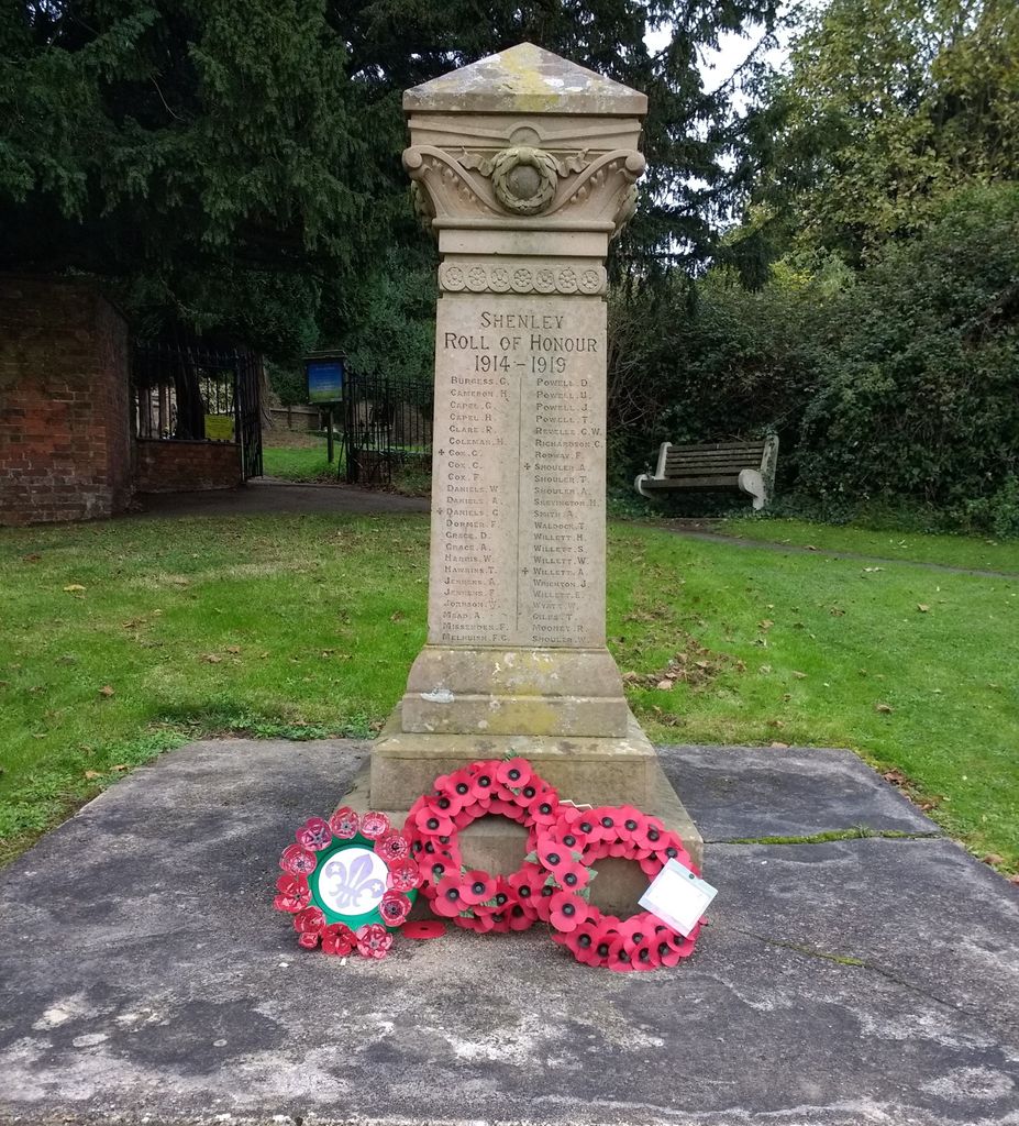
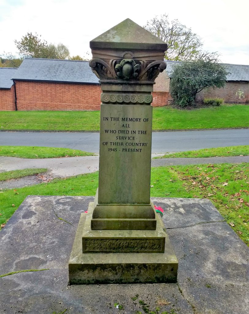
St. Mary Churchyard is located at Shenley Road, Shenley Church End Milton Keynes Borough ,Buckinghamshire , MK5 6LLEngland.
-
St. Mary Churchyard cemetery's updated grave count on graveviews.com?
0 memorials
-
Where are the coordinates of the St. Mary Churchyard?
Latitude: 52.0222200
Longitude: -0.7885200


Nearby Cemetories:
1. All Saints Churchyard
Loughton, Milton Keynes Borough, England
Coordinate: 52.0326533, -0.7797109
2. Crownhill Cemetery and Crematorium
Milton Keynes, Milton Keynes Borough, England
Coordinate: 52.0321870, -0.8054640
3. St Lawrence's Churchyard
Bradwell, Milton Keynes Borough, England
Coordinate: 52.0474500, -0.7891000
4. St Mary Churchyard
Whaddon, Aylesbury Vale District, England
Coordinate: 51.9993190, -0.8283310
5. Whalley Drive Cemetery
Bletchley, Milton Keynes Borough, England
Coordinate: 51.9964870, -0.7456010
6. St. Mary's Churchyard
Bletchley, Milton Keynes Borough, England
Coordinate: 51.9960183, -0.7444740
7. Wolverton Cemetery
Wolverton, Milton Keynes Borough, England
Coordinate: 52.0578540, -0.8184220
8. St Marys Churchyard
Woughton on the Green, Milton Keynes Borough, England
Coordinate: 52.0298869, -0.7234442
9. St George the Martyr Churchyard
Wolverton, Milton Keynes Borough, England
Coordinate: 52.0622410, -0.8075220
10. Selbourne Avenue Cemetery
Bletchley, Milton Keynes Borough, England
Coordinate: 51.9880347, -0.7493144
11. Holy Trinity Churchyard
Milton Keynes, Milton Keynes Borough, England
Coordinate: 52.0390700, -0.7253500
12. St. James Ecumenical Churchyard
New Bradwell, Milton Keynes Borough, England
Coordinate: 52.0651300, -0.7935050
13. All Saints Churchyard
Calverton, Milton Keynes Borough, England
Coordinate: 52.0439000, -0.8492000
14. Holy Trinity Churchyard
Woolstone, Milton Keynes Borough, England
Coordinate: 52.0450548, -0.7245233
15. London Road Cemetery
Stony Stratford, Milton Keynes Borough, England
Coordinate: 52.0529290, -0.8439400
16. St. Thomas' Churchyard
Simpson, Milton Keynes Borough, England
Coordinate: 52.0170487, -0.7142377
17. New Bradwell Cemetery
Stantonbury, Milton Keynes Borough, England
Coordinate: 52.0684700, -0.7743500
18. St. Michael's Churchyard Open University
Milton Keynes Borough, England
Coordinate: 52.0233487, -0.7118339
19. Holy Trinity Churchyard
Wolverton, Milton Keynes Borough, England
Coordinate: 52.0642500, -0.8297700
20. St. Faith Churchyard
Newton Longville, Aylesbury Vale District, England
Coordinate: 51.9748000, -0.7667600
21. Calverton Road Cemetery
Stony Stratford, Milton Keynes Borough, England
Coordinate: 52.0534300, -0.8511800
22. St. Martin's Churchyard
Fenny Stratford, Milton Keynes Borough, England
Coordinate: 51.9982400, -0.7157800
23. Bletchley Cemetery
Bletchley, Milton Keynes Borough, England
Coordinate: 51.9947900, -0.7189600
24. All Saints Churchyard
Nash, Aylesbury Vale District, England
Coordinate: 51.9990300, -0.8634000