
| Memorials | : | 0 |
| Location | : | Wolverton, Milton Keynes Borough, England |
| Website | : | www.milton-keynes.gov.uk/crematorium/ |
| Coordinate | : | 52.0578540, -0.8184220 |
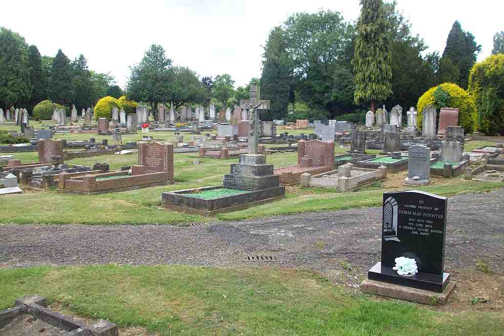
| Description | : | Wolverton Cemetery, also known locally as Woburn Avenue Cemetery, was founded in 1896. It is the fourth oldest municipal cemetery in the Milton Keynes catchment area and it is now managed by Milton Keynes Council. All MK cemetery records and registers are kept at the Crematorium at Crownhill. Burial information is available through their website. |
frequently asked questions (FAQ):
-
Where is Wolverton Cemetery?
Wolverton Cemetery is located at Woburn Avenue Wolverton, Milton Keynes Borough ,Buckinghamshire , MK12 5AZEngland.
-
Wolverton Cemetery cemetery's updated grave count on graveviews.com?
0 memorials
-
Where are the coordinates of the Wolverton Cemetery?
Latitude: 52.0578540
Longitude: -0.8184220


Nearby Cemetories:
1. St George the Martyr Churchyard
Wolverton, Milton Keynes Borough, England
Coordinate: 52.0622410, -0.8075220
2. Holy Trinity Churchyard
Wolverton, Milton Keynes Borough, England
Coordinate: 52.0642500, -0.8297700
3. London Road Cemetery
Stony Stratford, Milton Keynes Borough, England
Coordinate: 52.0529290, -0.8439400
4. St. James Ecumenical Churchyard
New Bradwell, Milton Keynes Borough, England
Coordinate: 52.0651300, -0.7935050
5. Calverton Road Cemetery
Stony Stratford, Milton Keynes Borough, England
Coordinate: 52.0534300, -0.8511800
6. St Lawrence's Churchyard
Bradwell, Milton Keynes Borough, England
Coordinate: 52.0474500, -0.7891000
7. St. Mary and St. Giles Churchyard
Stony Stratford, Milton Keynes Borough, England
Coordinate: 52.0569580, -0.8535910
8. St Mary Magdalen Churchyard
Stony Stratford, Milton Keynes Borough, England
Coordinate: 52.0587470, -0.8550560
9. All Saints Churchyard
Calverton, Milton Keynes Borough, England
Coordinate: 52.0439000, -0.8492000
10. St. Mary's Churchyard
Milton Keynes Borough, England
Coordinate: 52.0769923, -0.7933094
11. St. Peter & St. Paul's Parish Churchyard
Cosgrove, South Northamptonshire Borough, England
Coordinate: 52.0748600, -0.8474600
12. Crownhill Cemetery and Crematorium
Milton Keynes, Milton Keynes Borough, England
Coordinate: 52.0321870, -0.8054640
13. New Bradwell Cemetery
Stantonbury, Milton Keynes Borough, England
Coordinate: 52.0684700, -0.7743500
14. St Peter's Churchyard
Milton Keynes, Milton Keynes Borough, England
Coordinate: 52.0767000, -0.7821000
15. St Peter's Church
Stantonbury, Milton Keynes Borough, England
Coordinate: 52.0766920, -0.7820570
16. St. Guthlac's Churchyard
Milton Keynes Borough, England
Coordinate: 52.0483770, -0.8634780
17. St Guthlac's Church Passenham
Old Stratford, South Northamptonshire Borough, England
Coordinate: 52.0481170, -0.8634000
18. All Saints Churchyard
Loughton, Milton Keynes Borough, England
Coordinate: 52.0326533, -0.7797109
19. St. Simon & St. Jude Churchyard
Castlethorpe, Milton Keynes Borough, England
Coordinate: 52.0931117, -0.8349450
20. St. Andrew's Churchyard
Great Linford, Milton Keynes Borough, England
Coordinate: 52.0728600, -0.7597100
21. St. Mary Churchyard
Milton Keynes Borough, England
Coordinate: 52.0222200, -0.7885200
22. Holy Trinity Churchyard
Deanshanger, South Northamptonshire Borough, England
Coordinate: 52.0493600, -0.8907600
23. Assumption of the Blessed Virgin Mary Church
Beachampton, Aylesbury Vale District, England
Coordinate: 52.0267000, -0.8784000
24. Potterspury Cemetery
Potterspury, South Northamptonshire Borough, England
Coordinate: 52.0803020, -0.8898052