
| Memorials | : | 0 |
| Location | : | Barmby on the Marsh, East Riding of Yorkshire Unitary Authority, England |
| Coordinate | : | 53.7476490, -0.9549090 |
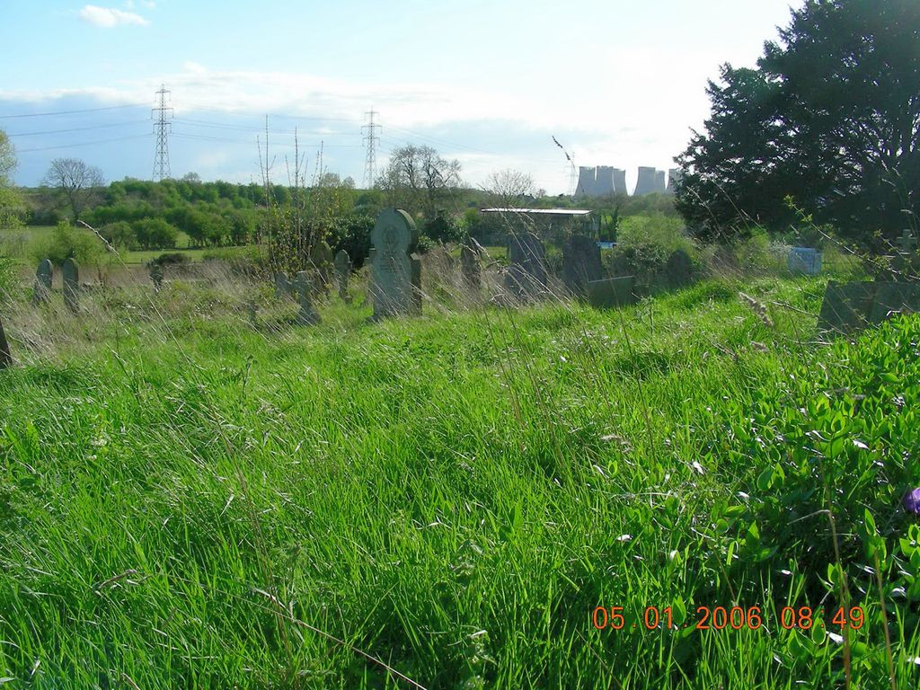
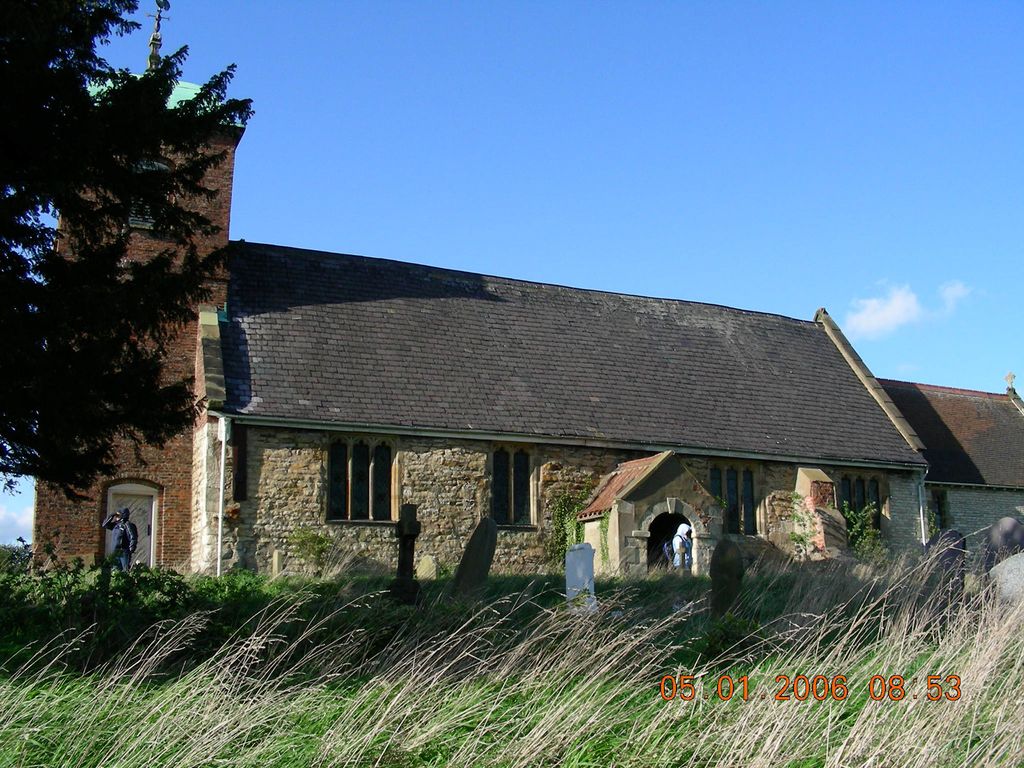
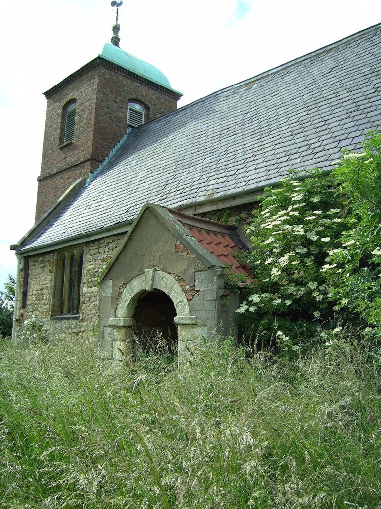
| Description | : | Barmby-on-the-Marsh was originally a chapelry in the parish of Howden, but set as an independent ecclesiastical parish in 1864. The churchyard cemetery surrounds the church building on all sides. The particulars of the first burial in the churchyard are unknown but some of the original Church of England parish registers and Bishop's transcripts been deposited in local government archives. Burials and baptisms at the St Helen's Churchyard start in 1763 and are recorded in the Howden parish register until 1779. Prior to this time, all burials recorded in the Howden parish register would have taken place at the Howden... Read More |
frequently asked questions (FAQ):
-
Where is St. Helen's Churchyard?
St. Helen's Churchyard is located at Barmby on the Marsh, East Riding of Yorkshire Unitary Authority ,East Riding of Yorkshire ,England.
-
St. Helen's Churchyard cemetery's updated grave count on graveviews.com?
0 memorials
-
Where are the coordinates of the St. Helen's Churchyard?
Latitude: 53.7476490
Longitude: -0.9549090
Nearby Cemetories:
1. Barmby on the Marsh Parish Burial Ground
Barmby on the Marsh, East Riding of Yorkshire Unitary Authority, England
Coordinate: 53.7472990, -0.9401910
2. St Peter and St Paul Churchyard
Drax, Selby District, England
Coordinate: 53.7293790, -0.9771560
3. Friends Burial Ground
Drax, Selby District, England
Coordinate: 53.7291640, -0.9771490
4. St Mary the Virgin Churchyard
Hemingbrough, Selby District, England
Coordinate: 53.7672100, -0.9796300
5. Drax Cemetery
Drax, Selby District, England
Coordinate: 53.7272540, -0.9875330
6. St David Churchyard
Airmyn, East Riding of Yorkshire Unitary Authority, England
Coordinate: 53.7178030, -0.9016700
7. Howden Cemetery
Howden, East Riding of Yorkshire Unitary Authority, England
Coordinate: 53.7438890, -0.8770090
8. Catholic Church of The Sacred Heart
Howden, East Riding of Yorkshire Unitary Authority, England
Coordinate: 53.7428360, -0.8709800
9. Carlton Cemetery
Carlton, Selby District, England
Coordinate: 53.7129500, -1.0199200
10. Howden Minster Churchyard
Howden, East Riding of Yorkshire Unitary Authority, England
Coordinate: 53.7449550, -0.8670300
11. St Mary Roman Catholic Church
Carlton, Selby District, England
Coordinate: 53.7111900, -1.0199300
12. St Mary Churchyard
Carlton, Selby District, England
Coordinate: 53.7088060, -1.0209800
13. Hook Cemetery
Hook, East Riding of Yorkshire Unitary Authority, England
Coordinate: 53.7204300, -0.8525380
14. Holy Trinity Churchyard
East Cowick, East Riding of Yorkshire Unitary Authority, England
Coordinate: 53.6866220, -1.0000200
15. St. John the Evangelist Churchyard
Goole, East Riding of Yorkshire Unitary Authority, England
Coordinate: 53.7024600, -0.8719260
16. St Mary the Virgin Churchyard
Hook, East Riding of Yorkshire Unitary Authority, England
Coordinate: 53.7207270, -0.8510590
17. Goole Cemetery
Goole, East Riding of Yorkshire Unitary Authority, England
Coordinate: 53.7105940, -0.8513370
18. All Saints Churchyard
Barlby, Selby District, England
Coordinate: 53.7987840, -1.0415840
19. All Saints Churchyard
Bubwith, East Riding of Yorkshire Unitary Authority, England
Coordinate: 53.8170680, -0.9200130
20. Selby Abbey
Selby, Selby District, England
Coordinate: 53.7840990, -1.0670270
21. Selby Cemetery
Selby, Selby District, England
Coordinate: 53.7766610, -1.0775960
22. St. Wilfrid's Parish Churchyard
Brayton, Selby District, England
Coordinate: 53.7718060, -1.0849010
23. All Saints Churchyard
Aughton, East Riding of Yorkshire Unitary Authority, England
Coordinate: 53.8393490, -0.9352200
24. St. Helen's Churchyard
Skipwith, Selby District, England
Coordinate: 53.8386300, -1.0022900