
| Memorials | : | 0 |
| Location | : | Barmby on the Marsh, East Riding of Yorkshire Unitary Authority, England |
| Coordinate | : | 53.7472990, -0.9401910 |
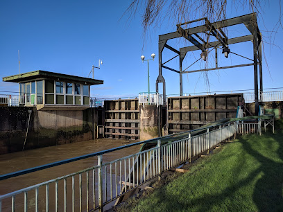
| Description | : | A newly-opened public cemetery operated by the local parish council. |
frequently asked questions (FAQ):
-
Where is Barmby on the Marsh Parish Burial Ground?
Barmby on the Marsh Parish Burial Ground is located at Barmby on the Marsh, East Riding of Yorkshire Unitary Authority ,East Riding of Yorkshire ,England.
-
Barmby on the Marsh Parish Burial Ground cemetery's updated grave count on graveviews.com?
0 memorials
-
Where are the coordinates of the Barmby on the Marsh Parish Burial Ground?
Latitude: 53.7472990
Longitude: -0.9401910
Nearby Cemetories:
1. St. Helen's Churchyard
Barmby on the Marsh, East Riding of Yorkshire Unitary Authority, England
Coordinate: 53.7476490, -0.9549090
2. St Peter and St Paul Churchyard
Drax, Selby District, England
Coordinate: 53.7293790, -0.9771560
3. Friends Burial Ground
Drax, Selby District, England
Coordinate: 53.7291640, -0.9771490
4. St Mary the Virgin Churchyard
Hemingbrough, Selby District, England
Coordinate: 53.7672100, -0.9796300
5. Drax Cemetery
Drax, Selby District, England
Coordinate: 53.7272540, -0.9875330
6. St David Churchyard
Airmyn, East Riding of Yorkshire Unitary Authority, England
Coordinate: 53.7178030, -0.9016700
7. Howden Cemetery
Howden, East Riding of Yorkshire Unitary Authority, England
Coordinate: 53.7438890, -0.8770090
8. Catholic Church of The Sacred Heart
Howden, East Riding of Yorkshire Unitary Authority, England
Coordinate: 53.7428360, -0.8709800
9. Howden Minster Churchyard
Howden, East Riding of Yorkshire Unitary Authority, England
Coordinate: 53.7449550, -0.8670300
10. Carlton Cemetery
Carlton, Selby District, England
Coordinate: 53.7129500, -1.0199200
11. Hook Cemetery
Hook, East Riding of Yorkshire Unitary Authority, England
Coordinate: 53.7204300, -0.8525380
12. St Mary the Virgin Churchyard
Hook, East Riding of Yorkshire Unitary Authority, England
Coordinate: 53.7207270, -0.8510590
13. St Mary Roman Catholic Church
Carlton, Selby District, England
Coordinate: 53.7111900, -1.0199300
14. St. John the Evangelist Churchyard
Goole, East Riding of Yorkshire Unitary Authority, England
Coordinate: 53.7024600, -0.8719260
15. St Mary Churchyard
Carlton, Selby District, England
Coordinate: 53.7088060, -1.0209800
16. Goole Cemetery
Goole, East Riding of Yorkshire Unitary Authority, England
Coordinate: 53.7105940, -0.8513370
17. Holy Trinity Churchyard
East Cowick, East Riding of Yorkshire Unitary Authority, England
Coordinate: 53.6866220, -1.0000200
18. All Saints Churchyard
Bubwith, East Riding of Yorkshire Unitary Authority, England
Coordinate: 53.8170680, -0.9200130
19. All Saints Churchyard
Barlby, Selby District, England
Coordinate: 53.7987840, -1.0415840
20. Selby Abbey
Selby, Selby District, England
Coordinate: 53.7840990, -1.0670270
21. Selby Cemetery
Selby, Selby District, England
Coordinate: 53.7766610, -1.0775960
22. St Peter Churchyard and Church Cemetery
Laxton, East Riding of Yorkshire Unitary Authority, England
Coordinate: 53.7196250, -0.8000900
23. St Michael Churchyard
Eastrington, East Riding of Yorkshire Unitary Authority, England
Coordinate: 53.7599690, -0.7931110
24. Eastrington Cemetery
Eastrington, East Riding of Yorkshire Unitary Authority, England
Coordinate: 53.7606920, -0.7922500