
| Memorials | : | 1 |
| Location | : | Jacobstow, Cornwall Unitary Authority, England |
| Coordinate | : | 50.7341700, -4.5547800 |
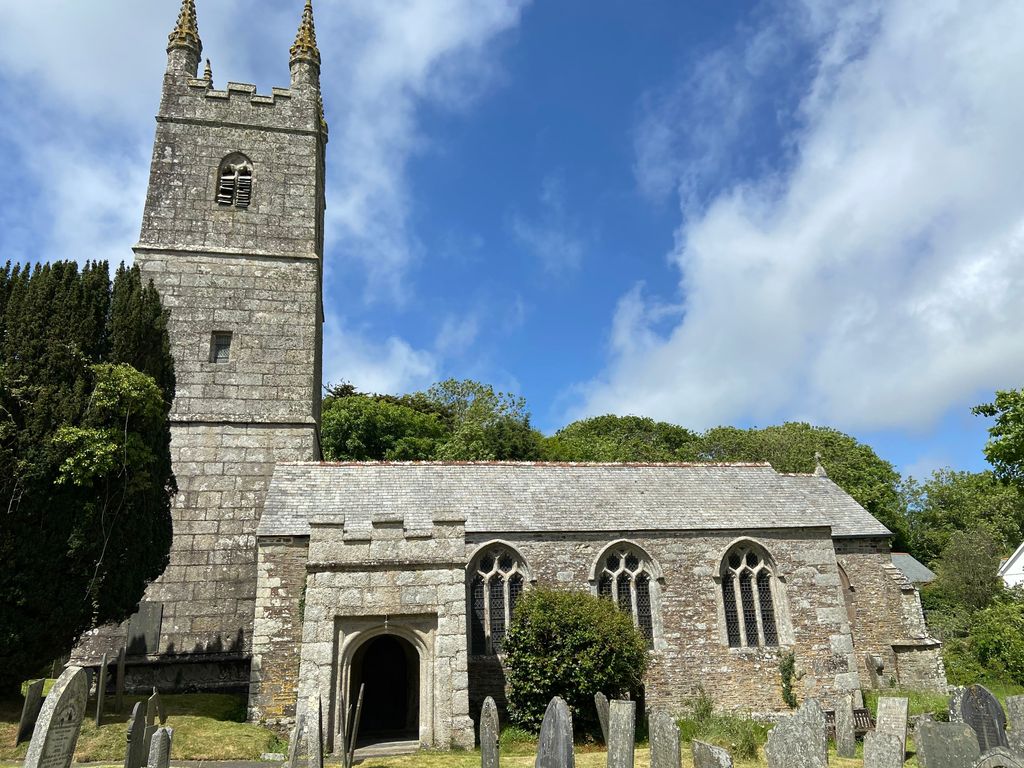
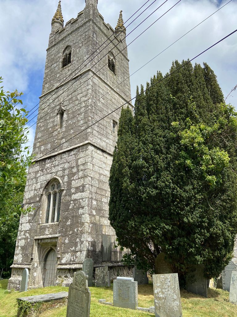
| Description | : | St James Church in Jacobstow, Cornwall, England is in the Anglican Diocese of Truro. It lies about 1 mile off the busy A39 at Wainhouse Corner, midway between Bude and Camelford. |
frequently asked questions (FAQ):
-
Where is St. James' Churchyard?
St. James' Churchyard is located at Jacobstow, Cornwall Unitary Authority ,Cornwall ,England.
-
St. James' Churchyard cemetery's updated grave count on graveviews.com?
1 memorials
-
Where are the coordinates of the St. James' Churchyard?
Latitude: 50.7341700
Longitude: -4.5547800
Nearby Cemetories:
1. Eden Methodist Chapel Cemetery
Jacobstow, Cornwall Unitary Authority, England
Coordinate: 50.7200700, -4.5591500
2. Canworthy Water Methodist Church Cemetery
Carnworthy Water, Cornwall Unitary Authority, England
Coordinate: 50.6939800, -4.5149200
3. St David Churchyard
Davidstow, Cornwall Unitary Authority, England
Coordinate: 50.6556270, -4.6170430
4. Tremail Methodist Chapelyard
Davidstow, Cornwall Unitary Authority, England
Coordinate: 50.6486072, -4.6010783
5. Minster Saint Merteriana Cemetery
Boscastle, Cornwall Unitary Authority, England
Coordinate: 50.6831500, -4.6759200
6. St. Michael & All Angels Churchyard
Bude, Cornwall Unitary Authority, England
Coordinate: 50.8275500, -4.5497500
7. Bude Extension Cemetery
Bude, Cornwall Unitary Authority, England
Coordinate: 50.8276510, -4.5499890
8. Bennacott Chapel
Boyton, Cornwall Unitary Authority, England
Coordinate: 50.7048188, -4.4127882
9. St. Swithin Churchyard
Launcells, Cornwall Unitary Authority, England
Coordinate: 50.8242240, -4.4944380
10. Forrabury Churchyard
Boscastle, Cornwall Unitary Authority, England
Coordinate: 50.6864280, -4.6971890
11. Launcells Methodist Churchyard
Launcells, Cornwall Unitary Authority, England
Coordinate: 50.8283007, -4.4656921
12. Boyton Methodist Chapel
Boyton, Cornwall Unitary Authority, England
Coordinate: 50.7023020, -4.3816220
13. Holy Cross Churchyard
Tetcott, Torridge District, England
Coordinate: 50.7443138, -4.3655843
14. St. Pancras Churchyard
Pancrasweek, Torridge District, England
Coordinate: 50.8268500, -4.4201500
15. The Old Sunday School
Camelford, Cornwall Unitary Authority, England
Coordinate: 50.6217300, -4.6800900
16. St. Stephen the Martyr
Launceston, Cornwall Unitary Authority, England
Coordinate: 50.6465400, -4.3702200
17. St. James the Great Churchyard
Kilkhampton, Cornwall Unitary Authority, England
Coordinate: 50.8750630, -4.4851140
18. Ss Peter and Paul Churchyard
Holsworthy, Torridge District, England
Coordinate: 50.8107500, -4.3525400
19. St Thomas the Apostle Churchyard
Launceston, Cornwall Unitary Authority, England
Coordinate: 50.6411650, -4.3662600
20. St. Giles' Parish Churchyard
St Giles on the Heath, Torridge District, England
Coordinate: 50.6914989, -4.3245055
21. St. Adwenna Churchyard
Advent, Cornwall Unitary Authority, England
Coordinate: 50.6033553, -4.6798271
22. Holsworthy Cemetery
Holsworthy, Torridge District, England
Coordinate: 50.8179000, -4.3473500
23. Saint John the Evangelist
Delabole, Cornwall Unitary Authority, England
Coordinate: 50.6246300, -4.7306900
24. St Julitta Lanteglos Churchyard
Lanteglos, Cornwall Unitary Authority, England
Coordinate: 50.6095360, -4.7038460