
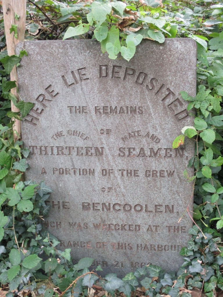
| Memorials | : | 0 |
| Location | : | Bude, Cornwall Unitary Authority, England |
| Coordinate | : | 50.8275500, -4.5497500 |
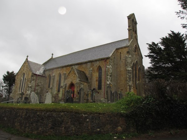
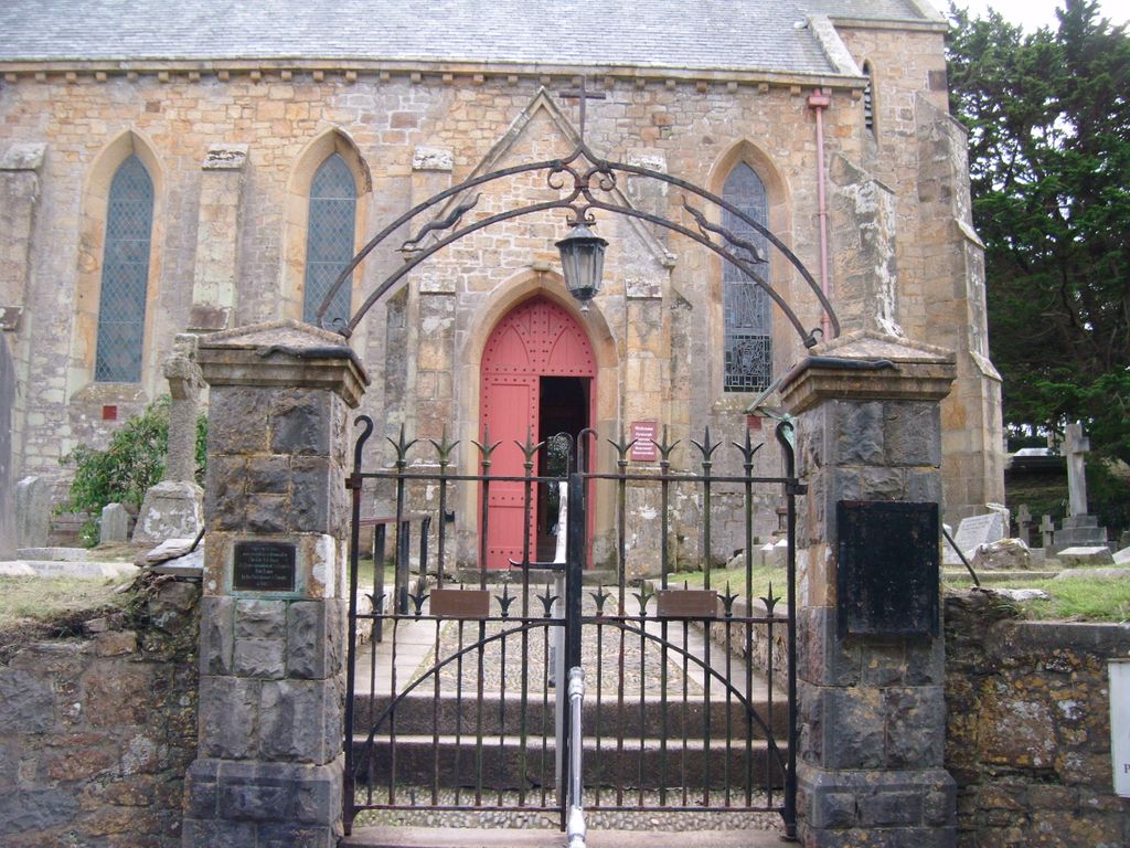
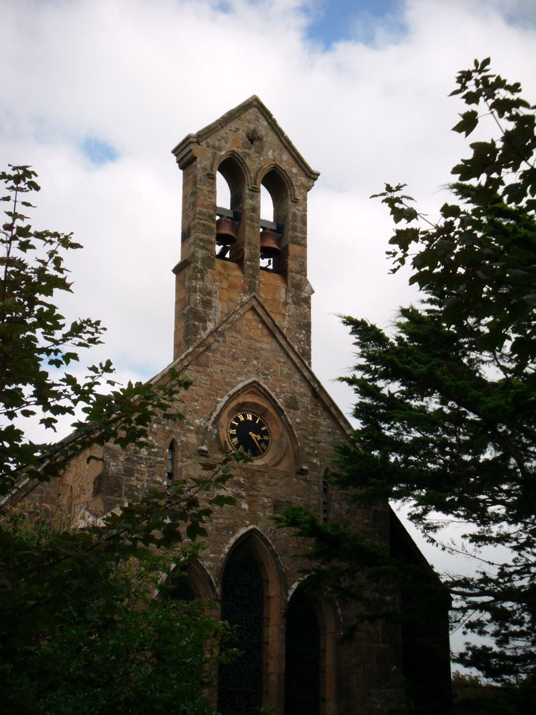
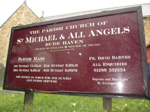
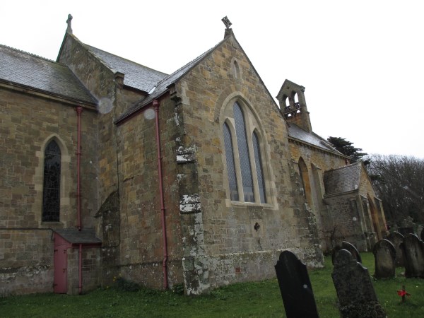
| Description | : | The Church of St. Michael and All Angels built in 1834/5 by George Wightwick, was the gift of Sir Thomas Dyke Acland. The church reflects the history of the area which it serves, which had enjoyed a new prosperity with the cutting of the Bude Canal, at great expense, between 1819-26. St Michael's was originally built as a Chapel of Ease to nearby Stratton Church, and only later became the parish church of Bude Haven as the town expanded with the advent of the London and South Western Railway in the 1890's and its new found popularity as a holiday... Read More |
frequently asked questions (FAQ):
-
Where is St. Michael & All Angels Churchyard?
St. Michael & All Angels Churchyard is located at Church Path, Bude Haven Bude, Cornwall Unitary Authority ,Cornwall , EX23 8SDEngland.
-
St. Michael & All Angels Churchyard cemetery's updated grave count on graveviews.com?
0 memorials
-
Where are the coordinates of the St. Michael & All Angels Churchyard?
Latitude: 50.8275500
Longitude: -4.5497500
Nearby Cemetories:
1. Bude Extension Cemetery
Bude, Cornwall Unitary Authority, England
Coordinate: 50.8276510, -4.5499890
2. St. Swithin Churchyard
Launcells, Cornwall Unitary Authority, England
Coordinate: 50.8242240, -4.4944380
3. Launcells Methodist Churchyard
Launcells, Cornwall Unitary Authority, England
Coordinate: 50.8283007, -4.4656921
4. St. James the Great Churchyard
Kilkhampton, Cornwall Unitary Authority, England
Coordinate: 50.8750630, -4.4851140
5. St. Pancras Churchyard
Pancrasweek, Torridge District, England
Coordinate: 50.8268500, -4.4201500
6. St. James' Churchyard
Jacobstow, Cornwall Unitary Authority, England
Coordinate: 50.7341700, -4.5547800
7. Eden Methodist Chapel Cemetery
Jacobstow, Cornwall Unitary Authority, England
Coordinate: 50.7200700, -4.5591500
8. Ss Peter and Paul Churchyard
Holsworthy, Torridge District, England
Coordinate: 50.8107500, -4.3525400
9. Holsworthy Cemetery
Holsworthy, Torridge District, England
Coordinate: 50.8179000, -4.3473500
10. Free Church Cemetery
Sutcombe, Torridge District, England
Coordinate: 50.8793320, -4.3517180
11. Canworthy Water Methodist Church Cemetery
Carnworthy Water, Cornwall Unitary Authority, England
Coordinate: 50.6939800, -4.5149200
12. Saint Andrew's Churchyard
Sutcombe, Torridge District, England
Coordinate: 50.8807900, -4.3512500
13. Holy Cross Churchyard
Tetcott, Torridge District, England
Coordinate: 50.7443138, -4.3655843
14. Bennacott Chapel
Boyton, Cornwall Unitary Authority, England
Coordinate: 50.7048188, -4.4127882
15. Woodacott Chapel
Thornbury, Torridge District, England
Coordinate: 50.8470860, -4.2930920
16. Boyton Methodist Chapel
Boyton, Cornwall Unitary Authority, England
Coordinate: 50.7023020, -4.3816220
17. Minster Saint Merteriana Cemetery
Boscastle, Cornwall Unitary Authority, England
Coordinate: 50.6831500, -4.6759200
18. St Nectan Churchyard
Stoke, Torridge District, England
Coordinate: 50.9949510, -4.5165690
19. Forrabury Churchyard
Boscastle, Cornwall Unitary Authority, England
Coordinate: 50.6864280, -4.6971890
20. Hartland Methodist Cemetery
Hartland, Torridge District, England
Coordinate: 50.9915000, -4.4767210
21. Hartland Abbey
Hartland, Torridge District, England
Coordinate: 50.9965700, -4.5086740
22. St. James' Churchyard
Abbots Bickington, Torridge District, England
Coordinate: 50.8961300, -4.2983800
23. St David Churchyard
Davidstow, Cornwall Unitary Authority, England
Coordinate: 50.6556270, -4.6170430
24. Tremail Methodist Chapelyard
Davidstow, Cornwall Unitary Authority, England
Coordinate: 50.6486072, -4.6010783