
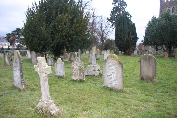
| Memorials | : | 0 |
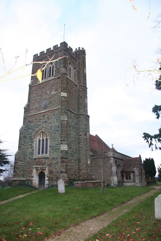
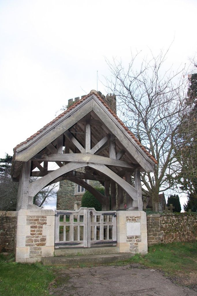
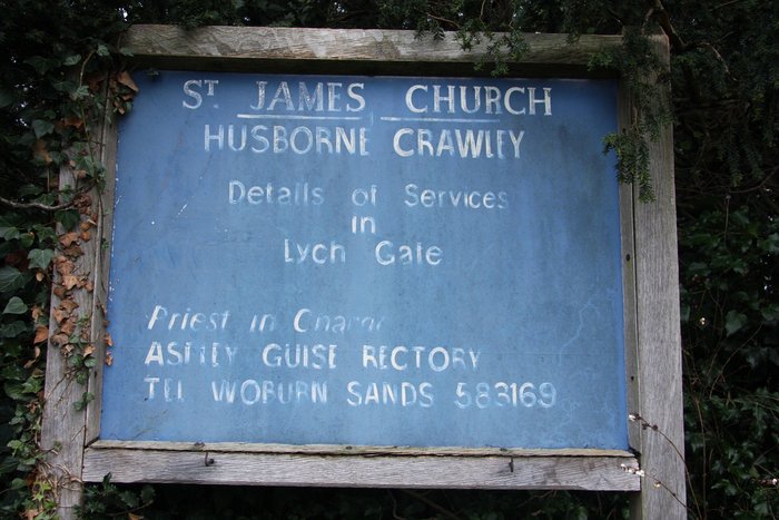
| Location | : | Husborne Crawley, Central Bedfordshire Unitary Authority, England |
| Coordinate | : | 52.0162250, -0.6090110 |
frequently asked questions (FAQ):
-
Where is St James Churchyard?
St James Churchyard is located at Husborne Crawley, Central Bedfordshire Unitary Authority ,Bedfordshire ,England.
-
St James Churchyard cemetery's updated grave count on graveviews.com?
0 memorials
-
Where are the coordinates of the St James Churchyard?
Latitude: 52.0162250
Longitude: -0.6090110
Nearby Cemetories:
1. St. Botolph's Churchyard
Aspley Guise, Central Bedfordshire Unitary Authority, England
Coordinate: 52.0166510, -0.6281470
2. St Marys Roman Catholic Cemetery
Woburn Sands, Milton Keynes Borough, England
Coordinate: 52.0103000, -0.6413000
3. All Saint's Churchyard
Ridgmont, Central Bedfordshire Unitary Authority, England
Coordinate: 52.0117910, -0.5719780
4. Woburn Sands & Aspley Heath War Memorial
Woburn, Central Bedfordshire Unitary Authority, England
Coordinate: 52.0115470, -0.6473350
5. St. Michael's Churchyard
Woburn Sands, Milton Keynes Borough, England
Coordinate: 52.0087770, -0.6485350
6. St Nicholas Churchyard
Hulcote, Central Bedfordshire Unitary Authority, England
Coordinate: 52.0399000, -0.6246000
7. St. Mary's Churchyard
Woburn, Central Bedfordshire Unitary Authority, England
Coordinate: 51.9896000, -0.6199000
8. St. Mary the Virgin Churchyard
Salford, Central Bedfordshire Unitary Authority, England
Coordinate: 52.0424070, -0.6368910
9. St. Mary's Churchyard
Wavendon, Milton Keynes Borough, England
Coordinate: 52.0257000, -0.6730000
10. St John the Baptist Churchyard
Eversholt, Central Bedfordshire Unitary Authority, England
Coordinate: 51.9822680, -0.5702150
11. All Saints Churchyard
Bow Brickhill, Milton Keynes Borough, England
Coordinate: 52.0005240, -0.6737110
12. All Saints Churchyard Extension
Bow Brickhill, Milton Keynes Borough, England
Coordinate: 52.0002300, -0.6737940
13. St Lawrence Churchyard
Steppingley, Central Bedfordshire Unitary Authority, England
Coordinate: 52.0080630, -0.5278050
14. St. Peter Churchyard
Milton Bryan, Central Bedfordshire Unitary Authority, England
Coordinate: 51.9671660, -0.5879490
15. St Peter and St Paul Churchyard
Cranfield, Central Bedfordshire Unitary Authority, England
Coordinate: 52.0679750, -0.6071570
16. Cranfield Cemetery
Cranfield, Central Bedfordshire Unitary Authority, England
Coordinate: 52.0683000, -0.6041200
17. St. Mary Magdalene Churchyard
Little Brickhill, Milton Keynes Borough, England
Coordinate: 51.9831000, -0.6763200
18. Mount Zion Burial Ground
Cranfield, Central Bedfordshire Unitary Authority, England
Coordinate: 52.0703595, -0.6110791
19. St. Michael and All Angels Churchyard
Millbrook, Central Bedfordshire Unitary Authority, England
Coordinate: 52.0358350, -0.5231810
20. St Mary the Virgin Churchyard
Marston Moretaine, Central Bedfordshire Unitary Authority, England
Coordinate: 52.0597750, -0.5484290
21. St Mary Churchyard
Potsgrove, Central Bedfordshire Unitary Authority, England
Coordinate: 51.9589970, -0.6166510
22. St Nicholas Churchyard
Tingrith, Central Bedfordshire Unitary Authority, England
Coordinate: 51.9812660, -0.5347790
23. St. Michael's Churchyard Open University
Milton Keynes Borough, England
Coordinate: 52.0233487, -0.7118339
24. St Peter and All Saints Churchyard
Battlesden, Central Bedfordshire Unitary Authority, England
Coordinate: 51.9520610, -0.6059540