
| Memorials | : | 0 |
| Location | : | Leicester, Leicester Unitary Authority, England |
| Coordinate | : | 52.6381940, -1.1403170 |
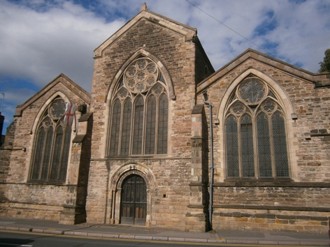
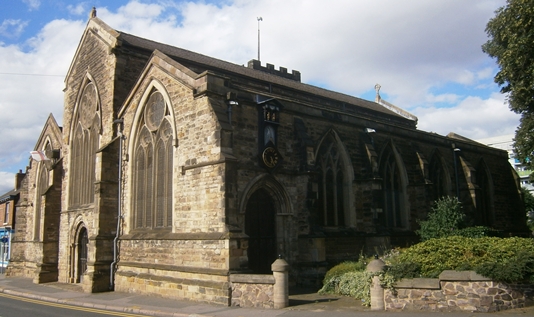
| Description | : | Grade I listed 12th century Anglican church, in the Norman and Gothic styles. It is no longer used for regular worship. |
frequently asked questions (FAQ):
-
Where is All Saints Church?
All Saints Church is located at Highcross Street, Leicester, Leicester, Leicester Unitary Authority ,Leicestershire , LE1 4PHEngland.
-
All Saints Church cemetery's updated grave count on graveviews.com?
0 memorials
-
Where are the coordinates of the All Saints Church?
Latitude: 52.6381940
Longitude: -1.1403170

Nearby Cemetories:
1. Great Meeting Unitarian Chapel
Leicester, Leicester Unitary Authority, England
Coordinate: 52.6379400, -1.1360390
2. St. Nicholas Church
Leicester, Leicester Unitary Authority, England
Coordinate: 52.6351400, -1.1408940
3. St Margaret Churchyard
Leicester, Leicester Unitary Authority, England
Coordinate: 52.6403430, -1.1363440
4. Leicester Cathedral
Leicester, Leicester Unitary Authority, England
Coordinate: 52.6347430, -1.1370210
5. St. Mary de Castro Churchyard
Leicester, Leicester Unitary Authority, England
Coordinate: 52.6322610, -1.1404000
6. Church of the Annunciation of St. Mary
Leicester, Leicester Unitary Authority, England
Coordinate: 52.6308229, -1.1417201
7. St George's Church
Leicester, Leicester Unitary Authority, England
Coordinate: 52.6344300, -1.1267420
8. Leicester Abbey
Leicester, Leicester Unitary Authority, England
Coordinate: 52.6489600, -1.1369470
9. St Peter's Church (Defunct)
Leicester, Leicester Unitary Authority, England
Coordinate: 52.6300260, -1.1164980
10. Welford Road Cemetery
Leicester, Leicester Unitary Authority, England
Coordinate: 52.6200104, -1.1295080
11. St. Peter's Churchyard
Belgrave, Leicester Unitary Authority, England
Coordinate: 52.6594208, -1.1255690
12. Gilroes Cemetery and Crematorium
Leicester, Leicester Unitary Authority, England
Coordinate: 52.6514359, -1.1721700
13. St. john the Baptist
Leicester, Leicester Unitary Authority, England
Coordinate: 52.6181730, -1.1118790
14. Belgrave Cemetery
Belgrave, Leicester Unitary Authority, England
Coordinate: 52.6653570, -1.1311220
15. St Peter's Churchyard
Braunstone, Blaby District, England
Coordinate: 52.6208940, -1.1812900
16. St Andrew Churchyard
Aylestone, Leicester Unitary Authority, England
Coordinate: 52.6038420, -1.1568900
17. Saint Mary Magdalene Churchyard
Knighton, Leicester Unitary Authority, England
Coordinate: 52.6054170, -1.1163730
18. St James the Great Churchyard
Birstall, Charnwood Borough, England
Coordinate: 52.6741150, -1.1189210
19. St. Mary's Churchyard
Humberstone, Leicester Unitary Authority, England
Coordinate: 52.6479200, -1.0760100
20. St Peter's Church
Glenfield, Blaby District, England
Coordinate: 52.6490490, -1.2063180
21. Greengate Lane Cemetery
Birstall, Charnwood Borough, England
Coordinate: 52.6800110, -1.1346940
22. St. Denys' Churchyard
Evington, Leicester Unitary Authority, England
Coordinate: 52.6193210, -1.0743860
23. St Mary's Church
Anstey, Charnwood Borough, England
Coordinate: 52.6720090, -1.1888250
24. Anstey Cemetery
Anstey, Charnwood Borough, England
Coordinate: 52.6680480, -1.1955570