
| Memorials | : | 0 |
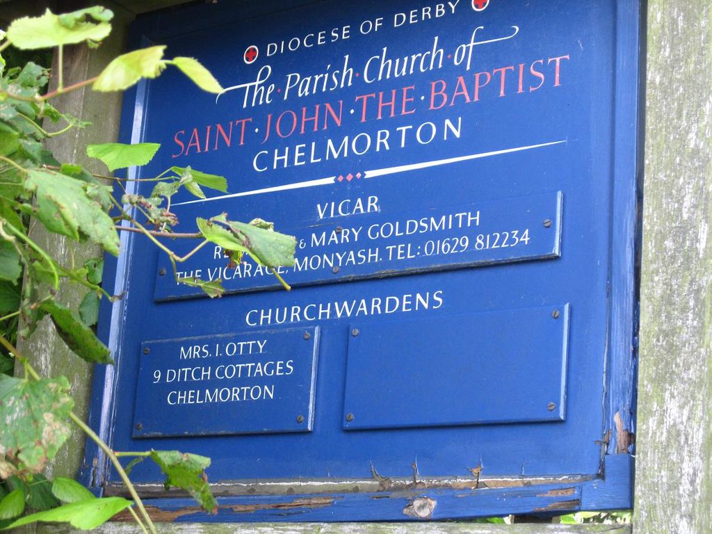
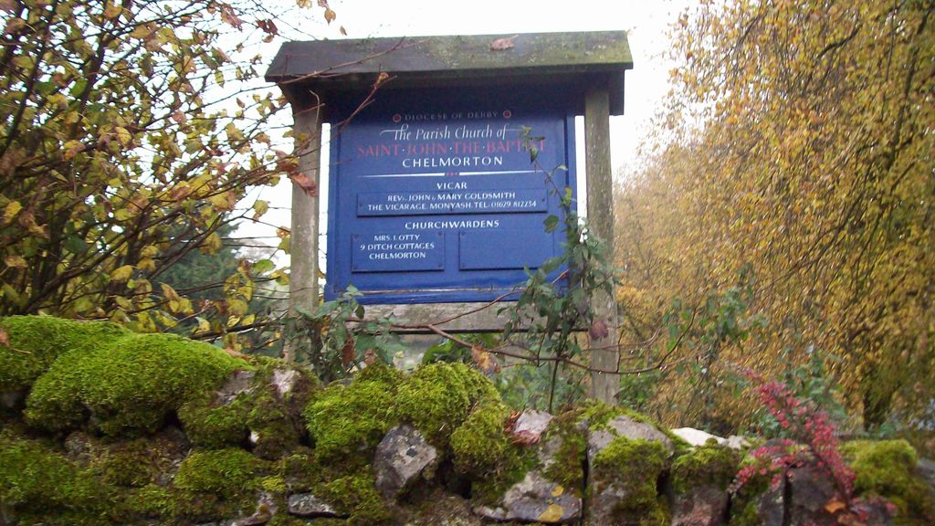
| Location | : | Chelmorton, Derbyshire Dales District, England |
| Coordinate | : | 53.2292770, -1.8283570 |
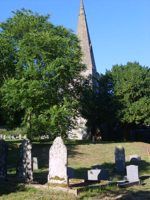
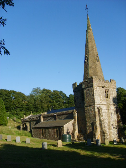
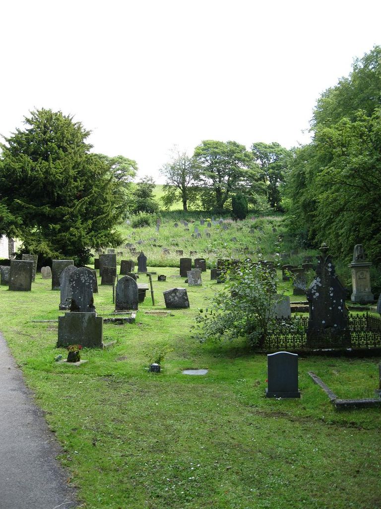
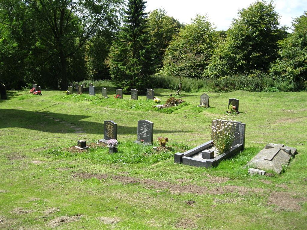
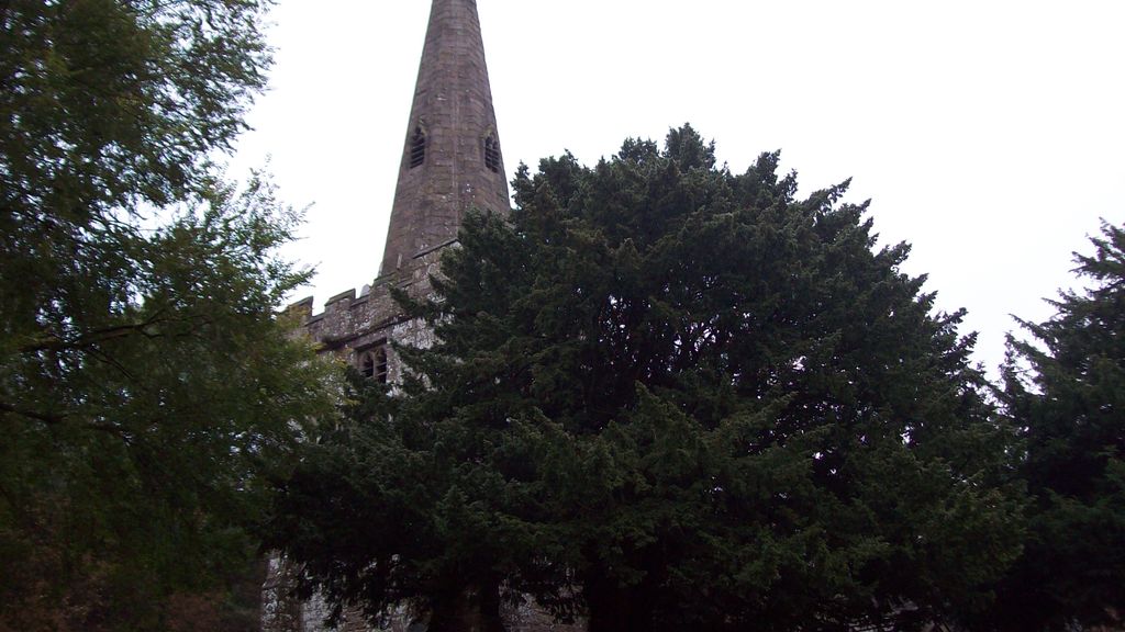
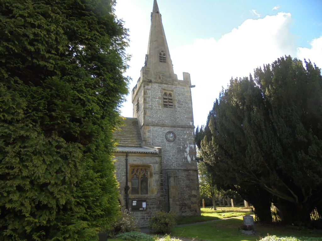
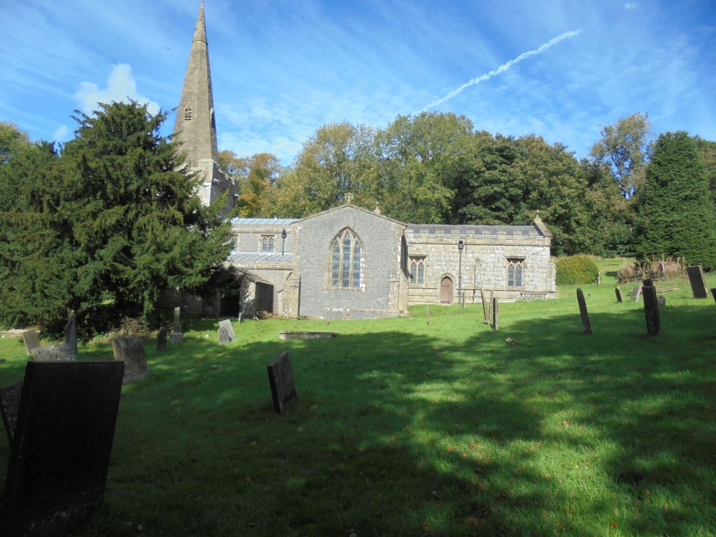
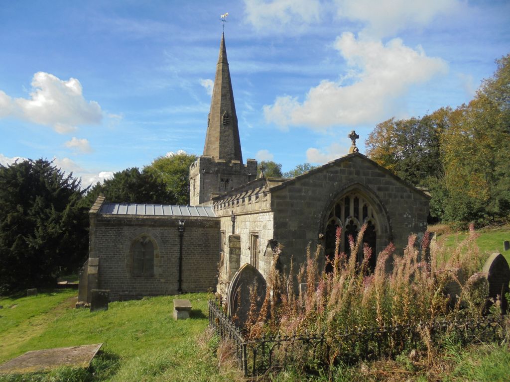
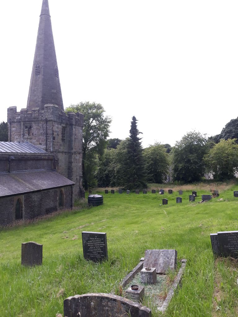
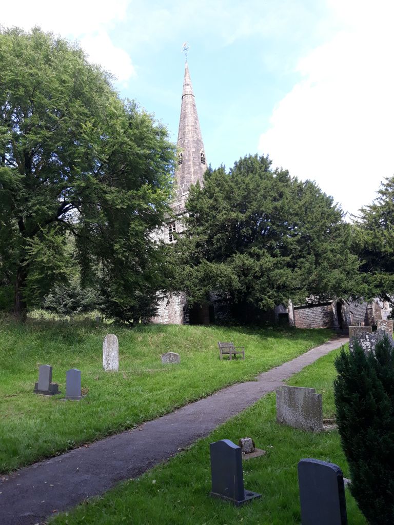
| Description | : | The Parish Church of St John the Baptist, one of the highest situated churches in the land, dates partly back to the early 13th century, though its building history is a little complex. It has a broad, low west 13th century tower capped with a 15th century spire. The burial ground extends beside and behind the church on a steep slope. |
frequently asked questions (FAQ):
-
Where is St. John the Baptist Churchyard?
St. John the Baptist Churchyard is located at Chelmorton, Derbyshire Dales District ,Derbyshire ,England.
-
St. John the Baptist Churchyard cemetery's updated grave count on graveviews.com?
0 memorials
-
Where are the coordinates of the St. John the Baptist Churchyard?
Latitude: 53.2292770
Longitude: -1.8283570
Nearby Cemetories:
1. Christ Churchyard
Kings Sterndale, High Peak Borough, England
Coordinate: 53.2421800, -1.8617860
2. St Michael and All Angels Churchyard
Taddington, Derbyshire Dales District, England
Coordinate: 53.2372500, -1.7897380
3. St Margaret
Wormhill, High Peak Borough, England
Coordinate: 53.2646730, -1.8154230
4. St. Michael and All Angels Churchyard
Earl Sterndale, Derbyshire Dales District, England
Coordinate: 53.2006470, -1.8657430
5. Monyash Quaker Burial Ground
Monyash, Derbyshire Dales District, England
Coordinate: 53.1960872, -1.7773422
6. Buxton Cemetery
Buxton, High Peak Borough, England
Coordinate: 53.2446830, -1.9013910
7. Harpur Hill Methodist Churchyard
Buxton, High Peak Borough, England
Coordinate: 53.2369210, -1.9053100
8. St. Leonard's Churchyard
Monyash, Derbyshire Dales District, England
Coordinate: 53.1951190, -1.7748480
9. St James Churchyard
Harpur Hill, High Peak Borough, England
Coordinate: 53.2374840, -1.9069170
10. St. Bartholomew Churchyard
Longnor, Staffordshire Moorlands District, England
Coordinate: 53.1818800, -1.8686700
11. St. Michael & All Angels Churchyard
Sheldon, Derbyshire Dales District, England
Coordinate: 53.2165050, -1.7387150
12. Litton Cemetery
Litton, Derbyshire Dales District, England
Coordinate: 53.2654380, -1.7573610
13. St Peter's Churchyard
Fairfield, High Peak Borough, England
Coordinate: 53.2642220, -1.9012830
14. Immaculate Heart of Mary, Roman Catholic Chapel
Tideswell, Derbyshire Dales District, England
Coordinate: 53.2761640, -1.7741580
15. Church of St. Anne
Buxton, High Peak Borough, England
Coordinate: 53.2538256, -1.9157350
16. St John the Baptist Tideswell
Tideswell, Derbyshire Dales District, England
Coordinate: 53.2785640, -1.7728500
17. St John the Baptist Churchyard
Buxton, High Peak Borough, England
Coordinate: 53.2589380, -1.9172770
18. Little Longstone Chapel
Little Longstone, Derbyshire Dales District, England
Coordinate: 53.2413241, -1.7203296
19. Tideswell Parish Council Cemetery
Tideswell, Derbyshire Dales District, England
Coordinate: 53.2846630, -1.7639730
20. Christ Church Churchyard
Burbage, High Peak Borough, England
Coordinate: 53.2528840, -1.9357390
21. Holy Trinity Churchyard
Ashford-in-the-Water, Derbyshire Dales District, England
Coordinate: 53.2241640, -1.7093610
22. The Good Shepherd Churchyard
Wardlow, Derbyshire Dales District, England
Coordinate: 53.2693970, -1.7294140
23. Dove Holes Methodist Churchyard
Dove Holes, High Peak Borough, England
Coordinate: 53.2975100, -1.8878900
24. Trot Lane Private Cemetery
Foolow, Derbyshire Dales District, England
Coordinate: 53.2872651, -1.7434660