
| Memorials | : | 0 |
| Location | : | Dove Holes, High Peak Borough, England |
| Coordinate | : | 53.2975100, -1.8878900 |
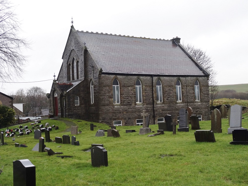
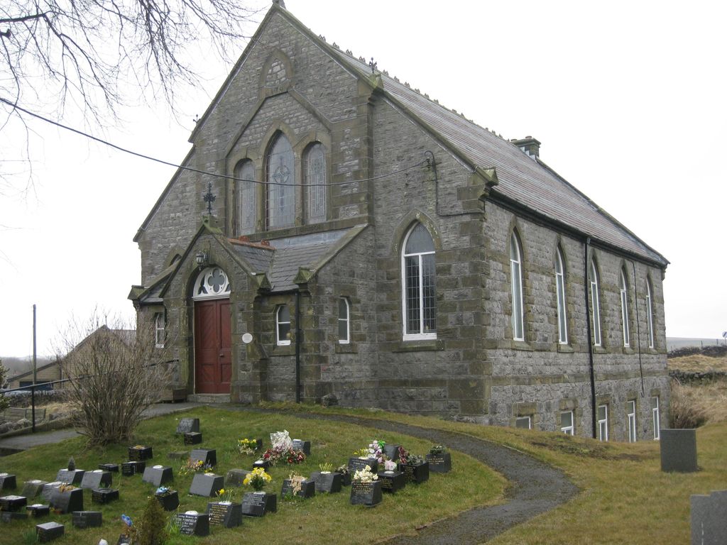
| Description | : | Dove Holes Methodist Church was built in 1876 and is situated on the A6 road, near Buxton. |
frequently asked questions (FAQ):
-
Where is Dove Holes Methodist Churchyard?
Dove Holes Methodist Churchyard is located at Buxton Road Dove Holes, High Peak Borough ,Derbyshire , SK17 8DWEngland.
-
Dove Holes Methodist Churchyard cemetery's updated grave count on graveviews.com?
0 memorials
-
Where are the coordinates of the Dove Holes Methodist Churchyard?
Latitude: 53.2975100
Longitude: -1.8878900
Nearby Cemetories:
1. St Paul Churchyard
Dove Holes, High Peak Borough, England
Coordinate: 53.3007950, -1.8859330
2. Town End Methodist Churchyard
Chapel-en-le-Frith, High Peak Borough, England
Coordinate: 53.3246590, -1.9090850
3. St Thomas A Beckett Churchyard
Chapel-en-le-Frith, High Peak Borough, England
Coordinate: 53.3243340, -1.9148240
4. St Peter's Churchyard
Fairfield, High Peak Borough, England
Coordinate: 53.2642220, -1.9012830
5. Charles King and Martyr Parish Churchyard
Peak Forest, High Peak Borough, England
Coordinate: 53.3095830, -1.8303960
6. Wesleyan Chapel
Peak Forest, High Peak Borough, England
Coordinate: 53.3116840, -1.8302360
7. Chinley Independent Chapelyard
Chapel-en-le-Frith, High Peak Borough, England
Coordinate: 53.3349830, -1.9182290
8. St John the Baptist Churchyard
Buxton, High Peak Borough, England
Coordinate: 53.2589380, -1.9172770
9. Church of St. Anne
Buxton, High Peak Borough, England
Coordinate: 53.2538256, -1.9157350
10. White Knowle Methodist Chapel
Chinley, High Peak Borough, England
Coordinate: 53.3427389, -1.9242500
11. Christ Church Churchyard
Burbage, High Peak Borough, England
Coordinate: 53.2528840, -1.9357390
12. Fernilee Methodist Church
Fernilee, High Peak Borough, England
Coordinate: 53.3072690, -1.9752940
13. Buxton Cemetery
Buxton, High Peak Borough, England
Coordinate: 53.2446830, -1.9013910
14. St Margaret
Wormhill, High Peak Borough, England
Coordinate: 53.2646730, -1.8154230
15. Christ Churchyard
Kings Sterndale, High Peak Borough, England
Coordinate: 53.2421800, -1.8617860
16. Buxworth Primitive Methodist Churchyard
Chinley, High Peak Borough, England
Coordinate: 53.3364680, -1.9662910
17. Primitive Methodist Chapel 1841
Buxworth, High Peak Borough, England
Coordinate: 53.3363378, -1.9667282
18. St James Churchyard
Harpur Hill, High Peak Borough, England
Coordinate: 53.2374840, -1.9069170
19. Harpur Hill Methodist Churchyard
Buxton, High Peak Borough, England
Coordinate: 53.2369210, -1.9053100
20. St. James Churchyard
Buxworth, High Peak Borough, England
Coordinate: 53.3362500, -1.9688500
21. St. James Churchyard
Whaley Bridge, High Peak Borough, England
Coordinate: 53.3153270, -1.9918840
22. Edale Methodist Chapel
Edale, High Peak Borough, England
Coordinate: 53.3601000, -1.8315000
23. Immaculate Heart of Mary, Roman Catholic Chapel
Tideswell, Derbyshire Dales District, England
Coordinate: 53.2761640, -1.7741580
24. St John the Baptist Tideswell
Tideswell, Derbyshire Dales District, England
Coordinate: 53.2785640, -1.7728500