
| Memorials | : | 3 |
| Location | : | Buxton, High Peak Borough, England |
| Coordinate | : | 53.2446830, -1.9013910 |
frequently asked questions (FAQ):
-
Where is Buxton Cemetery?
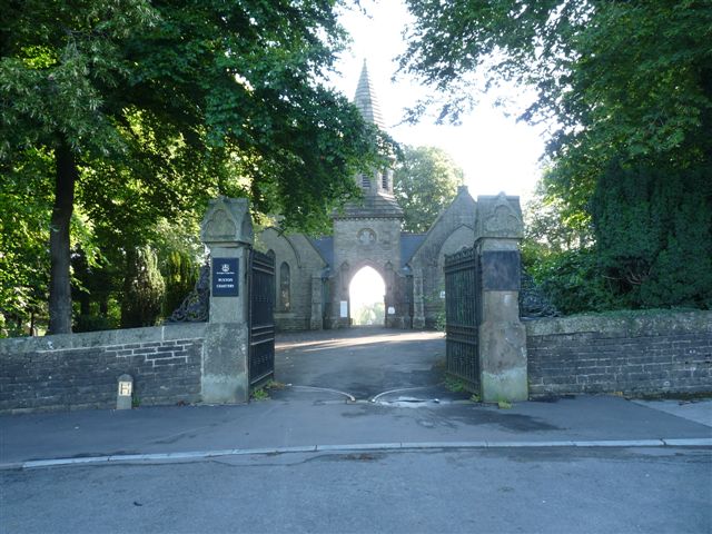
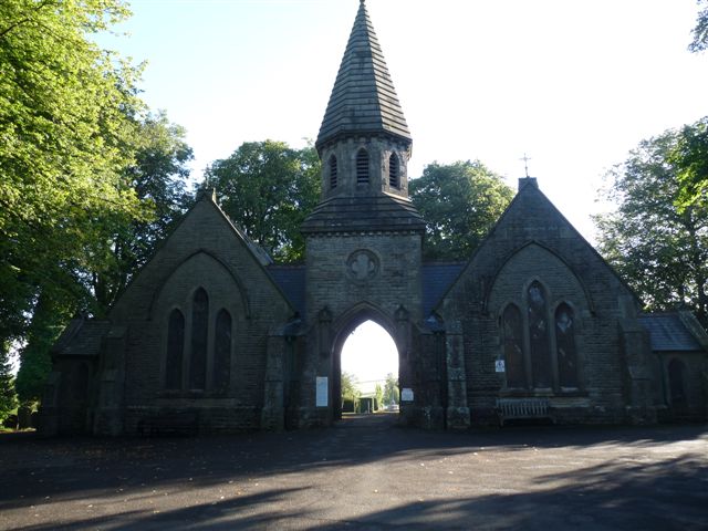
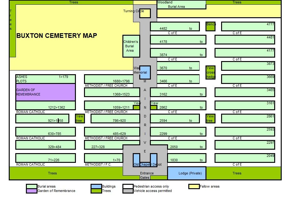
Buxton Cemetery is located at Ashbourne Road Buxton, High Peak Borough ,Derbyshire ,England.
-
Buxton Cemetery cemetery's updated grave count on graveviews.com?
2 memorials
-
Where are the coordinates of the Buxton Cemetery?
Latitude: 53.2446830
Longitude: -1.9013910
Nearby Cemetories:
1. St James Churchyard
Harpur Hill, High Peak Borough, England
Coordinate: 53.2374840, -1.9069170
2. Harpur Hill Methodist Churchyard
Buxton, High Peak Borough, England
Coordinate: 53.2369210, -1.9053100
3. Church of St. Anne
Buxton, High Peak Borough, England
Coordinate: 53.2538256, -1.9157350
4. St John the Baptist Churchyard
Buxton, High Peak Borough, England
Coordinate: 53.2589380, -1.9172770
5. St Peter's Churchyard
Fairfield, High Peak Borough, England
Coordinate: 53.2642220, -1.9012830
6. Christ Church Churchyard
Burbage, High Peak Borough, England
Coordinate: 53.2528840, -1.9357390
7. Christ Churchyard
Kings Sterndale, High Peak Borough, England
Coordinate: 53.2421800, -1.8617860
8. St. John the Baptist Churchyard
Chelmorton, Derbyshire Dales District, England
Coordinate: 53.2292770, -1.8283570
9. St. Michael and All Angels Churchyard
Earl Sterndale, Derbyshire Dales District, England
Coordinate: 53.2006470, -1.8657430
10. Dove Holes Methodist Churchyard
Dove Holes, High Peak Borough, England
Coordinate: 53.2975100, -1.8878900
11. St Margaret
Wormhill, High Peak Borough, England
Coordinate: 53.2646730, -1.8154230
12. St. Paul's Churchyard
Quarnford, Staffordshire Moorlands District, England
Coordinate: 53.2018260, -1.9628630
13. St Paul Churchyard
Dove Holes, High Peak Borough, England
Coordinate: 53.3007950, -1.8859330
14. St. Bartholomew Churchyard
Longnor, Staffordshire Moorlands District, England
Coordinate: 53.1818800, -1.8686700
15. St Michael and All Angels Churchyard
Taddington, Derbyshire Dales District, England
Coordinate: 53.2372500, -1.7897380
16. Fernilee Methodist Church
Fernilee, High Peak Borough, England
Coordinate: 53.3072690, -1.9752940
17. Charles King and Martyr Parish Churchyard
Peak Forest, High Peak Borough, England
Coordinate: 53.3095830, -1.8303960
18. Wesleyan Chapel
Peak Forest, High Peak Borough, England
Coordinate: 53.3116840, -1.8302360
19. St. Saviour Churchyard
Wildboarclough, Cheshire East Unitary Authority, England
Coordinate: 53.2161170, -2.0254580
20. St Thomas A Beckett Churchyard
Chapel-en-le-Frith, High Peak Borough, England
Coordinate: 53.3243340, -1.9148240
21. Town End Methodist Churchyard
Chapel-en-le-Frith, High Peak Borough, England
Coordinate: 53.3246590, -1.9090850
22. Immaculate Heart of Mary, Roman Catholic Chapel
Tideswell, Derbyshire Dales District, England
Coordinate: 53.2761640, -1.7741580
23. St . Stephen's Church Forest Chapel
Macclesfield Forest, Cheshire East Unitary Authority, England
Coordinate: 53.2462260, -2.0399720
24. St John the Baptist Tideswell
Tideswell, Derbyshire Dales District, England
Coordinate: 53.2785640, -1.7728500