
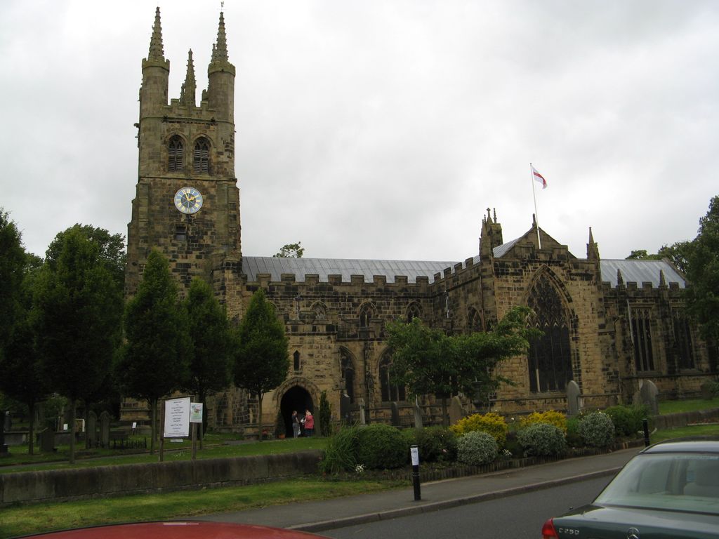
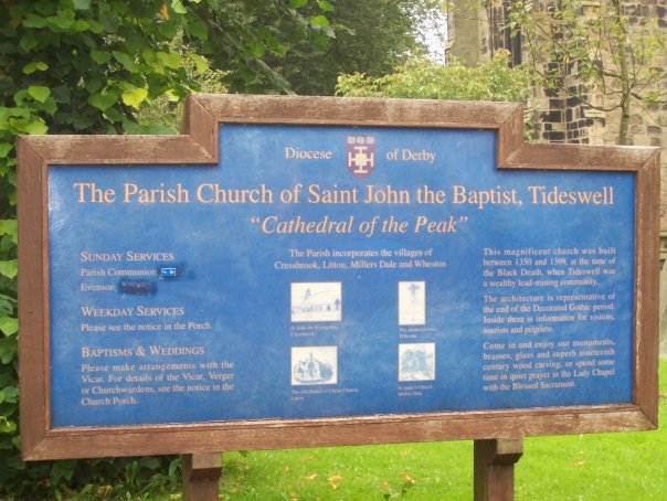
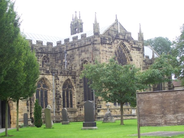
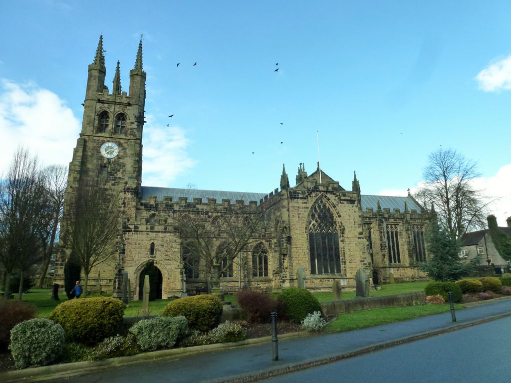
| Memorials | : | 0 |
| Location | : | Tideswell, Derbyshire Dales District, England |
| Coordinate | : | 53.2785640, -1.7728500 |
frequently asked questions (FAQ):
-
Where is St John the Baptist Tideswell?
St John the Baptist Tideswell is located at Tideswell, Derbyshire Dales District ,Derbyshire ,England.
-
St John the Baptist Tideswell cemetery's updated grave count on graveviews.com?
0 memorials
-
Where are the coordinates of the St John the Baptist Tideswell?
Latitude: 53.2785640
Longitude: -1.7728500
Nearby Cemetories:
1. Immaculate Heart of Mary, Roman Catholic Chapel
Tideswell, Derbyshire Dales District, England
Coordinate: 53.2761640, -1.7741580
2. Tideswell Parish Council Cemetery
Tideswell, Derbyshire Dales District, England
Coordinate: 53.2846630, -1.7639730
3. Litton Cemetery
Litton, Derbyshire Dales District, England
Coordinate: 53.2654380, -1.7573610
4. Trot Lane Private Cemetery
Foolow, Derbyshire Dales District, England
Coordinate: 53.2872651, -1.7434660
5. The Good Shepherd Churchyard
Wardlow, Derbyshire Dales District, England
Coordinate: 53.2693970, -1.7294140
6. St Margaret
Wormhill, High Peak Borough, England
Coordinate: 53.2646730, -1.8154230
7. Methodist Churchyard
Great Hucklow, Derbyshire Dales District, England
Coordinate: 53.2970009, -1.7330000
8. St Michael and All Angels Churchyard
Taddington, Derbyshire Dales District, England
Coordinate: 53.2372500, -1.7897380
9. Charles King and Martyr Parish Churchyard
Peak Forest, High Peak Borough, England
Coordinate: 53.3095830, -1.8303960
10. Hamlet of Bretton
Eyam, Derbyshire Dales District, England
Coordinate: 53.2979962, -1.7008309
11. Wesleyan Chapel
Peak Forest, High Peak Borough, England
Coordinate: 53.3116840, -1.8302360
12. Little Longstone Chapel
Little Longstone, Derbyshire Dales District, England
Coordinate: 53.2413241, -1.7203296
13. Methodist Chapel Graveyard
Bradwell, Derbyshire Dales District, England
Coordinate: 53.3264690, -1.7417860
14. St Barnabas Churchyard
Bradwell, Derbyshire Dales District, England
Coordinate: 53.3263560, -1.7387040
15. Bethlehem Churchyard
Bradwell, Derbyshire Dales District, England
Coordinate: 53.3277120, -1.7417070
16. Saint Giles Churchyard
Great Longstone, Derbyshire Dales District, England
Coordinate: 53.2432100, -1.7009100
17. St. Lawrence's Churchyard
Eyam, Derbyshire Dales District, England
Coordinate: 53.2842751, -1.6749160
18. St. John the Baptist Churchyard
Chelmorton, Derbyshire Dales District, England
Coordinate: 53.2292770, -1.8283570
19. Eyam Village
Eyam, Derbyshire Dales District, England
Coordinate: 53.2843748, -1.6717200
20. St. Edmund's Churchyard
Castleton, High Peak Borough, England
Coordinate: 53.3428300, -1.7758600
21. Christ Churchyard
Kings Sterndale, High Peak Borough, England
Coordinate: 53.2421800, -1.8617860
22. St. Michael & All Angels Churchyard
Sheldon, Derbyshire Dales District, England
Coordinate: 53.2165050, -1.7387150
23. Riley Farm
Eyam, Derbyshire Dales District, England
Coordinate: 53.2857957, -1.6636787
24. Holy Trinity Churchyard
Ashford-in-the-Water, Derbyshire Dales District, England
Coordinate: 53.2241640, -1.7093610