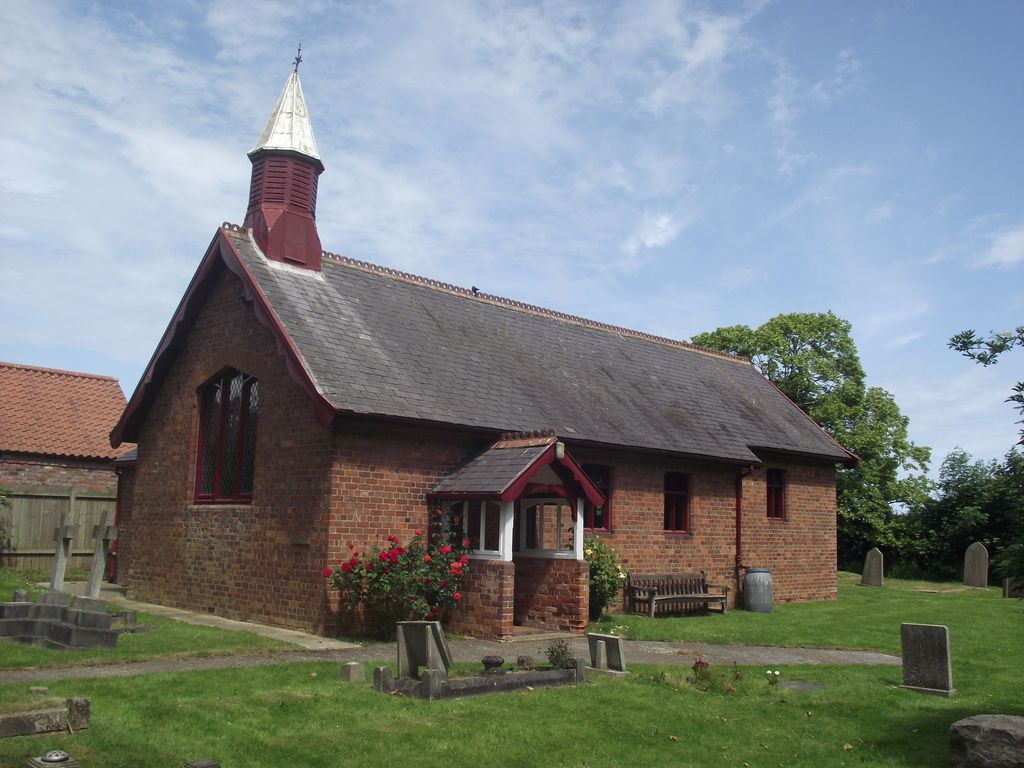
| Memorials | : | 0 |
| Location | : | Bewholme, East Riding of Yorkshire Unitary Authority, England |
| Coordinate | : | 53.9336770, -0.2262599 |
| Description | : | Built in 1900, St John the Baptist in Bewholme became the parish church for the Parish of Nunkeeling when St Mary Magdalene & St Helen church in neighbouring Nunkeeling was formally closed. Burial registers for St John the Baptist (to 1993) are included in the Nunkeeling Parish Records (Church of England) and have been deposited with the East Riding Archives (The Treasure House, Champney Road, Beverley). |
frequently asked questions (FAQ):
-
Where is St. John the Baptist Churchyard?
St. John the Baptist Churchyard is located at Bewholme, East Riding of Yorkshire Unitary Authority ,East Riding of Yorkshire , YO25 8DYEngland.
-
St. John the Baptist Churchyard cemetery's updated grave count on graveviews.com?
0 memorials
-
Where are the coordinates of the St. John the Baptist Churchyard?
Latitude: 53.9336770
Longitude: -0.2262599
Nearby Cemetories:
1. St. Lawrence Churchyard
Atwick, East Riding of Yorkshire Unitary Authority, England
Coordinate: 53.9397250, -0.1968630
2. St. Nicholas Churchyard
Dunnington, East Riding of Yorkshire Unitary Authority, England
Coordinate: 53.9504440, -0.2442030
3. St. Nicholas Churchyard
Hornsea, East Riding of Yorkshire Unitary Authority, England
Coordinate: 53.9108000, -0.1731280
4. Southgate Cemetery
Hornsea, East Riding of Yorkshire Unitary Authority, England
Coordinate: 53.9082500, -0.1706000
5. Edenfield Cemetery
Hornsea, East Riding of Yorkshire Unitary Authority, England
Coordinate: 53.8991362, -0.1755450
6. St. Mary's Churchyard
Brandesburton, East Riding of Yorkshire Unitary Authority, England
Coordinate: 53.9129460, -0.2968880
7. St. Giles' Churchyard
Goxhill, East Riding of Yorkshire Unitary Authority, England
Coordinate: 53.8860480, -0.1981080
8. St Leonard Churchyard
Beeford, East Riding of Yorkshire Unitary Authority, England
Coordinate: 53.9731490, -0.2801510
9. St. Michael's Churchyard
Catwick, East Riding of Yorkshire Unitary Authority, England
Coordinate: 53.8921250, -0.2805722
10. Holy Trinity Churchyard
Leven, East Riding of Yorkshire Unitary Authority, England
Coordinate: 53.8915167, -0.3172194
11. St James of Compostella Churchyard
Lissett, East Riding of Yorkshire Unitary Authority, England
Coordinate: 54.0059600, -0.2552300
12. St Margaret Churchyard
Long Riston, East Riding of Yorkshire Unitary Authority, England
Coordinate: 53.8686420, -0.2928580
13. St Andrew Churchyard
Foston, East Riding of Yorkshire Unitary Authority, England
Coordinate: 53.9864230, -0.3227200
14. St. Faith Churchyard
Leven, East Riding of Yorkshire Unitary Authority, England
Coordinate: 53.8943111, -0.3407167
15. All Saints Churchyard
Barmston, East Riding of Yorkshire Unitary Authority, England
Coordinate: 54.0128770, -0.2363350
16. Aldbrough Cemetery
Aldbrough, East Riding of Yorkshire Unitary Authority, England
Coordinate: 53.8288200, -0.1257900
17. St. John of Beverley Churchyard
Harpham, East Riding of Yorkshire Unitary Authority, England
Coordinate: 54.0387080, -0.3336340
18. St. Martin's Churchyard
Lowthorpe, East Riding of Yorkshire Unitary Authority, England
Coordinate: 54.0318880, -0.3537900
19. St. Bartholomew Churchyard
Aldbrough, East Riding of Yorkshire Unitary Authority, England
Coordinate: 53.8297390, -0.1107480
20. St Peter Churchyard
Hutton Cranswick, East Riding of Yorkshire Unitary Authority, England
Coordinate: 53.9660000, -0.4405180
21. St Martin Churchyard
Burton Agnes, East Riding of Yorkshire Unitary Authority, England
Coordinate: 54.0534690, -0.3180740
22. Burton Agnes Cemetery
Burton Agnes, East Riding of Yorkshire Unitary Authority, England
Coordinate: 54.0535070, -0.3202460
23. St Margaret Churchyard
Beswick, East Riding of Yorkshire Unitary Authority, England
Coordinate: 53.9194140, -0.4599290
24. Driffield Cemetery
Driffield, East Riding of Yorkshire Unitary Authority, England
Coordinate: 54.0112620, -0.4254680


