
| Memorials | : | 0 |
| Location | : | Dunnington, East Riding of Yorkshire Unitary Authority, England |
| Coordinate | : | 53.9504440, -0.2442030 |
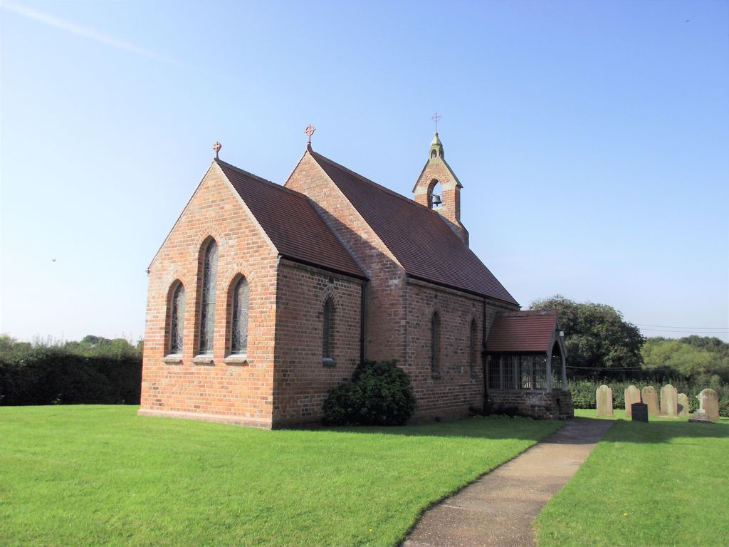
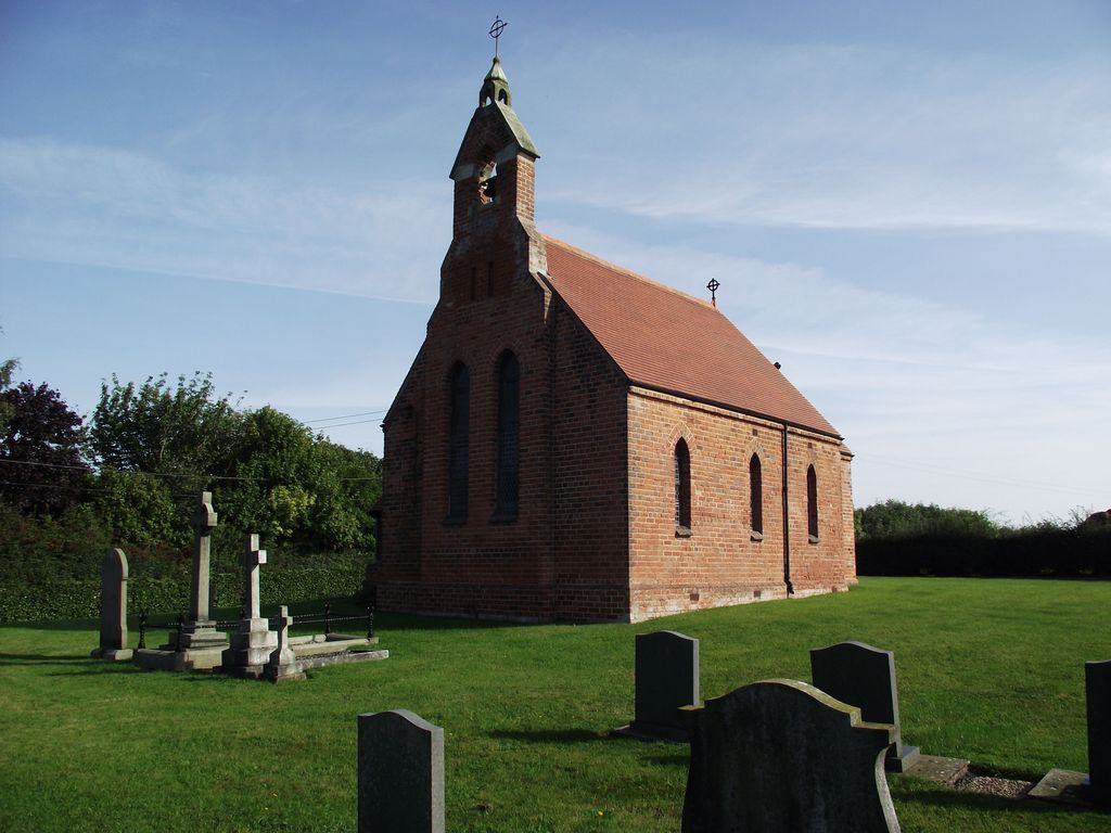
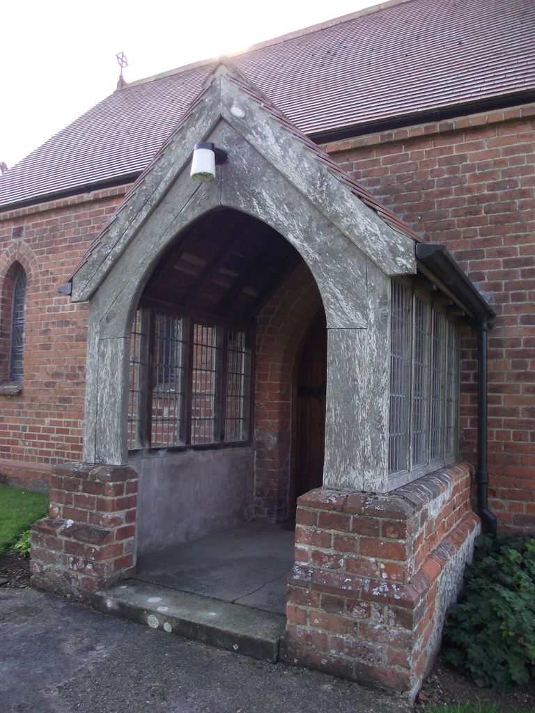
| Description | : | The ancient chapel of St. Nicholas, Dunnington which had been in ruins for more than a century, was rebuilt in 1879 at the cost of £500 and is an edifice of red brick in early English style, consisting of Chancel, Nave and North Porch and has one bell in the Western Gable. The stained glass windows were inserted by Mrs Sarah Ansley in memory of her husband George John Ansley who died in 1879. In 1903 H.J. Tebbutt, Rector had the interior remodelled, raising the floor of the chancel and extending it into the Nave and further raising the floor... Read More |
frequently asked questions (FAQ):
-
Where is St. Nicholas Churchyard?
St. Nicholas Churchyard is located at Dunnington, East Riding of Yorkshire Unitary Authority ,East Riding of Yorkshire ,England.
-
St. Nicholas Churchyard cemetery's updated grave count on graveviews.com?
0 memorials
-
Where are the coordinates of the St. Nicholas Churchyard?
Latitude: 53.9504440
Longitude: -0.2442030
Nearby Cemetories:
1. St. John the Baptist Churchyard
Bewholme, East Riding of Yorkshire Unitary Authority, England
Coordinate: 53.9336770, -0.2262599
2. St. Lawrence Churchyard
Atwick, East Riding of Yorkshire Unitary Authority, England
Coordinate: 53.9397250, -0.1968630
3. St Leonard Churchyard
Beeford, East Riding of Yorkshire Unitary Authority, England
Coordinate: 53.9731490, -0.2801510
4. St. Mary's Churchyard
Brandesburton, East Riding of Yorkshire Unitary Authority, England
Coordinate: 53.9129460, -0.2968880
5. St James of Compostella Churchyard
Lissett, East Riding of Yorkshire Unitary Authority, England
Coordinate: 54.0059600, -0.2552300
6. St. Nicholas Churchyard
Hornsea, East Riding of Yorkshire Unitary Authority, England
Coordinate: 53.9108000, -0.1731280
7. St Andrew Churchyard
Foston, East Riding of Yorkshire Unitary Authority, England
Coordinate: 53.9864230, -0.3227200
8. Southgate Cemetery
Hornsea, East Riding of Yorkshire Unitary Authority, England
Coordinate: 53.9082500, -0.1706000
9. St. Michael's Churchyard
Catwick, East Riding of Yorkshire Unitary Authority, England
Coordinate: 53.8921250, -0.2805722
10. All Saints Churchyard
Barmston, East Riding of Yorkshire Unitary Authority, England
Coordinate: 54.0128770, -0.2363350
11. Edenfield Cemetery
Hornsea, East Riding of Yorkshire Unitary Authority, England
Coordinate: 53.8991362, -0.1755450
12. St. Giles' Churchyard
Goxhill, East Riding of Yorkshire Unitary Authority, England
Coordinate: 53.8860480, -0.1981080
13. Holy Trinity Churchyard
Leven, East Riding of Yorkshire Unitary Authority, England
Coordinate: 53.8915167, -0.3172194
14. St. Faith Churchyard
Leven, East Riding of Yorkshire Unitary Authority, England
Coordinate: 53.8943111, -0.3407167
15. St Margaret Churchyard
Long Riston, East Riding of Yorkshire Unitary Authority, England
Coordinate: 53.8686420, -0.2928580
16. St. John of Beverley Churchyard
Harpham, East Riding of Yorkshire Unitary Authority, England
Coordinate: 54.0387080, -0.3336340
17. St. Martin's Churchyard
Lowthorpe, East Riding of Yorkshire Unitary Authority, England
Coordinate: 54.0318880, -0.3537900
18. St Martin Churchyard
Burton Agnes, East Riding of Yorkshire Unitary Authority, England
Coordinate: 54.0534690, -0.3180740
19. Burton Agnes Cemetery
Burton Agnes, East Riding of Yorkshire Unitary Authority, England
Coordinate: 54.0535070, -0.3202460
20. St Peter Churchyard
Hutton Cranswick, East Riding of Yorkshire Unitary Authority, England
Coordinate: 53.9660000, -0.4405180
21. Driffield Cemetery
Driffield, East Riding of Yorkshire Unitary Authority, England
Coordinate: 54.0112620, -0.4254680
22. St John the Baptist Churchyard
Carnaby, East Riding of Yorkshire Unitary Authority, England
Coordinate: 54.0735150, -0.2524190
23. St Magnus Churchyard
Bessingby, East Riding of Yorkshire Unitary Authority, England
Coordinate: 54.0762540, -0.2300000
24. All Saints Churchyard
Driffield, East Riding of Yorkshire Unitary Authority, England
Coordinate: 54.0077480, -0.4419340