
| Memorials | : | 0 |
| Location | : | Atwick, East Riding of Yorkshire Unitary Authority, England |
| Coordinate | : | 53.9397250, -0.1968630 |
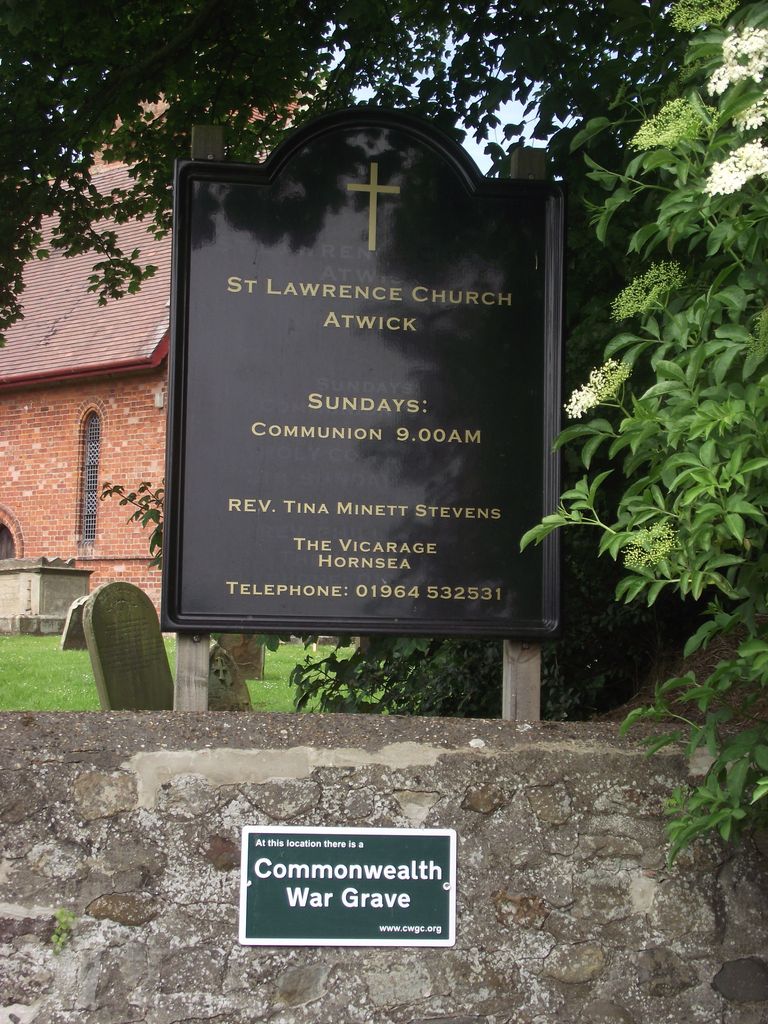
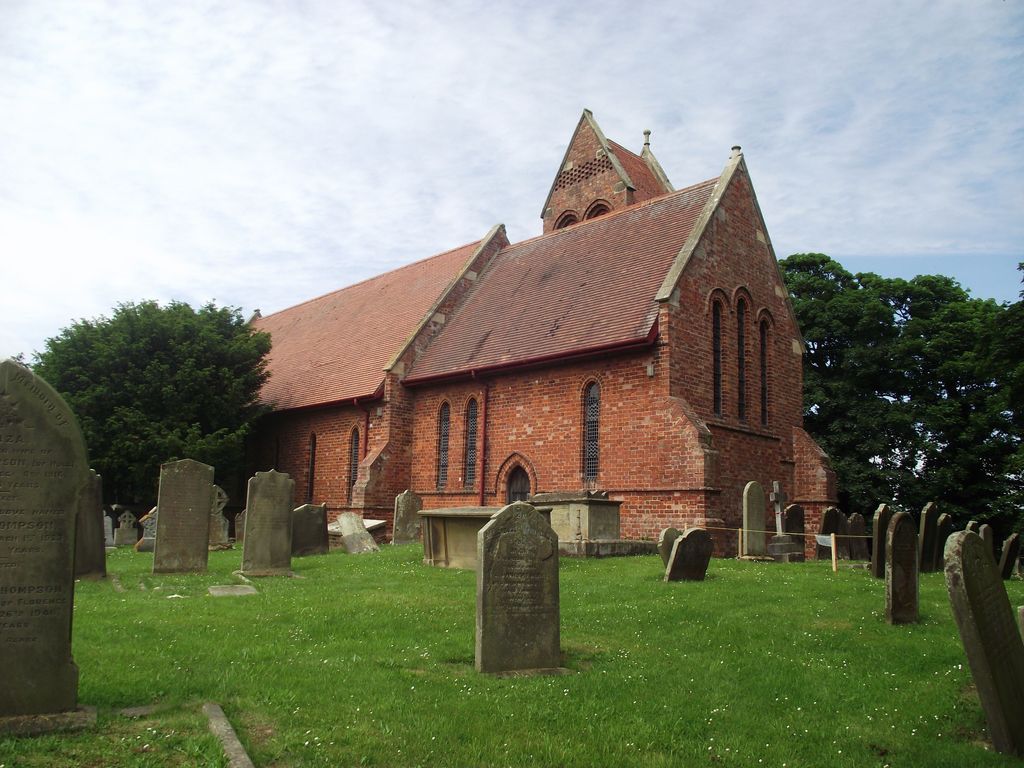
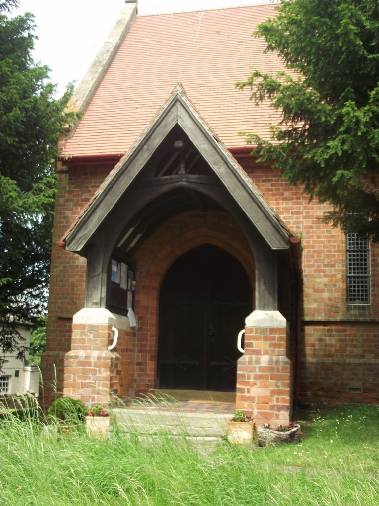
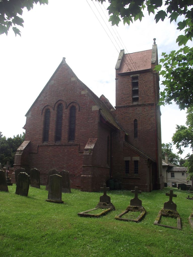
| Description | : | The church of St. Lawerence was rebuilt in the 19th century. The earlier building was dedicated to St. Peter in 1925, but the modern dedication was in use by 1461. Before the 19th century, the church comprised chancel, nave with south porch and west tower. The chancel was in disrepair in 1575. The tower was rebuilt in brick in 1829 and other parts of the building then repaired, the church was rebuilt in 1876 to designs by Hugh Roumieu Gough of London. It is of bright red brick with a red tile roof, it is 1th century in style, and... Read More |
frequently asked questions (FAQ):
-
Where is St. Lawrence Churchyard?
St. Lawrence Churchyard is located at Atwick, East Riding of Yorkshire Unitary Authority ,East Riding of Yorkshire ,England.
-
St. Lawrence Churchyard cemetery's updated grave count on graveviews.com?
0 memorials
-
Where are the coordinates of the St. Lawrence Churchyard?
Latitude: 53.9397250
Longitude: -0.1968630
Nearby Cemetories:
1. St. John the Baptist Churchyard
Bewholme, East Riding of Yorkshire Unitary Authority, England
Coordinate: 53.9336770, -0.2262599
2. St. Nicholas Churchyard
Dunnington, East Riding of Yorkshire Unitary Authority, England
Coordinate: 53.9504440, -0.2442030
3. St. Nicholas Churchyard
Hornsea, East Riding of Yorkshire Unitary Authority, England
Coordinate: 53.9108000, -0.1731280
4. Southgate Cemetery
Hornsea, East Riding of Yorkshire Unitary Authority, England
Coordinate: 53.9082500, -0.1706000
5. Edenfield Cemetery
Hornsea, East Riding of Yorkshire Unitary Authority, England
Coordinate: 53.8991362, -0.1755450
6. St. Giles' Churchyard
Goxhill, East Riding of Yorkshire Unitary Authority, England
Coordinate: 53.8860480, -0.1981080
7. St Leonard Churchyard
Beeford, East Riding of Yorkshire Unitary Authority, England
Coordinate: 53.9731490, -0.2801510
8. St. Mary's Churchyard
Brandesburton, East Riding of Yorkshire Unitary Authority, England
Coordinate: 53.9129460, -0.2968880
9. St. Michael's Churchyard
Catwick, East Riding of Yorkshire Unitary Authority, England
Coordinate: 53.8921250, -0.2805722
10. St James of Compostella Churchyard
Lissett, East Riding of Yorkshire Unitary Authority, England
Coordinate: 54.0059600, -0.2552300
11. All Saints Churchyard
Barmston, East Riding of Yorkshire Unitary Authority, England
Coordinate: 54.0128770, -0.2363350
12. Holy Trinity Churchyard
Leven, East Riding of Yorkshire Unitary Authority, England
Coordinate: 53.8915167, -0.3172194
13. St Andrew Churchyard
Foston, East Riding of Yorkshire Unitary Authority, England
Coordinate: 53.9864230, -0.3227200
14. St Margaret Churchyard
Long Riston, East Riding of Yorkshire Unitary Authority, England
Coordinate: 53.8686420, -0.2928580
15. St. Faith Churchyard
Leven, East Riding of Yorkshire Unitary Authority, England
Coordinate: 53.8943111, -0.3407167
16. Aldbrough Cemetery
Aldbrough, East Riding of Yorkshire Unitary Authority, England
Coordinate: 53.8288200, -0.1257900
17. St. Bartholomew Churchyard
Aldbrough, East Riding of Yorkshire Unitary Authority, England
Coordinate: 53.8297390, -0.1107480
18. St. John of Beverley Churchyard
Harpham, East Riding of Yorkshire Unitary Authority, England
Coordinate: 54.0387080, -0.3336340
19. St. Martin's Churchyard
Lowthorpe, East Riding of Yorkshire Unitary Authority, England
Coordinate: 54.0318880, -0.3537900
20. St Martin Churchyard
Burton Agnes, East Riding of Yorkshire Unitary Authority, England
Coordinate: 54.0534690, -0.3180740
21. Burton Agnes Cemetery
Burton Agnes, East Riding of Yorkshire Unitary Authority, England
Coordinate: 54.0535070, -0.3202460
22. St John the Baptist Churchyard
Carnaby, East Riding of Yorkshire Unitary Authority, England
Coordinate: 54.0735150, -0.2524190
23. St Magnus Churchyard
Bessingby, East Riding of Yorkshire Unitary Authority, England
Coordinate: 54.0762540, -0.2300000
24. St Peter Churchyard
Hutton Cranswick, East Riding of Yorkshire Unitary Authority, England
Coordinate: 53.9660000, -0.4405180