
| Memorials | : | 0 |
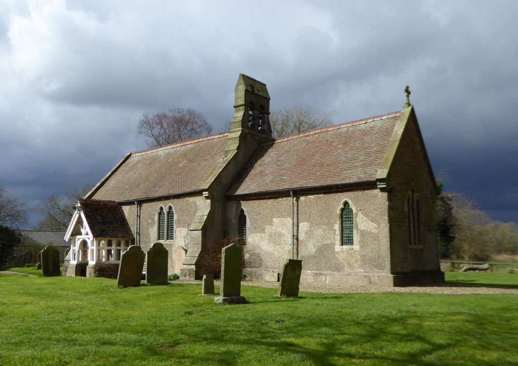
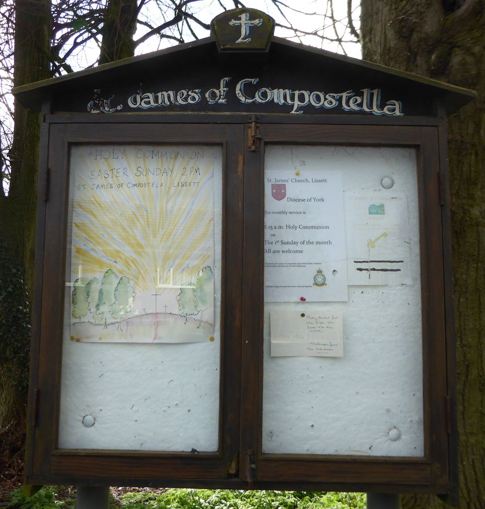
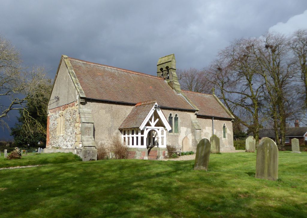
| Location | : | Lissett, East Riding of Yorkshire Unitary Authority, England |
| Coordinate | : | 54.0059600, -0.2552300 |
| Description | : | Built in the 12th. century, the church was remodelled in the 13th century but largely rebuilt in 1741 after storm damage. In 1876, it was restored by John Dent, Lord of the Manor. |
frequently asked questions (FAQ):
-
Where is St James of Compostella Churchyard?
St James of Compostella Churchyard is located at Main Street Lissett, East Riding of Yorkshire Unitary Authority ,East Riding of Yorkshire , YO25 8HYEngland.
-
St James of Compostella Churchyard cemetery's updated grave count on graveviews.com?
0 memorials
-
Where are the coordinates of the St James of Compostella Churchyard?
Latitude: 54.0059600
Longitude: -0.2552300
Nearby Cemetories:
1. All Saints Churchyard
Barmston, East Riding of Yorkshire Unitary Authority, England
Coordinate: 54.0128770, -0.2363350
2. St Leonard Churchyard
Beeford, East Riding of Yorkshire Unitary Authority, England
Coordinate: 53.9731490, -0.2801510
3. St Andrew Churchyard
Foston, East Riding of Yorkshire Unitary Authority, England
Coordinate: 53.9864230, -0.3227200
4. St. Nicholas Churchyard
Dunnington, East Riding of Yorkshire Unitary Authority, England
Coordinate: 53.9504440, -0.2442030
5. St. John of Beverley Churchyard
Harpham, East Riding of Yorkshire Unitary Authority, England
Coordinate: 54.0387080, -0.3336340
6. St Martin Churchyard
Burton Agnes, East Riding of Yorkshire Unitary Authority, England
Coordinate: 54.0534690, -0.3180740
7. Burton Agnes Cemetery
Burton Agnes, East Riding of Yorkshire Unitary Authority, England
Coordinate: 54.0535070, -0.3202460
8. St. Martin's Churchyard
Lowthorpe, East Riding of Yorkshire Unitary Authority, England
Coordinate: 54.0318880, -0.3537900
9. St John the Baptist Churchyard
Carnaby, East Riding of Yorkshire Unitary Authority, England
Coordinate: 54.0735150, -0.2524190
10. St Magnus Churchyard
Bessingby, East Riding of Yorkshire Unitary Authority, England
Coordinate: 54.0762540, -0.2300000
11. St. John the Baptist Churchyard
Bewholme, East Riding of Yorkshire Unitary Authority, England
Coordinate: 53.9336770, -0.2262599
12. St. Lawrence Churchyard
Atwick, East Riding of Yorkshire Unitary Authority, England
Coordinate: 53.9397250, -0.1968630
13. St Andrew Churchyard
Boynton, East Riding of Yorkshire Unitary Authority, England
Coordinate: 54.0950500, -0.2635100
14. All Saints Churchyard
Kilham, East Riding of Yorkshire Unitary Authority, England
Coordinate: 54.0645570, -0.3750570
15. Kilham Cemetery
Kilham, East Riding of Yorkshire Unitary Authority, England
Coordinate: 54.0687100, -0.3690310
16. Priory Church of St. Mary Churchyard
Bridlington, East Riding of Yorkshire Unitary Authority, England
Coordinate: 54.0943730, -0.2018530
17. St. Mary's Churchyard
Brandesburton, East Riding of Yorkshire Unitary Authority, England
Coordinate: 53.9129460, -0.2968880
18. Bridlington Cemetery
Bridlington, East Riding of Yorkshire Unitary Authority, England
Coordinate: 54.0961100, -0.1941400
19. Driffield Cemetery
Driffield, East Riding of Yorkshire Unitary Authority, England
Coordinate: 54.0112620, -0.4254680
20. St. Nicholas Churchyard
Hornsea, East Riding of Yorkshire Unitary Authority, England
Coordinate: 53.9108000, -0.1731280
21. Southgate Cemetery
Hornsea, East Riding of Yorkshire Unitary Authority, England
Coordinate: 53.9082500, -0.1706000
22. All Saints Churchyard
Driffield, East Riding of Yorkshire Unitary Authority, England
Coordinate: 54.0077480, -0.4419340
23. St. John the Evangelist Churchyard
Bridlington, East Riding of Yorkshire Unitary Authority, England
Coordinate: 54.1035900, -0.1646040
24. St. Michael's Churchyard
Catwick, East Riding of Yorkshire Unitary Authority, England
Coordinate: 53.8921250, -0.2805722