
| Memorials | : | 304 |
| Location | : | North Baddesley, Test Valley Borough, England |
| Coordinate | : | 50.9858300, -1.4283100 |
| Description | : | The village of North Baddesley is located in the beautiful Test Valley, famous for its trout fishing and is approximately 3 miles (4.8 km) south of Romsey between Chilworth and Ampfield and 6 miles (10 km) north of Southampton in the county of Hampshire, England. Its roots stretch back to the Domesday Book of 1086. |
frequently asked questions (FAQ):
-
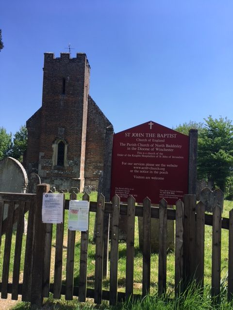
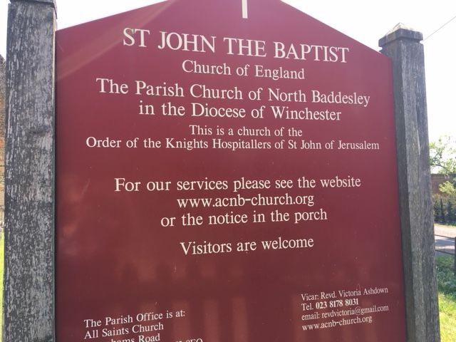
Where is St John the Baptist Churchyard?
St John the Baptist Churchyard is located at Flexford Road North Baddesley, Test Valley Borough ,Hampshire , SO52 9DFEngland.
-
St John the Baptist Churchyard cemetery's updated grave count on graveviews.com?
304 memorials
-
Where are the coordinates of the St John the Baptist Churchyard?
Latitude: 50.9858300
Longitude: -1.4283100
Nearby Cemetories:
1. St. Deny's Churchyard
Chilworth, Test Valley Borough, England
Coordinate: 50.9669770, -1.4226050
2. Ramalley Cemetery
Chandlers Ford, Eastleigh Borough, England
Coordinate: 50.9912950, -1.3914870
3. St. Mark's Churchyard
Ampfield, Test Valley Borough, England
Coordinate: 51.0093350, -1.4211790
4. Pine Road Cemetery
Chandlers Ford, Eastleigh Borough, England
Coordinate: 50.9969590, -1.3904110
5. Botley Road Cemetery
Romsey, Test Valley Borough, England
Coordinate: 50.9884090, -1.4784770
6. Woodley Cemetery
Romsey, Test Valley Borough, England
Coordinate: 51.0075340, -1.4724670
7. St John the Evangelist Churchyard
Rownhams, Test Valley Borough, England
Coordinate: 50.9520900, -1.4541200
8. Hampshire Fire and Rescue Garden of Remembrance
Eastleigh, Eastleigh Borough, England
Coordinate: 50.9728200, -1.3710200
9. Eastleigh Cemetery
Eastleigh, Eastleigh Borough, England
Coordinate: 50.9724710, -1.3612860
10. Southampton Crematorium and Garden of Remembrance
Southampton, Southampton Unitary Authority, England
Coordinate: 50.9471770, -1.3899120
11. All Saints Churchyard
Hursley, City of Winchester, England
Coordinate: 51.0253320, -1.3914090
12. Romsey Abbey
Romsey, Test Valley Borough, England
Coordinate: 50.9896510, -1.5012580
13. Hursley Church Cemetery
Hursley, City of Winchester, England
Coordinate: 51.0250150, -1.3877460
14. St Nicolas Churchyard
North Stoneham, Eastleigh Borough, England
Coordinate: 50.9535160, -1.3741760
15. All Saints Churchyard
Braishfield, Test Valley Borough, England
Coordinate: 51.0271030, -1.4650780
16. Hollybrook Cemetery
Southampton, Southampton Unitary Authority, England
Coordinate: 50.9340680, -1.4312970
17. St. Matthew's Churchyard
Otterbourne, City of Winchester, England
Coordinate: 51.0030630, -1.3503880
18. Hollybrook War Memorial
Southampton, Southampton Unitary Authority, England
Coordinate: 50.9337420, -1.4311350
19. St Boniface Churchyard
Nursling, Test Valley Borough, England
Coordinate: 50.9464660, -1.4896760
20. St. Matthew's Old Graveyard
Winchester, City of Winchester, England
Coordinate: 51.0015670, -1.3383760
21. St Mary Churchyard
Bishopstoke, Eastleigh Borough, England
Coordinate: 50.9760650, -1.3358720
22. St. James by the Park Cemetery
Southampton Unitary Authority, England
Coordinate: 50.9267988, -1.4283898
23. St James by the Park Churchyard
Shirley, Southampton Unitary Authority, England
Coordinate: 50.9266800, -1.4285800
24. St. John's Churchyard
Farley Chamberlayne, City of Winchester, England
Coordinate: 51.0449700, -1.4343600