
| Memorials | : | 13 |
| Location | : | Rownhams, Test Valley Borough, England |
| Coordinate | : | 50.9520900, -1.4541200 |
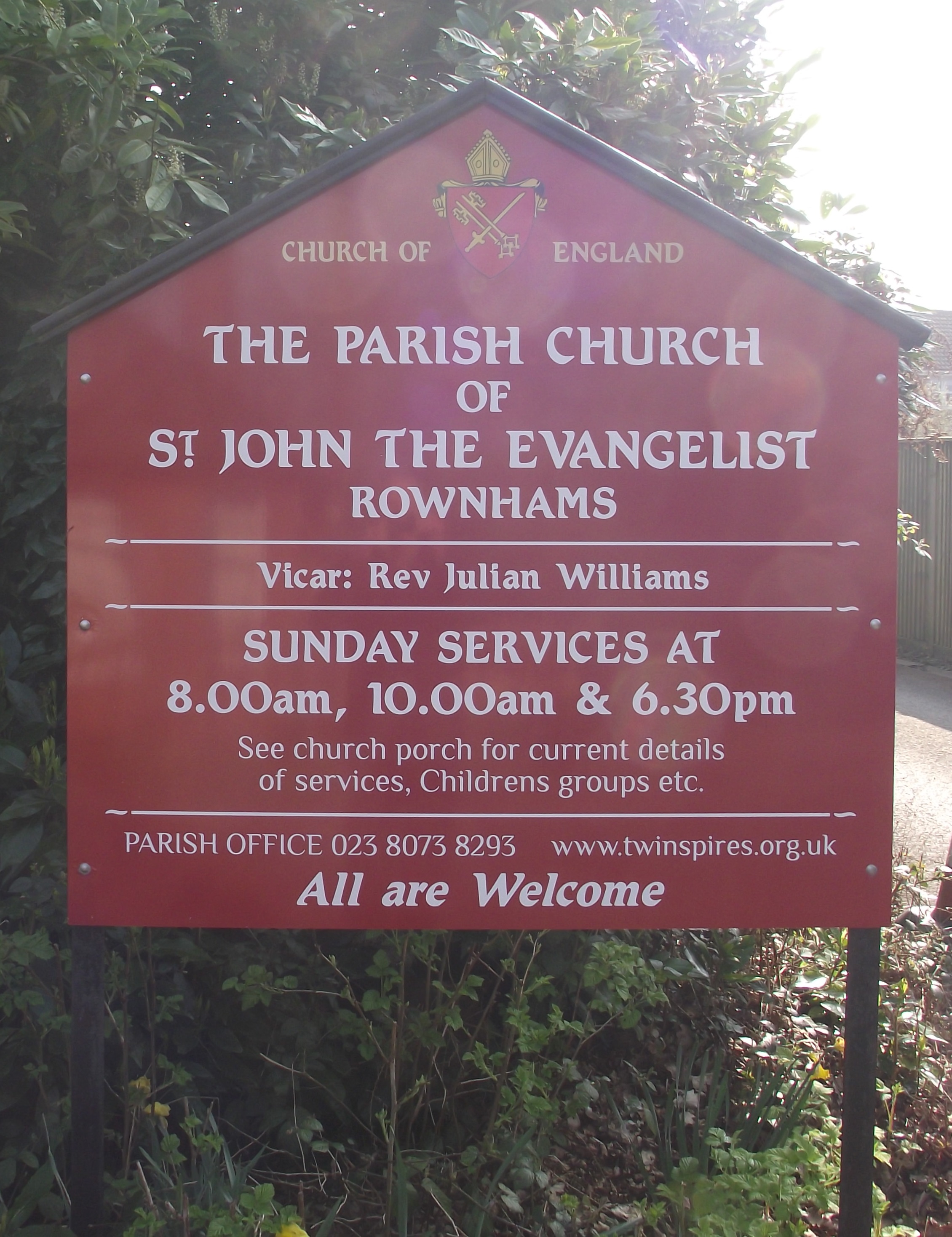
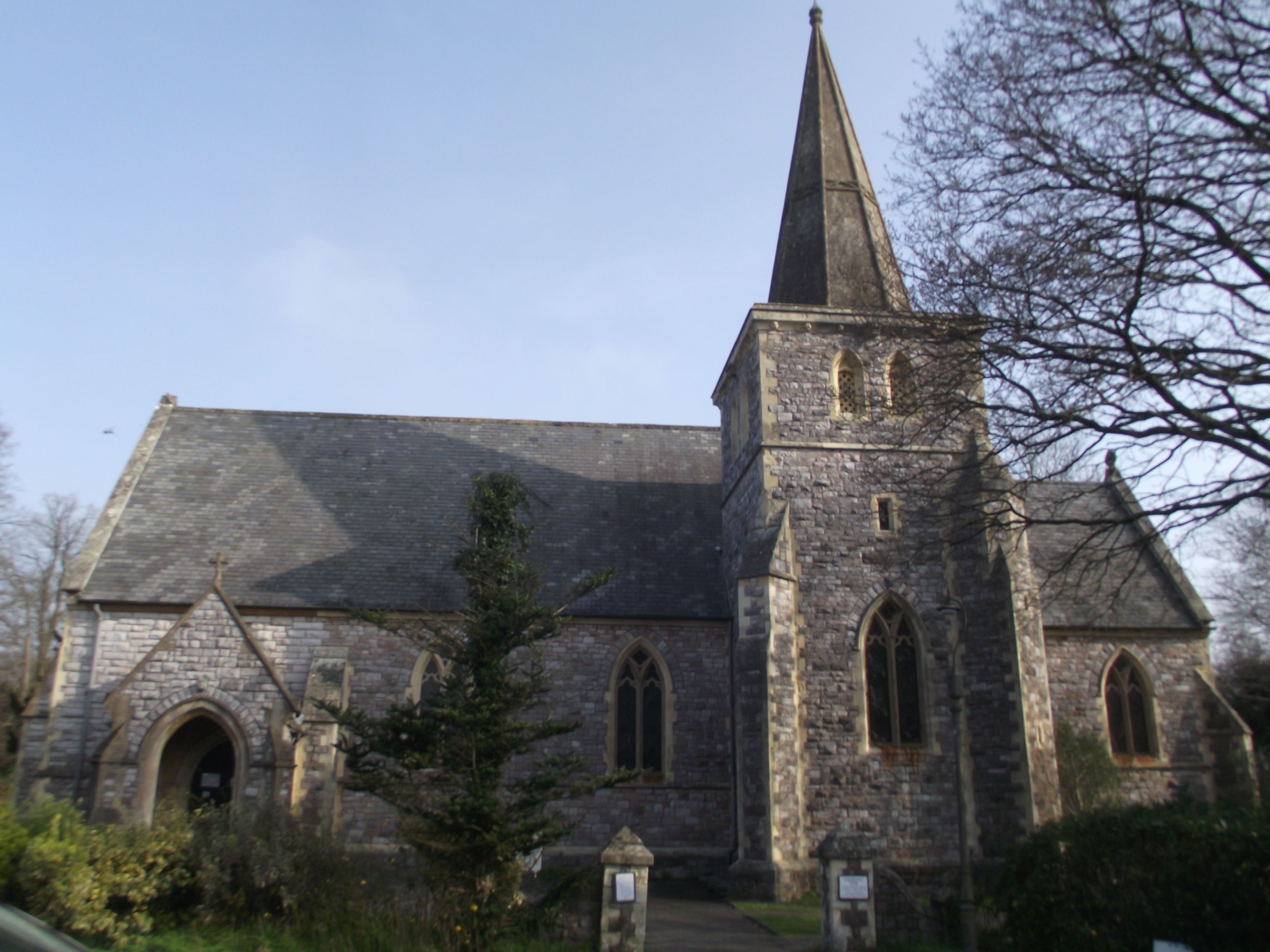
| Description | : | St John the Evangelist is now known as St John the Evangelist, Nursling w Rownhams |
frequently asked questions (FAQ):
-
Where is St John the Evangelist Churchyard?
St John the Evangelist Churchyard is located at Horns Drove Rownhams, Test Valley Borough ,Hampshire , SO16 8AHEngland.
-
St John the Evangelist Churchyard cemetery's updated grave count on graveviews.com?
13 memorials
-
Where are the coordinates of the St John the Evangelist Churchyard?
Latitude: 50.9520900
Longitude: -1.4541200
Nearby Cemetories:
1. Hollybrook Cemetery
Southampton, Southampton Unitary Authority, England
Coordinate: 50.9340680, -1.4312970
2. St Boniface Churchyard
Nursling, Test Valley Borough, England
Coordinate: 50.9464660, -1.4896760
3. Hollybrook War Memorial
Southampton, Southampton Unitary Authority, England
Coordinate: 50.9337420, -1.4311350
4. St. Deny's Churchyard
Chilworth, Test Valley Borough, England
Coordinate: 50.9669770, -1.4226050
5. St. James by the Park Cemetery
Southampton Unitary Authority, England
Coordinate: 50.9267988, -1.4283898
6. St James by the Park Churchyard
Shirley, Southampton Unitary Authority, England
Coordinate: 50.9266800, -1.4285800
7. Millbrook Cemetery
Millbrook, Southampton Unitary Authority, England
Coordinate: 50.9164900, -1.4526100
8. Holy Trinity Churchyard
Millbrook, Southampton Unitary Authority, England
Coordinate: 50.9158400, -1.4535100
9. St John the Baptist Churchyard
North Baddesley, Test Valley Borough, England
Coordinate: 50.9858300, -1.4283100
10. St. Nicholas Churchyard
Millbrook, Southampton Unitary Authority, England
Coordinate: 50.9139100, -1.4439800
11. Botley Road Cemetery
Romsey, Test Valley Borough, England
Coordinate: 50.9884090, -1.4784770
12. Southampton Crematorium and Garden of Remembrance
Southampton, Southampton Unitary Authority, England
Coordinate: 50.9471770, -1.3899120
13. Southampton Old Cemetery
Southampton, Southampton Unitary Authority, England
Coordinate: 50.9202900, -1.4130650
14. Highfield Churchyard
Portswood, Southampton Unitary Authority, England
Coordinate: 50.9295400, -1.3949800
15. St. Mary the Virgin Churchyard
Eling, New Forest District, England
Coordinate: 50.9103000, -1.4795700
16. Eling Cemetery
Eling, New Forest District, England
Coordinate: 50.9092640, -1.4817810
17. Romsey Abbey
Romsey, Test Valley Borough, England
Coordinate: 50.9896510, -1.5012580
18. St Nicolas Churchyard
North Stoneham, Eastleigh Borough, England
Coordinate: 50.9535160, -1.3741760
19. St. Mary's Churchyard
Swaythling, Southampton Unitary Authority, England
Coordinate: 50.9367800, -1.3752300
20. Ramalley Cemetery
Chandlers Ford, Eastleigh Borough, England
Coordinate: 50.9912950, -1.3914870
21. Hampshire Fire and Rescue Garden of Remembrance
Eastleigh, Eastleigh Borough, England
Coordinate: 50.9728200, -1.3710200
22. Woodley Cemetery
Romsey, Test Valley Borough, England
Coordinate: 51.0075340, -1.4724670
23. South Stoneham Cemetery
Swaythling, Southampton Unitary Authority, England
Coordinate: 50.9401030, -1.3660260
24. St. Matthew's Churchyard
Netley Marsh, New Forest District, England
Coordinate: 50.9161620, -1.5285530