
| Memorials | : | 82 |
| Location | : | Southampton, Southampton Unitary Authority, England |
| Coordinate | : | 50.9337420, -1.4311350 |
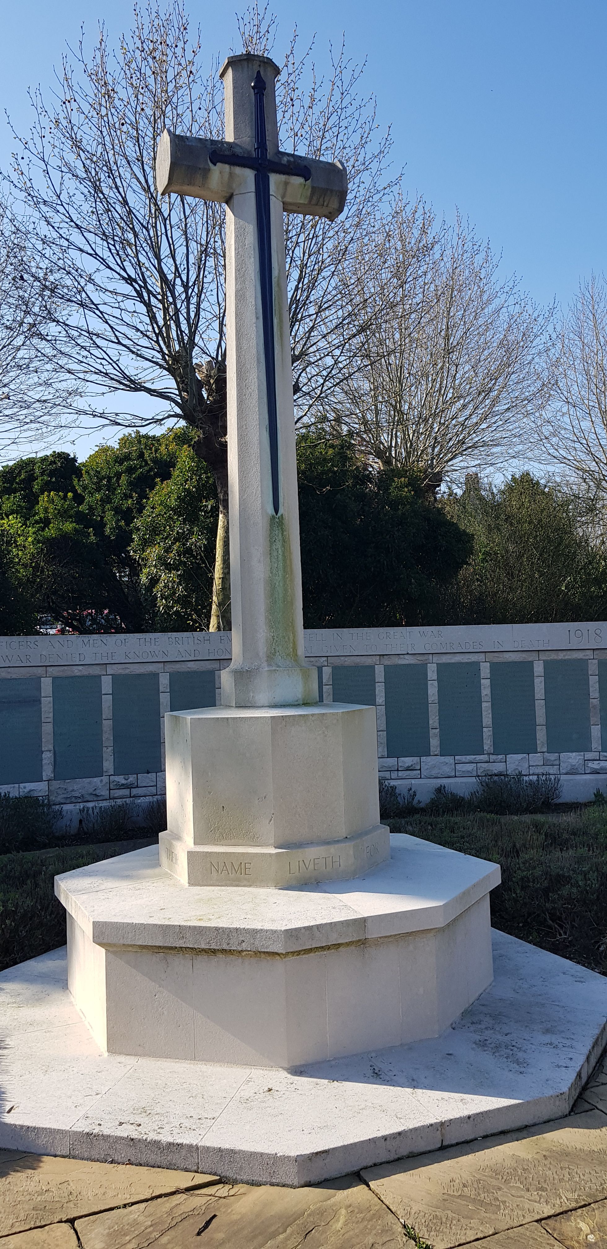
| Description | : | This War Memorial is maintained by the Commonwealth War Graves Commission. The cenotaph wall lists Commonwealth land and air force personnel who were lost at sea in World War I and have no known grave. These include Field Marshal Earl Kitchener and others who were lost on HMS Hampshire in 1916, and most of the South African Native Labour Corps personnel who were lost in the sinking of SS Mendi in 1917. |
frequently asked questions (FAQ):
-
Where is Hollybrook War Memorial?
Hollybrook War Memorial is located at Tremona Road, Shirley District Southampton, Southampton Unitary Authority ,Hampshire , SO16 6HWEngland.
-
Hollybrook War Memorial cemetery's updated grave count on graveviews.com?
82 memorials
-
Where are the coordinates of the Hollybrook War Memorial?
Latitude: 50.9337420
Longitude: -1.4311350


Nearby Cemetories:
1. Hollybrook Cemetery
Southampton, Southampton Unitary Authority, England
Coordinate: 50.9340680, -1.4312970
2. St. James by the Park Cemetery
Southampton Unitary Authority, England
Coordinate: 50.9267988, -1.4283898
3. St James by the Park Churchyard
Shirley, Southampton Unitary Authority, England
Coordinate: 50.9266800, -1.4285800
4. Southampton Old Cemetery
Southampton, Southampton Unitary Authority, England
Coordinate: 50.9202900, -1.4130650
5. St. Nicholas Churchyard
Millbrook, Southampton Unitary Authority, England
Coordinate: 50.9139100, -1.4439800
6. Millbrook Cemetery
Millbrook, Southampton Unitary Authority, England
Coordinate: 50.9164900, -1.4526100
7. Holy Trinity Churchyard
Millbrook, Southampton Unitary Authority, England
Coordinate: 50.9158400, -1.4535100
8. Highfield Churchyard
Portswood, Southampton Unitary Authority, England
Coordinate: 50.9295400, -1.3949800
9. St John the Evangelist Churchyard
Rownhams, Test Valley Borough, England
Coordinate: 50.9520900, -1.4541200
10. Southampton Crematorium and Garden of Remembrance
Southampton, Southampton Unitary Authority, England
Coordinate: 50.9471770, -1.3899120
11. St. Deny's Churchyard
Chilworth, Test Valley Borough, England
Coordinate: 50.9669770, -1.4226050
12. St. Mary's Churchyard
Swaythling, Southampton Unitary Authority, England
Coordinate: 50.9367800, -1.3752300
13. All Saints Catacombs and Burial Ground (Defunct)
Southampton, Southampton Unitary Authority, England
Coordinate: 50.9013350, -1.4021500
14. St Michael the Archangel Churchyard
Southampton, Southampton Unitary Authority, England
Coordinate: 50.8996200, -1.4056900
15. St Mary Churchyard
Southampton, Southampton Unitary Authority, England
Coordinate: 50.9027100, -1.3960800
16. Holyrood Church
Southampton Unitary Authority, England
Coordinate: 50.8997498, -1.4034560
17. Holyrood Churchyard
Southampton, Southampton Unitary Authority, England
Coordinate: 50.8996600, -1.4035300
18. St. Mary the Virgin Churchyard
Eling, New Forest District, England
Coordinate: 50.9103000, -1.4795700
19. St Boniface Churchyard
Nursling, Test Valley Borough, England
Coordinate: 50.9464660, -1.4896760
20. St Lawrence with St John Churchyard
Southampton, Southampton Unitary Authority, England
Coordinate: 50.8977570, -1.4052470
21. Eling Cemetery
Eling, New Forest District, England
Coordinate: 50.9092640, -1.4817810
22. St Nicolas Churchyard
North Stoneham, Eastleigh Borough, England
Coordinate: 50.9535160, -1.3741760
23. St. Julien's Church
Southampton, Southampton Unitary Authority, England
Coordinate: 50.8965000, -1.4036000
24. South Stoneham Cemetery
Swaythling, Southampton Unitary Authority, England
Coordinate: 50.9401030, -1.3660260