
| Memorials | : | 40 |
| Location | : | Great Rissington, Cotswold District, England |
| Phone | : | +44 (0)1451 798651 |
| Website | : | www.bourtonparishchurch.co.uk/st-john-the-baptist-great/4591003804 |
| Coordinate | : | 51.8526130, -1.7180490 |
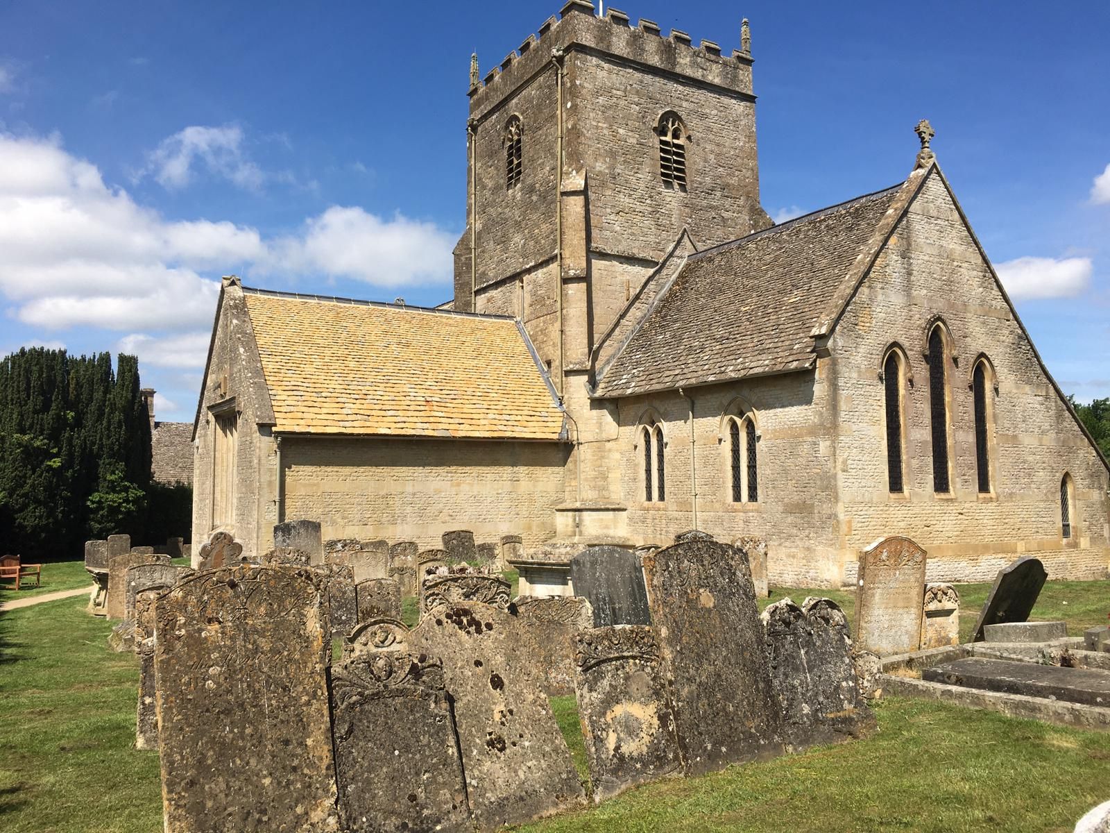
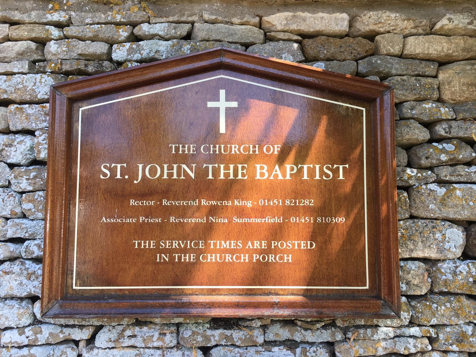
| Description | : | "A 12th century church situated beside the manor house in this lovely Cotswold village. The situation of St John the Baptist makes for a classic view. To the one side are imposing gateposts which give way to a wide avenue of trees leading to the manor house. To the other, screened by tall hedges, is a Georgian rectory. In the centre, occupying a small rise, is St John the Baptist church. The oldest parts of the church date from the 12th century. The square central tower, ornamented with battlements and pinnacles, is 15th century." See fuller description here: https://www.britainexpress.com/counties/glouces/churches/Great-Rissington.htm |
frequently asked questions (FAQ):
-
Where is St. John the Baptist Churchyard?
St. John the Baptist Churchyard is located at Great Rissington, Cotswold District ,Gloucestershire , GL54 2FNEngland.
-
St. John the Baptist Churchyard cemetery's updated grave count on graveviews.com?
40 memorials
-
Where are the coordinates of the St. John the Baptist Churchyard?
Latitude: 51.8526130
Longitude: -1.7180490
Nearby Cemetories:
1. St. Peter's Churchyard
Little Rissington, Cotswold District, England
Coordinate: 51.8780460, -1.7262610
2. Sherborne Churchyard extension
Sherborne, Cotswold District, England
Coordinate: 51.8308450, -1.7536600
3. St Mary Magdalene Churchyard
Sherborne, Cotswold District, England
Coordinate: 51.8308380, -1.7562570
4. Water Cemetery
Bourton-on-the-Water, Cotswold District, England
Coordinate: 51.8853540, -1.7530440
5. Baptist Churchyard
Bourton-on-the-Water, Cotswold District, England
Coordinate: 51.8856973, -1.7530678
6. St. Peter's Churchyard
Little Barrington, Cotswold District, England
Coordinate: 51.8130930, -1.6983770
7. St Lawrence Churchyard
Bourton-on-the-Water, Cotswold District, England
Coordinate: 51.8860500, -1.7588250
8. Saint John the Baptist Church
Fifield, West Oxfordshire District, England
Coordinate: 51.8668460, -1.6536260
9. St Nicholas Churchyard
Idbury, West Oxfordshire District, England
Coordinate: 51.8784370, -1.6584080
10. St. John The Evangelist Churchyard
Taynton, West Oxfordshire District, England
Coordinate: 51.8216040, -1.6621950
11. St. Mary the Virgin Churchyard
Icomb, Cotswold District, England
Coordinate: 51.9018000, -1.6905000
12. St. Mary's Churchyard
Lower Slaughter, Cotswold District, England
Coordinate: 51.9018830, -1.7605380
13. Burford Cemetery
Burford, West Oxfordshire District, England
Coordinate: 51.8084000, -1.6489600
14. St. Simon-St. Jude
Milton-under-Wychwood, West Oxfordshire District, England
Coordinate: 51.8660230, -1.6170140
15. Milton-under-Wychwood Cemetery
Milton-under-Wychwood, West Oxfordshire District, England
Coordinate: 51.8684380, -1.6176370
16. The Parish Church of St. Peter
Upper Slaughter, Cotswold District, England
Coordinate: 51.9074150, -1.7764140
17. Milton-under-Wychwood Friends Burial Ground
Milton-under-Wychwood, West Oxfordshire District, England
Coordinate: 51.8638040, -1.6109590
18. St. John the Baptist Churchyard
Burford, West Oxfordshire District, England
Coordinate: 51.8096490, -1.6341730
19. St James The Great Churchyard
Fulbrook, West Oxfordshire District, England
Coordinate: 51.8153500, -1.6265430
20. St. Mary's Churchyard
Westwell, West Oxfordshire District, England
Coordinate: 51.7886840, -1.6779678
21. Baptist Burial Ground
Burford, West Oxfordshire District, England
Coordinate: 51.8070150, -1.6338030
22. Stow-on-the-Wold Cemetery
Stow-on-the-Wold, Cotswold District, England
Coordinate: 51.9264100, -1.7254670
23. Saint Mary the Virgin Churchyard and Vaults
Shipton-under-Wychwood, West Oxfordshire District, England
Coordinate: 51.8597520, -1.5952810
24. St. Edward Churchyard
Stow-on-the-Wold, Cotswold District, England
Coordinate: 51.9299810, -1.7238290