
| Memorials | : | 55 |
| Location | : | Sherborne, Cotswold District, England |
| Coordinate | : | 51.8308380, -1.7562570 |
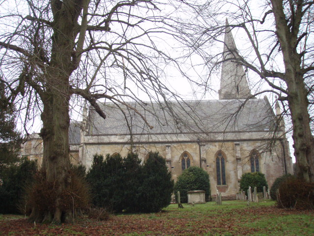
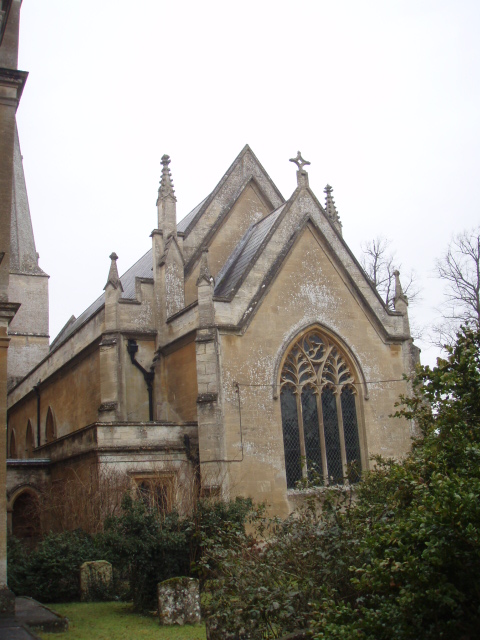
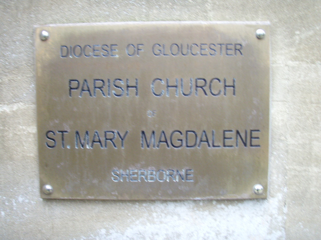
| Description | : | The present Church of England parish church of Saint Mary Magdalene is in the centre of the village. Its bell tower and spire were built late in the 13th or early in the 14th century. The church is next to Sherborne House, which was built for Thomas Dutton after he bought the manor of Sherborne in 1551.Elizabeth I stayed at the house in 1592. John Dutton had the house re-faced in 1651-53 and James Dutton, 1st Baron Sherborne had laterations made to the church between 1743 and 1776 including the addition of a Doric portico. In 1850-59 John Dutton, 2nd... Read More |
frequently asked questions (FAQ):
-
Where is St Mary Magdalene Churchyard?
St Mary Magdalene Churchyard is located at Sherborne, Cotswold District ,Gloucestershire , GL54 3DZEngland.
-
St Mary Magdalene Churchyard cemetery's updated grave count on graveviews.com?
55 memorials
-
Where are the coordinates of the St Mary Magdalene Churchyard?
Latitude: 51.8308380
Longitude: -1.7562570
Nearby Cemetories:
1. Sherborne Churchyard extension
Sherborne, Cotswold District, England
Coordinate: 51.8308450, -1.7536600
2. St. John the Baptist Churchyard
Great Rissington, Cotswold District, England
Coordinate: 51.8526130, -1.7180490
3. St. Peter's Churchyard
Little Barrington, Cotswold District, England
Coordinate: 51.8130930, -1.6983770
4. St. Peter's Churchyard
Little Rissington, Cotswold District, England
Coordinate: 51.8780460, -1.7262610
5. SS Peter & Paul
Northleach, Cotswold District, England
Coordinate: 51.8295720, -1.8390300
6. Water Cemetery
Bourton-on-the-Water, Cotswold District, England
Coordinate: 51.8853540, -1.7530440
7. Baptist Churchyard
Bourton-on-the-Water, Cotswold District, England
Coordinate: 51.8856973, -1.7530678
8. St Lawrence Churchyard
Bourton-on-the-Water, Cotswold District, England
Coordinate: 51.8860500, -1.7588250
9. St. John The Evangelist Churchyard
Taynton, West Oxfordshire District, England
Coordinate: 51.8216040, -1.6621950
10. All Saints Churchyard
Turkdean, Cotswold District, England
Coordinate: 51.8554710, -1.8456120
11. St. Mary's Churchyard
Westwell, West Oxfordshire District, England
Coordinate: 51.7886840, -1.6779678
12. Burford Cemetery
Burford, West Oxfordshire District, England
Coordinate: 51.8084000, -1.6489600
13. St. Mary's Churchyard
Lower Slaughter, Cotswold District, England
Coordinate: 51.9018830, -1.7605380
14. St Bartholomew Churchyard
Notgrove, Cotswold District, England
Coordinate: 51.8778620, -1.8426720
15. Saint John the Baptist Church
Fifield, West Oxfordshire District, England
Coordinate: 51.8668460, -1.6536260
16. St Nicholas Churchyard
Idbury, West Oxfordshire District, England
Coordinate: 51.8784370, -1.6584080
17. The Parish Church of St. Peter
Upper Slaughter, Cotswold District, England
Coordinate: 51.9074150, -1.7764140
18. St. John the Baptist Churchyard
Burford, West Oxfordshire District, England
Coordinate: 51.8096490, -1.6341730
19. Baptist Burial Ground
Burford, West Oxfordshire District, England
Coordinate: 51.8070150, -1.6338030
20. St James The Great Churchyard
Fulbrook, West Oxfordshire District, England
Coordinate: 51.8153500, -1.6265430
21. St. Mary the Virgin Churchyard
Icomb, Cotswold District, England
Coordinate: 51.9018000, -1.6905000
22. St. Nicholas Churchyard
Hatherop, Cotswold District, England
Coordinate: 51.7444700, -1.7780800
23. St. Nicholas' Churchyard
Hatherop, Cotswold District, England
Coordinate: 51.7443000, -1.7786600
24. St. Mary the Virgin Churchyard
Bibury, Cotswold District, England
Coordinate: 51.7587037, -1.8376852