
| Memorials | : | 0 |
| Location | : | Farnborough, Rushmoor Borough, England |
| Coordinate | : | 51.2973050, -0.7819310 |
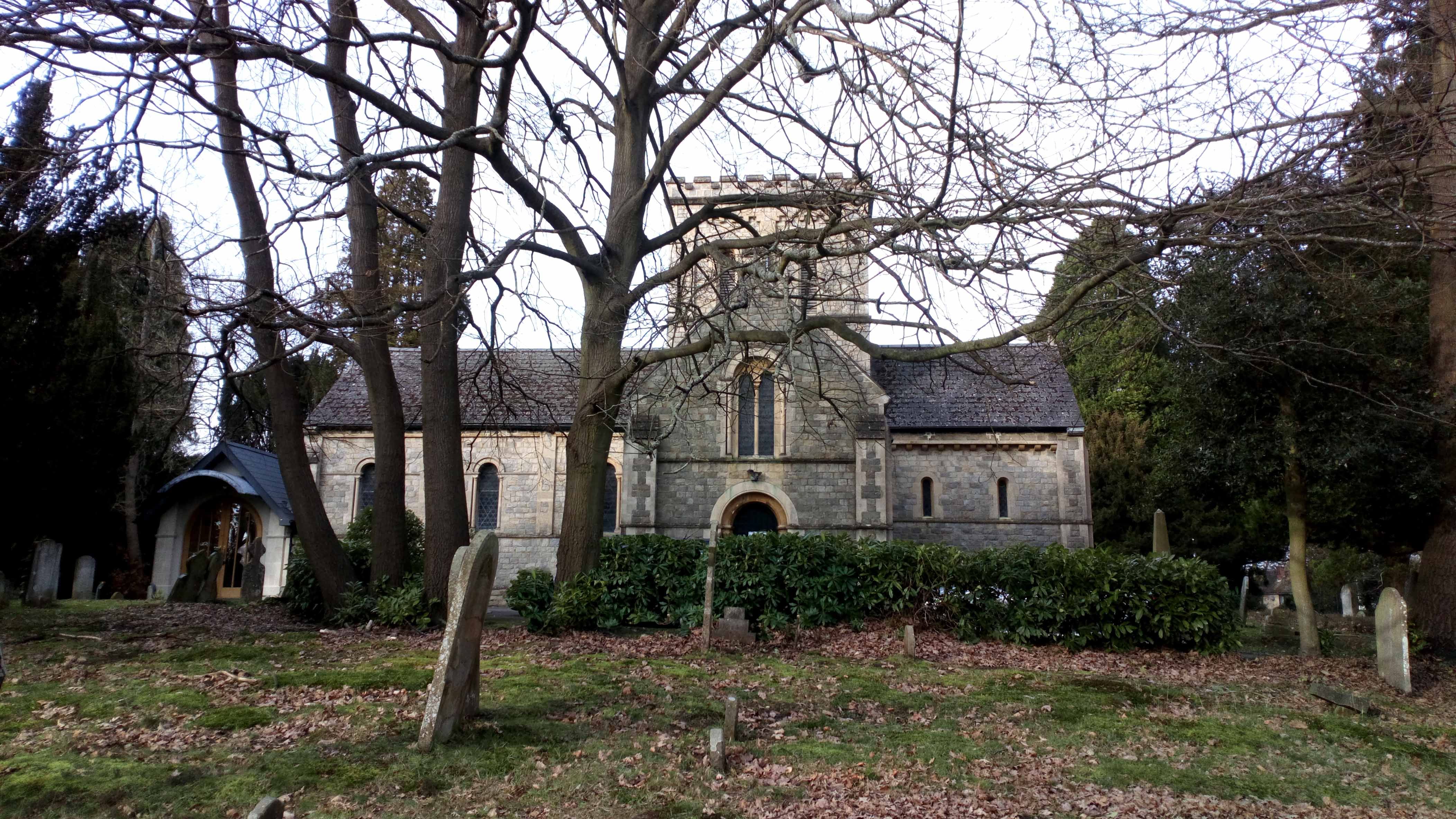
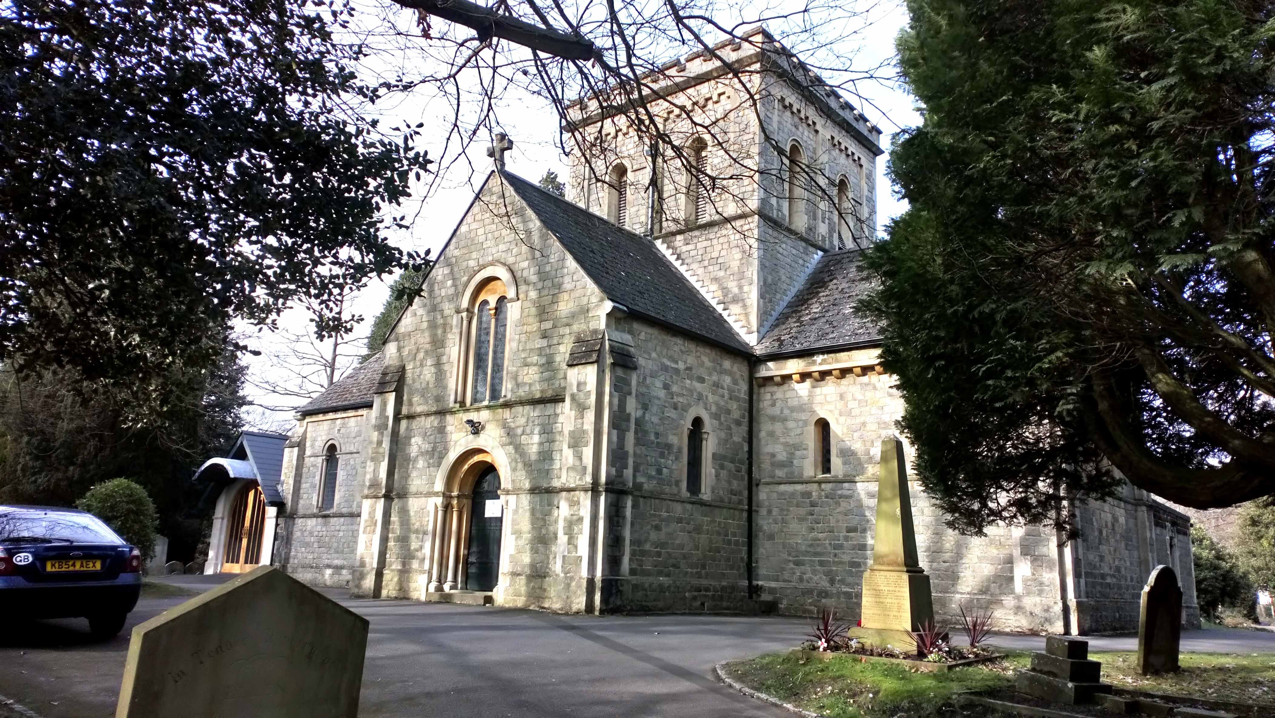
| Description | : | St. John's was built in 1844, patterned on the much larger St. Cross church on the outskirts of Winchester. It was designed to serve the small rural community of Cove and the big house in the area. You can still see the special seats where they sat. The church is not large, and seats about 120. The village of Cove is now a suburb of Farnborough. |
frequently asked questions (FAQ):
-
Where is St. John the Baptist Churchyard?
St. John the Baptist Churchyard is located at St Johns Road, Cove Farnborough, Rushmoor Borough ,Hampshire , GU14 9PWEngland.
-
St. John the Baptist Churchyard cemetery's updated grave count on graveviews.com?
0 memorials
-
Where are the coordinates of the St. John the Baptist Churchyard?
Latitude: 51.2973050
Longitude: -0.7819310
Nearby Cemetories:
1. Victoria Road Cemetery
Farnborough, Rushmoor Borough, England
Coordinate: 51.2941300, -0.7593900
2. St Michael's Abbey
Farnborough, Rushmoor Borough, England
Coordinate: 51.2971140, -0.7497110
3. St. Peter's Churchyard
Farnborough, Rushmoor Borough, England
Coordinate: 51.2924100, -0.7499300
4. Ship Lane Cemetery
Farnborough, Rushmoor Borough, England
Coordinate: 51.3057800, -0.7488900
5. Holy Trinity Churchyard
Blackwater, Hart District, England
Coordinate: 51.3269100, -0.7773800
6. Hawley Cemetery
Blackwater, Hart District, England
Coordinate: 51.3280700, -0.7778700
7. St Peter's Churchyard
Frimley, Surrey Heath Borough, England
Coordinate: 51.3149770, -0.7393330
8. Heathlands Cemetery
Yateley, Hart District, England
Coordinate: 51.3308800, -0.8172500
9. All Saints Churchyard
Fleet, Hart District, England
Coordinate: 51.2838060, -0.8427500
10. St. Michael‘s Churchyard
Camberley, Surrey Heath Borough, England
Coordinate: 51.3367810, -0.7596560
11. Hope Cemetery
Fleet, Hart District, England
Coordinate: 51.2827800, -0.8495300
12. Church of Saint Francis of Assisi
Camberley, Surrey Heath Borough, England
Coordinate: 51.3311000, -0.7350400
13. Sandhurst Royal Military Academy Cemetery
Sandhurst, Bracknell Forest Borough, England
Coordinate: 51.3431310, -0.7675360
14. Aldershot Military Cemetery
Aldershot, Rushmoor Borough, England
Coordinate: 51.2554779, -0.7449350
15. Deepcut Military Cemetery
Deepcut, Surrey Heath Borough, England
Coordinate: 51.3062170, -0.7049060
16. Fleet Cemetery
Fleet, Hart District, England
Coordinate: 51.2718100, -0.8523700
17. Aldershot Jewish Cemetery
Aldershot, Rushmoor Borough, England
Coordinate: 51.2508900, -0.7463000
18. Redan Road Cemetery
Aldershot, Rushmoor Borough, England
Coordinate: 51.2495610, -0.7488900
19. St Peter Churchyard
Yateley, Hart District, England
Coordinate: 51.3411500, -0.8278000
20. Christ Church Churchyard
Crookham Village, Hart District, England
Coordinate: 51.2597200, -0.8438180
21. St. Michael's and All Angels Churchyard
Sandhurst, Bracknell Forest Borough, England
Coordinate: 51.3498240, -0.8155500
22. St Michael the Archangel Churchyard
Aldershot, Rushmoor Borough, England
Coordinate: 51.2414300, -0.7558900
23. Ash War Memorial
Ash, Guildford Borough, England
Coordinate: 51.2546746, -0.7157783
24. Emery Gates Cemetery
Ash, Guildford Borough, England
Coordinate: 51.2500370, -0.7163210