
| Memorials | : | 0 |
| Location | : | Farnborough, Rushmoor Borough, England |
| Coordinate | : | 51.3057800, -0.7488900 |
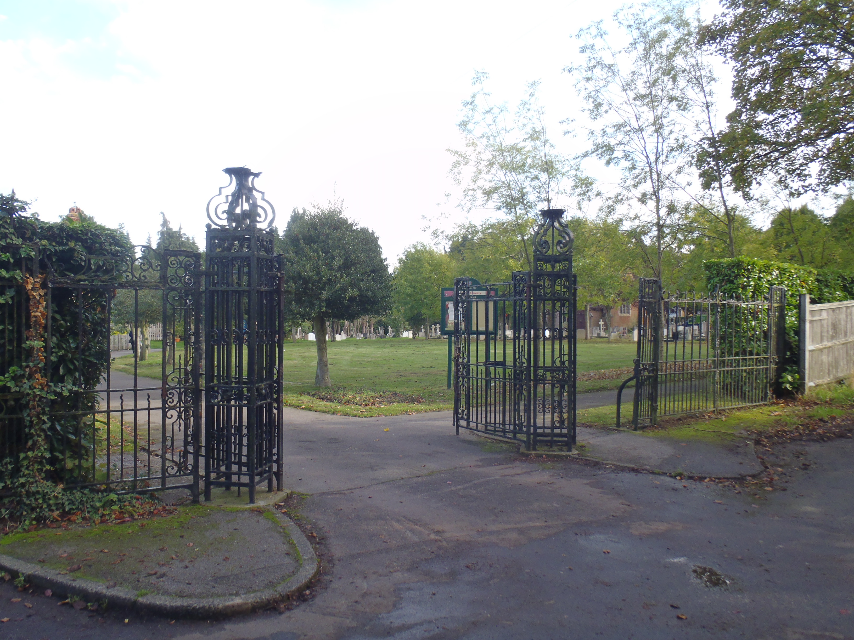
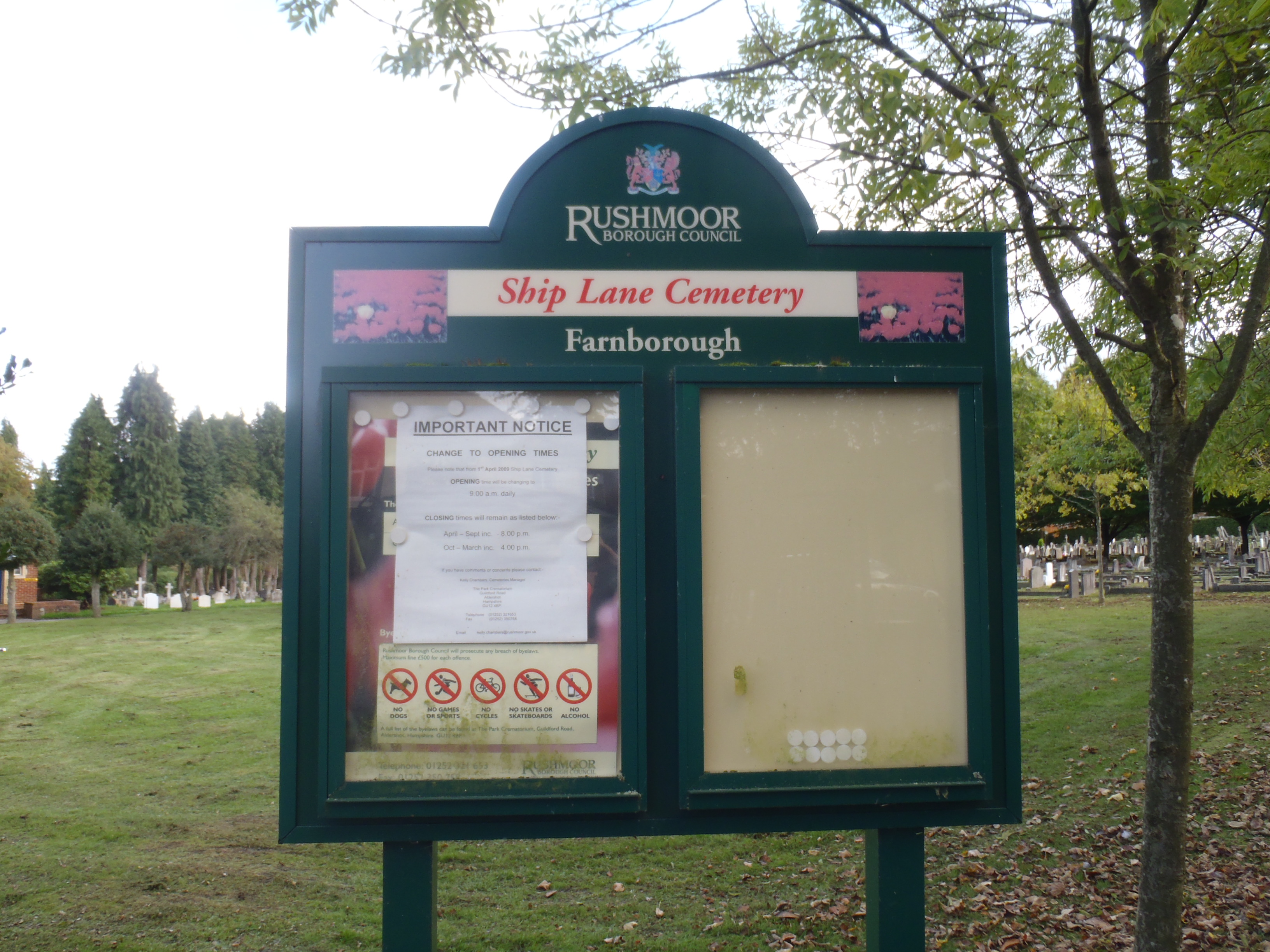
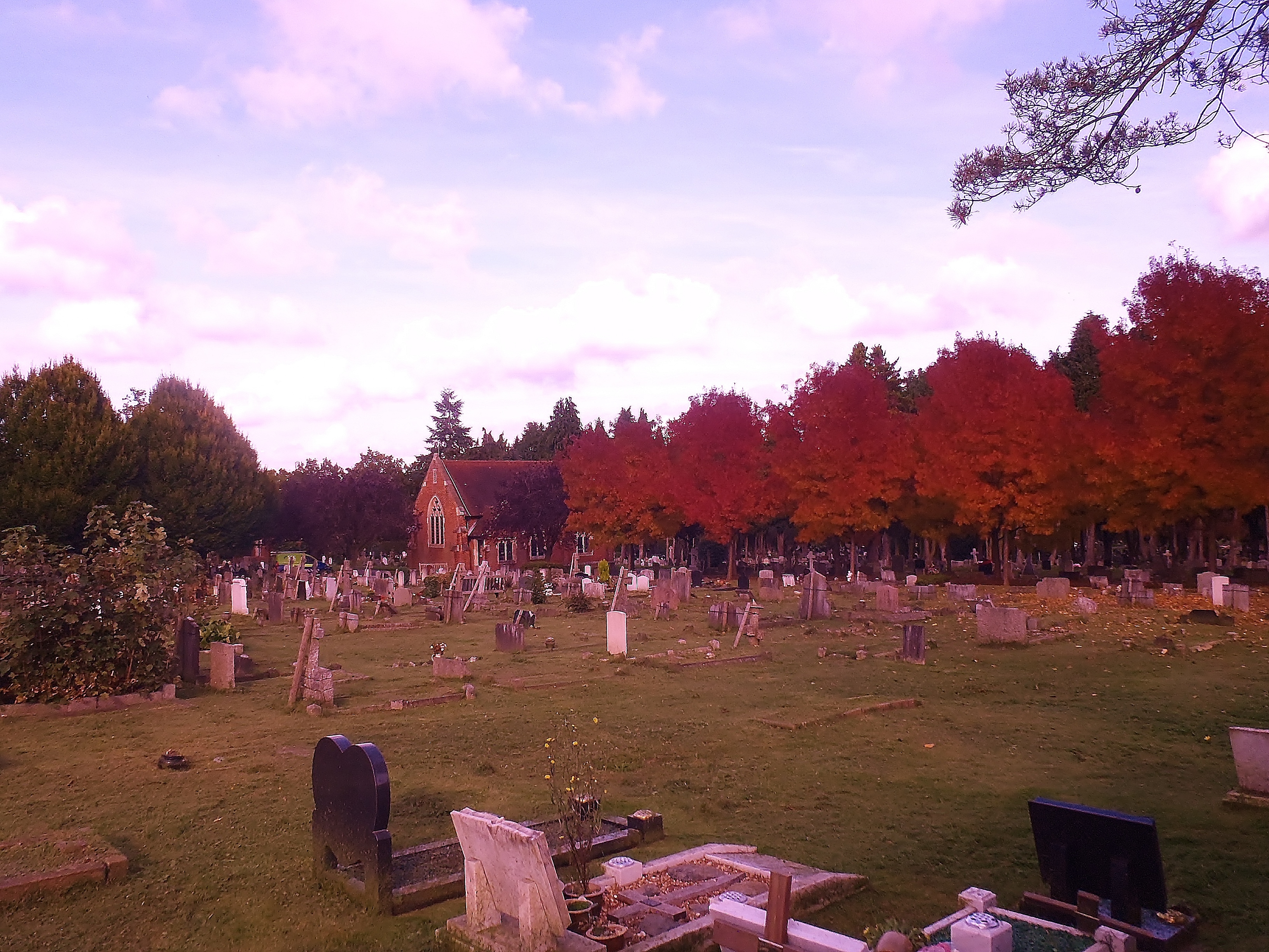
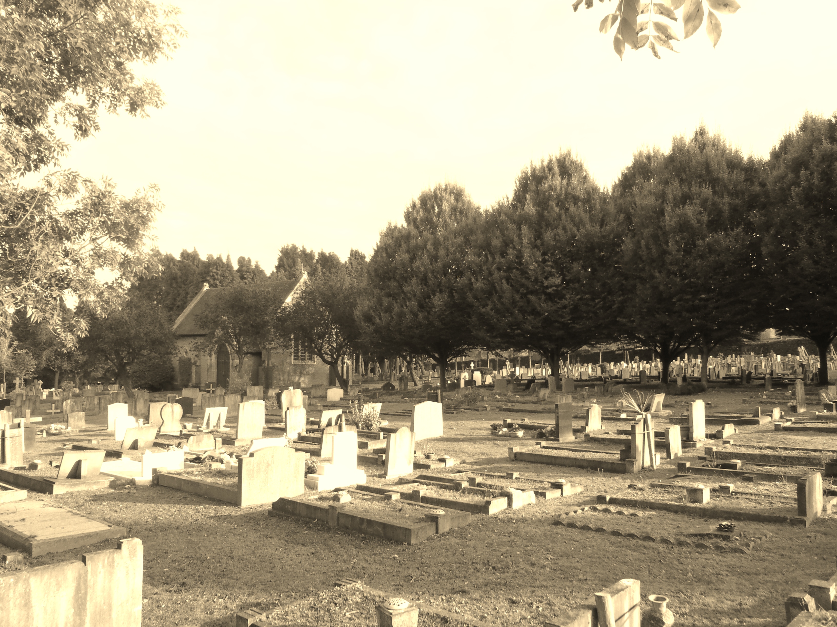
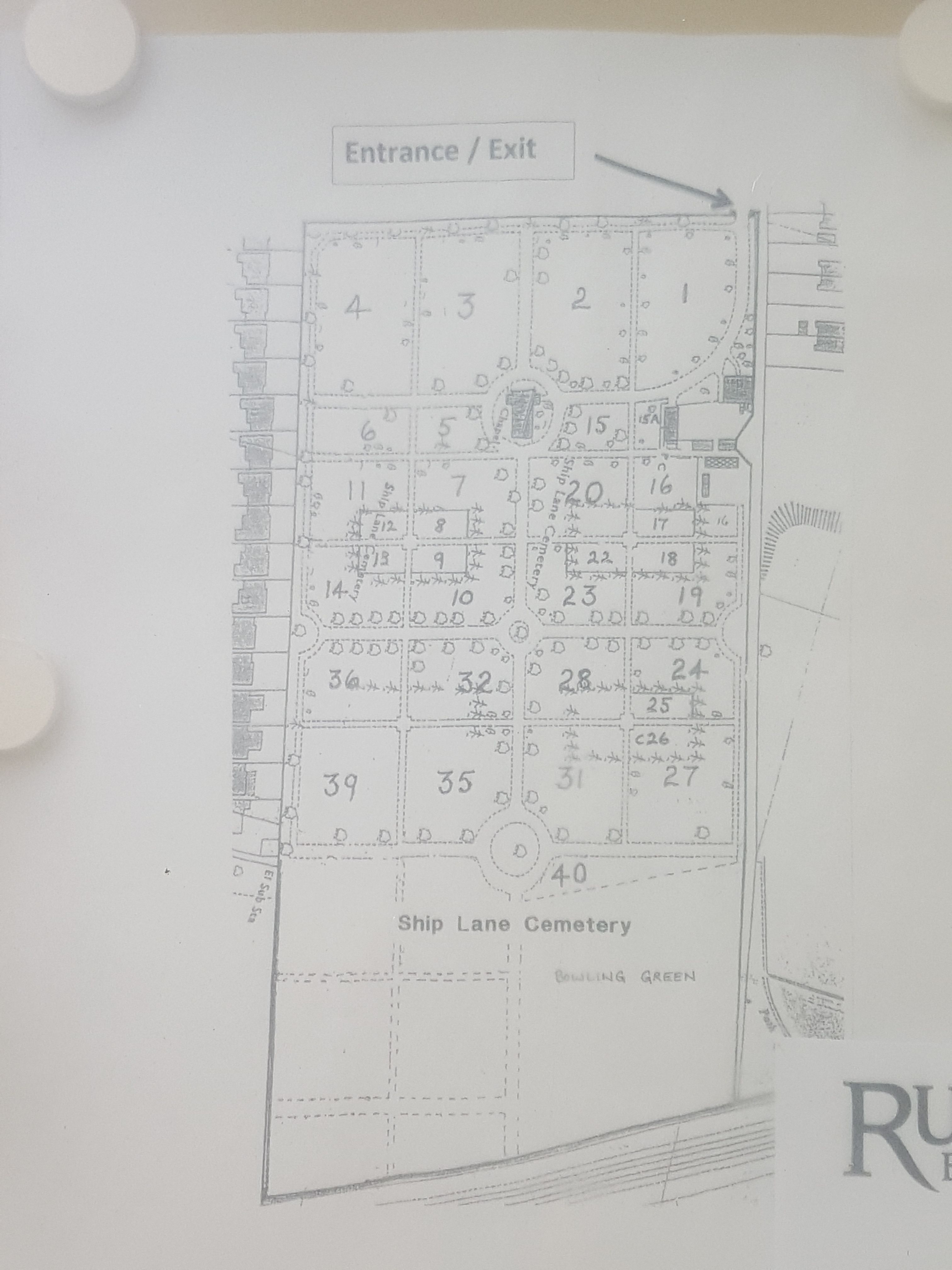
| Description | : | This cemetery is one of the three operated by the Rushmoor Borough Council. |
frequently asked questions (FAQ):
-
Where is Ship Lane Cemetery?
Ship Lane Cemetery is located at Mariners Drive Farnborough, Rushmoor Borough ,Hampshire , GU14 8BHEngland.
-
Ship Lane Cemetery cemetery's updated grave count on graveviews.com?
0 memorials
-
Where are the coordinates of the Ship Lane Cemetery?
Latitude: 51.3057800
Longitude: -0.7488900
Nearby Cemetories:
1. St Michael's Abbey
Farnborough, Rushmoor Borough, England
Coordinate: 51.2971140, -0.7497110
2. St Peter's Churchyard
Frimley, Surrey Heath Borough, England
Coordinate: 51.3149770, -0.7393330
3. Victoria Road Cemetery
Farnborough, Rushmoor Borough, England
Coordinate: 51.2941300, -0.7593900
4. St. Peter's Churchyard
Farnborough, Rushmoor Borough, England
Coordinate: 51.2924100, -0.7499300
5. St. John the Baptist Churchyard
Farnborough, Rushmoor Borough, England
Coordinate: 51.2973050, -0.7819310
6. Church of Saint Francis of Assisi
Camberley, Surrey Heath Borough, England
Coordinate: 51.3311000, -0.7350400
7. Deepcut Military Cemetery
Deepcut, Surrey Heath Borough, England
Coordinate: 51.3062170, -0.7049060
8. Holy Trinity Churchyard
Blackwater, Hart District, England
Coordinate: 51.3269100, -0.7773800
9. Hawley Cemetery
Blackwater, Hart District, England
Coordinate: 51.3280700, -0.7778700
10. St. Michael‘s Churchyard
Camberley, Surrey Heath Borough, England
Coordinate: 51.3367810, -0.7596560
11. Sandhurst Royal Military Academy Cemetery
Sandhurst, Bracknell Forest Borough, England
Coordinate: 51.3431310, -0.7675360
12. Heathlands Cemetery
Yateley, Hart District, England
Coordinate: 51.3308800, -0.8172500
13. Aldershot Military Cemetery
Aldershot, Rushmoor Borough, England
Coordinate: 51.2554779, -0.7449350
14. Aldershot Jewish Cemetery
Aldershot, Rushmoor Borough, England
Coordinate: 51.2508900, -0.7463000
15. Ash War Memorial
Ash, Guildford Borough, England
Coordinate: 51.2546746, -0.7157783
16. Redan Road Cemetery
Aldershot, Rushmoor Borough, England
Coordinate: 51.2495610, -0.7488900
17. Emery Gates Cemetery
Ash, Guildford Borough, England
Coordinate: 51.2500370, -0.7163210
18. St Peter Churchyard
Ash, Guildford Borough, England
Coordinate: 51.2490760, -0.7155380
19. St. Michael's and All Angels Churchyard
Sandhurst, Bracknell Forest Borough, England
Coordinate: 51.3498240, -0.8155500
20. St Peter Churchyard
Yateley, Hart District, England
Coordinate: 51.3411500, -0.8278000
21. All Saints Churchyard
Fleet, Hart District, England
Coordinate: 51.2838060, -0.8427500
22. St Michael and All Angels Churchyard
Pirbright, Guildford Borough, England
Coordinate: 51.2945800, -0.6500000
23. St Michael the Archangel Churchyard
Aldershot, Rushmoor Borough, England
Coordinate: 51.2414300, -0.7558900
24. St. Mark's Churchyard
Pirbright, Guildford Borough, England
Coordinate: 51.2549050, -0.6812810