
| Memorials | : | 0 |
| Location | : | Farnborough, Rushmoor Borough, England |
| Coordinate | : | 51.2941300, -0.7593900 |
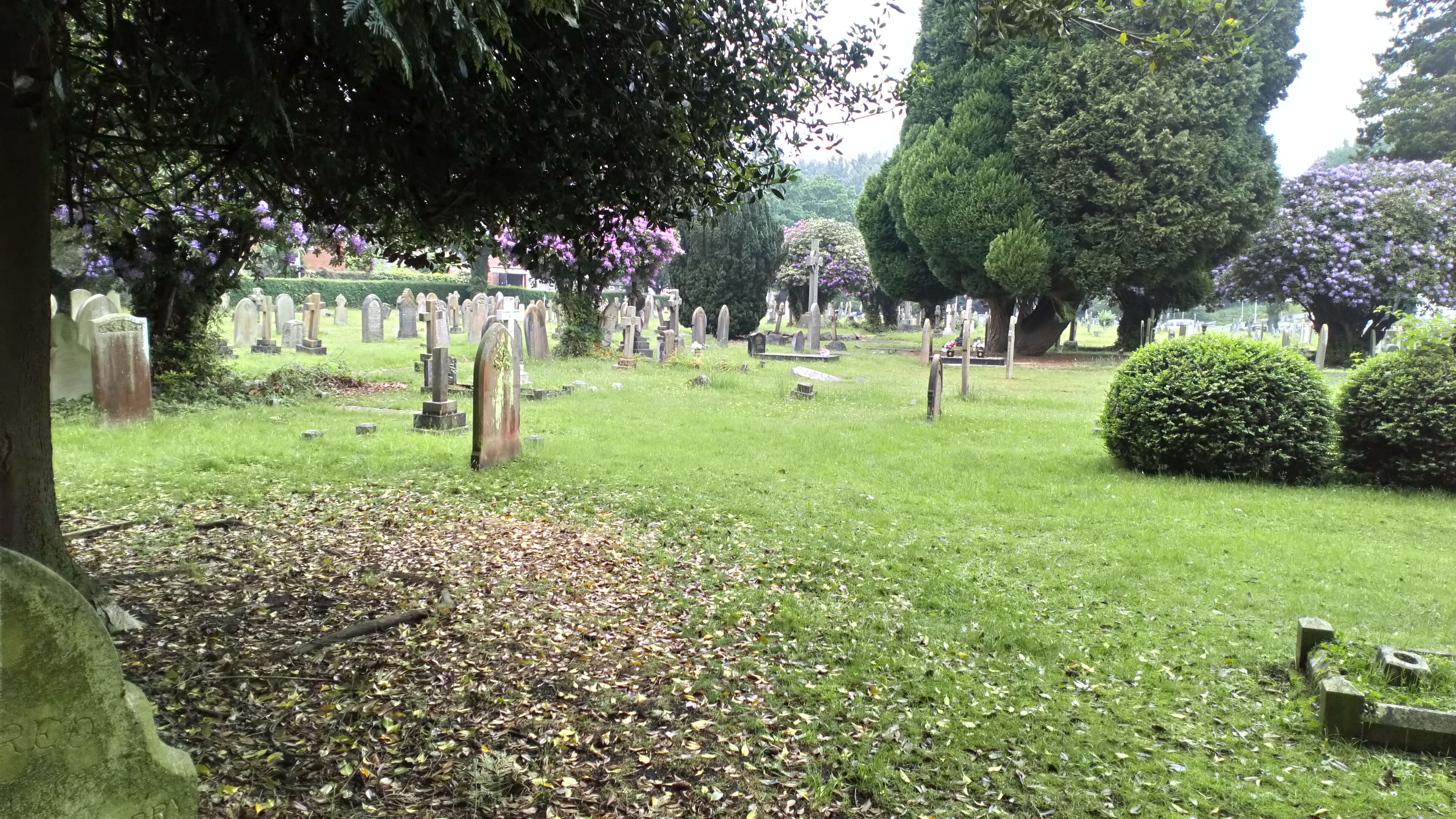
| Description | : | The cemetery was opened in 1859 because the small churchyard at the Parish Church of St Peter in Farnborough was full due to the large number of military burials which took place after the Crimean War. Many of the soldiers returning to their base in North Camp died of their wounds and had to be buried in Farnborough as the North Camp was within the parish boundary. It was built by David Smith, builder, of Frimley at a cost of £283 and it took 2 months to build. It was consecrated in 1859, and the the first burial was that... Read More |
frequently asked questions (FAQ):
-
Where is Victoria Road Cemetery?
Victoria Road Cemetery is located at Union Street Farnborough, Rushmoor Borough ,Hampshire , GU14 7PLEngland.
-
Victoria Road Cemetery cemetery's updated grave count on graveviews.com?
0 memorials
-
Where are the coordinates of the Victoria Road Cemetery?
Latitude: 51.2941300
Longitude: -0.7593900
Nearby Cemetories:
1. St. Peter's Churchyard
Farnborough, Rushmoor Borough, England
Coordinate: 51.2924100, -0.7499300
2. St Michael's Abbey
Farnborough, Rushmoor Borough, England
Coordinate: 51.2971140, -0.7497110
3. Ship Lane Cemetery
Farnborough, Rushmoor Borough, England
Coordinate: 51.3057800, -0.7488900
4. St. John the Baptist Churchyard
Farnborough, Rushmoor Borough, England
Coordinate: 51.2973050, -0.7819310
5. St Peter's Churchyard
Frimley, Surrey Heath Borough, England
Coordinate: 51.3149770, -0.7393330
6. Holy Trinity Churchyard
Blackwater, Hart District, England
Coordinate: 51.3269100, -0.7773800
7. Hawley Cemetery
Blackwater, Hart District, England
Coordinate: 51.3280700, -0.7778700
8. Deepcut Military Cemetery
Deepcut, Surrey Heath Borough, England
Coordinate: 51.3062170, -0.7049060
9. Aldershot Military Cemetery
Aldershot, Rushmoor Borough, England
Coordinate: 51.2554779, -0.7449350
10. Church of Saint Francis of Assisi
Camberley, Surrey Heath Borough, England
Coordinate: 51.3311000, -0.7350400
11. St. Michael‘s Churchyard
Camberley, Surrey Heath Borough, England
Coordinate: 51.3367810, -0.7596560
12. Aldershot Jewish Cemetery
Aldershot, Rushmoor Borough, England
Coordinate: 51.2508900, -0.7463000
13. Redan Road Cemetery
Aldershot, Rushmoor Borough, England
Coordinate: 51.2495610, -0.7488900
14. Ash War Memorial
Ash, Guildford Borough, England
Coordinate: 51.2546746, -0.7157783
15. Sandhurst Royal Military Academy Cemetery
Sandhurst, Bracknell Forest Borough, England
Coordinate: 51.3431310, -0.7675360
16. Heathlands Cemetery
Yateley, Hart District, England
Coordinate: 51.3308800, -0.8172500
17. Emery Gates Cemetery
Ash, Guildford Borough, England
Coordinate: 51.2500370, -0.7163210
18. St Michael the Archangel Churchyard
Aldershot, Rushmoor Borough, England
Coordinate: 51.2414300, -0.7558900
19. St Peter Churchyard
Ash, Guildford Borough, England
Coordinate: 51.2490760, -0.7155380
20. All Saints Churchyard
Fleet, Hart District, England
Coordinate: 51.2838060, -0.8427500
21. Hope Cemetery
Fleet, Hart District, England
Coordinate: 51.2827800, -0.8495300
22. Aldershot Crematorium
Aldershot, Rushmoor Borough, England
Coordinate: 51.2325970, -0.7443200
23. Fleet Cemetery
Fleet, Hart District, England
Coordinate: 51.2718100, -0.8523700
24. St. Mark's Churchyard
Pirbright, Guildford Borough, England
Coordinate: 51.2549050, -0.6812810