
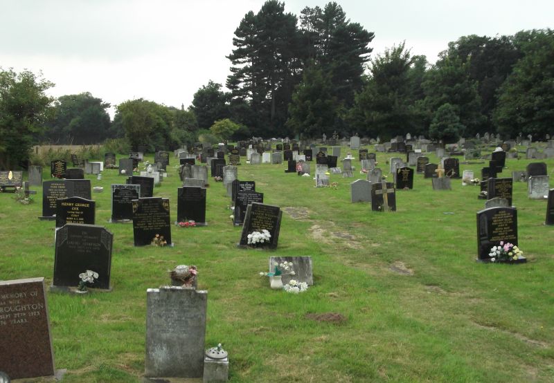
| Memorials | : | 281 |
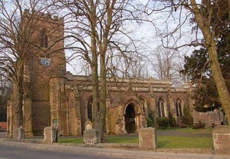
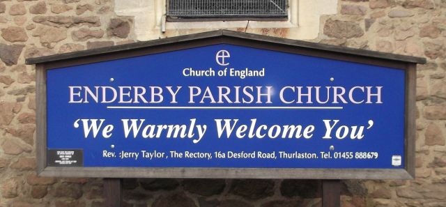
| Location | : | Enderby, Blaby District, England |
| Coordinate | : | 52.5901570, -1.2077130 |
| Description | : | Parish of Enderby with Lubbesthorpe. |
frequently asked questions (FAQ):
-
Where is St John the Baptist Churchyard?
St John the Baptist Churchyard is located at Leicester Road Enderby, Blaby District ,Leicestershire , LE19 4AREngland.
-
St John the Baptist Churchyard cemetery's updated grave count on graveviews.com?
281 memorials
-
Where are the coordinates of the St John the Baptist Churchyard?
Latitude: 52.5901570
Longitude: -1.2077130

Nearby Cemetories:
1. Enderby Dissenters' Cemetery
Enderby, Blaby District, England
Coordinate: 52.5904190, -1.2049480
2. Enderby New Cemetery
Enderby, Blaby District, England
Coordinate: 52.5902330, -1.2048290
3. All Saints Churchyard
Narborough, Blaby District, England
Coordinate: 52.5730420, -1.2038480
4. Huncote Cemetery
Huncote, Blaby District, England
Coordinate: 52.5764090, -1.2391220
5. Saint Peter's Churchyard
Whetstone, Blaby District, England
Coordinate: 52.5727910, -1.1788510
6. Whetstone Cemetery
Whetstone, Blaby District, England
Coordinate: 52.5722900, -1.1779200
7. All Saints Churchyard
Thurlaston, Blaby District, England
Coordinate: 52.5870530, -1.2599600
8. All Saints Churchyard
Blaby, Blaby District, England
Coordinate: 52.5754960, -1.1600850
9. St Andrew Churchyard
Aylestone, Leicester Unitary Authority, England
Coordinate: 52.6038420, -1.1568900
10. St Peter's Churchyard
Braunstone, Blaby District, England
Coordinate: 52.6208940, -1.1812900
11. Cosby Cemetery
Cosby, Blaby District, England
Coordinate: 52.5560490, -1.1962970
12. Blaby Cemetery
Blaby, Blaby District, England
Coordinate: 52.5738950, -1.1541280
13. St Michael & All Angels
Croft, Blaby District, England
Coordinate: 52.5593821, -1.2484472
14. St Michael and All Angels Churchyard
Cosby, Blaby District, England
Coordinate: 52.5488260, -1.1933700
15. Saffron Hill Cemetery
Leicester, Leicester Unitary Authority, England
Coordinate: 52.5934120, -1.1310010
16. St Bartholomew Churchyard
Kirby Muxloe, Blaby District, England
Coordinate: 52.6371750, -1.2320940
17. Kirby Muxloe Cemetery
Kirby Muxloe, Blaby District, England
Coordinate: 52.6373740, -1.2337780
18. Sutton Elms Baptist Chapelyard
Broughton Astley, Harborough District, England
Coordinate: 52.5389370, -1.2328020
19. St Andrew's Churchyard
Countesthorpe, Blaby District, England
Coordinate: 52.5536270, -1.1379810
20. Welford Road Cemetery
Leicester, Leicester Unitary Authority, England
Coordinate: 52.6200104, -1.1295080
21. Countesthorpe Parish Cemetery
Countesthorpe, Blaby District, England
Coordinate: 52.5577540, -1.1309080
22. East Shilton Cemetery
Earl Shilton, Hinckley and Bosworth Borough, England
Coordinate: 52.5768930, -1.2987500
23. Church of the Annunciation of St. Mary
Leicester, Leicester Unitary Authority, England
Coordinate: 52.6308229, -1.1417201
24. Saint Mary Magdalene Churchyard
Knighton, Leicester Unitary Authority, England
Coordinate: 52.6054170, -1.1163730