
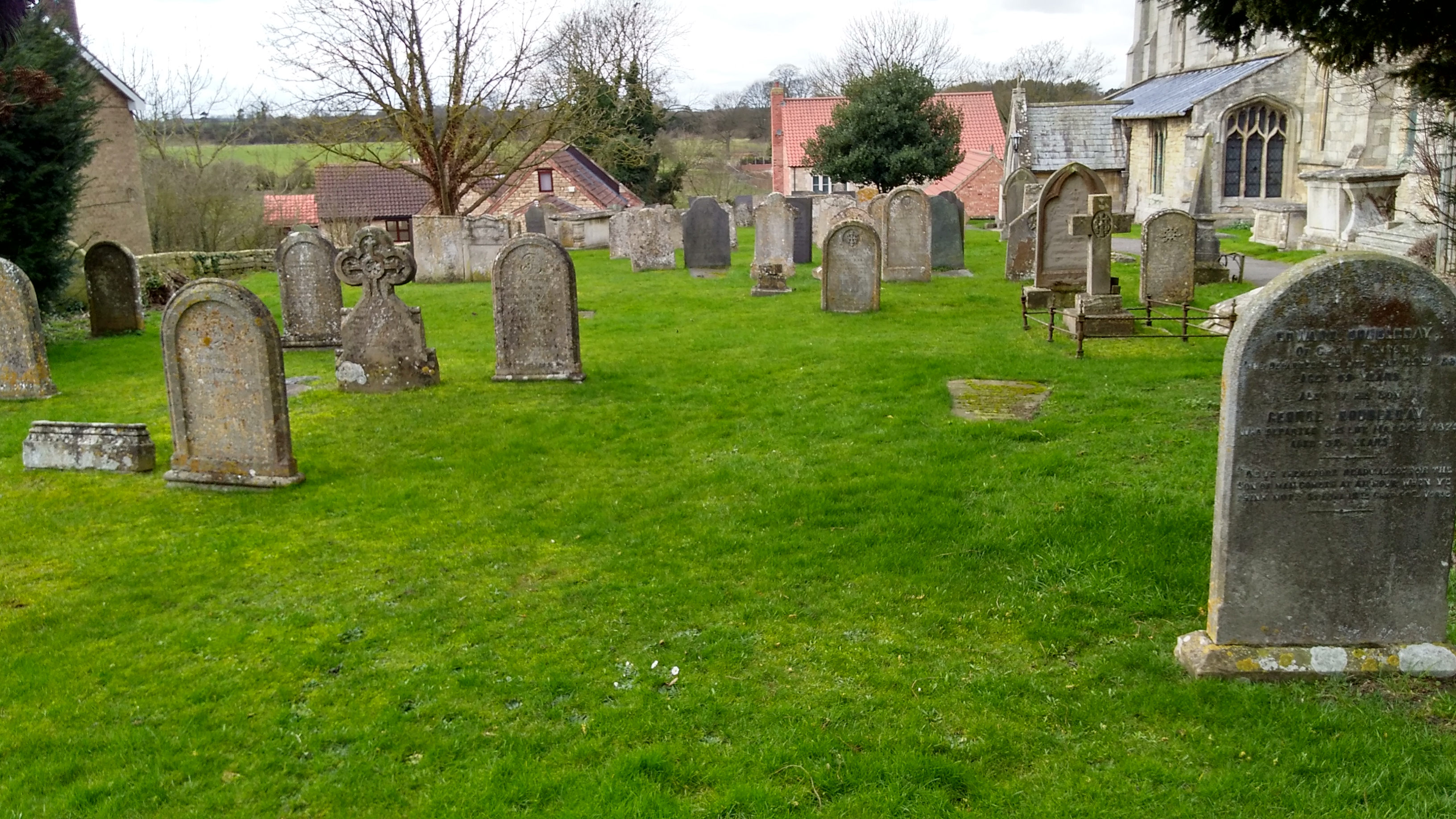
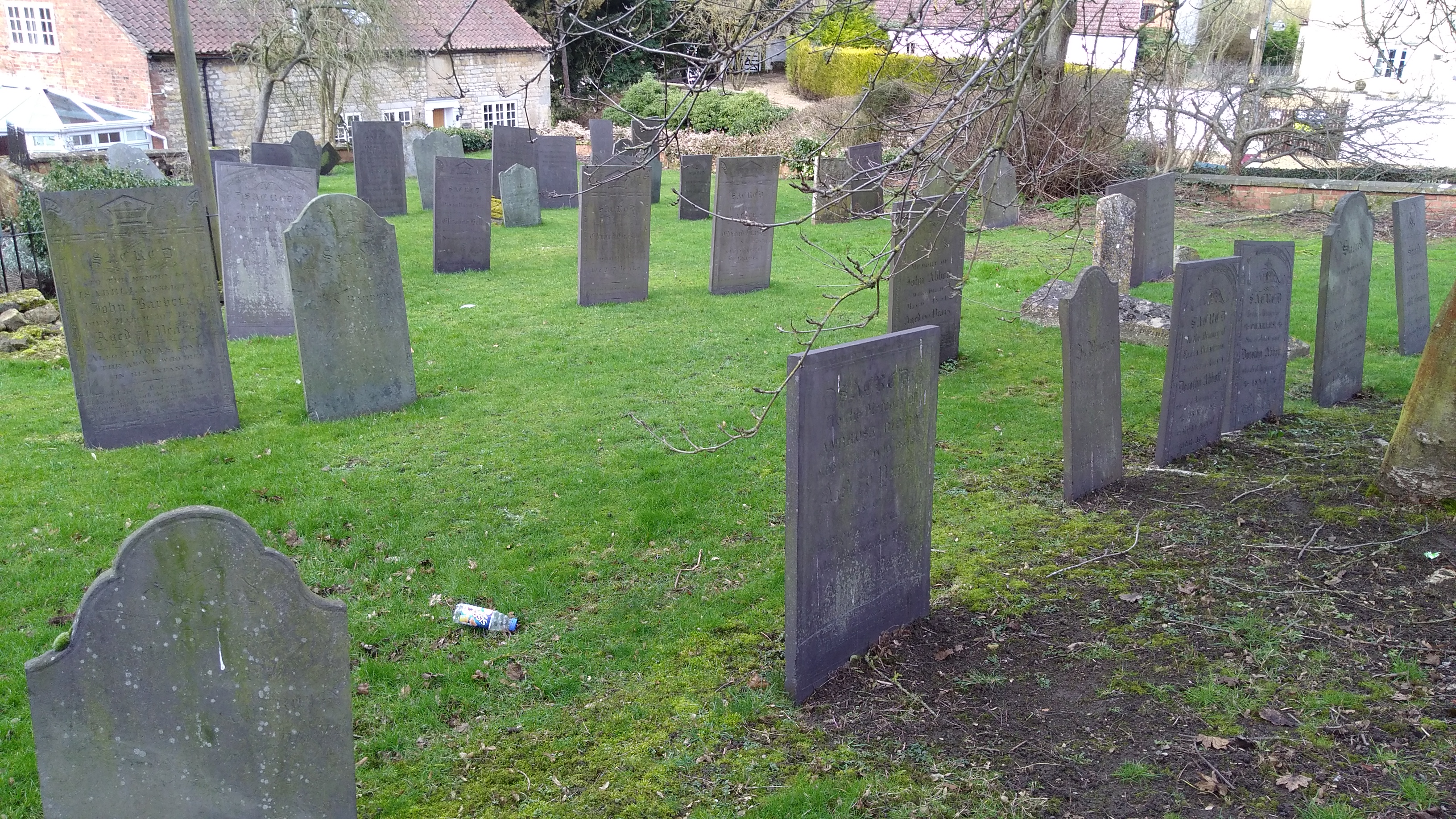
| Memorials | : | 39 |
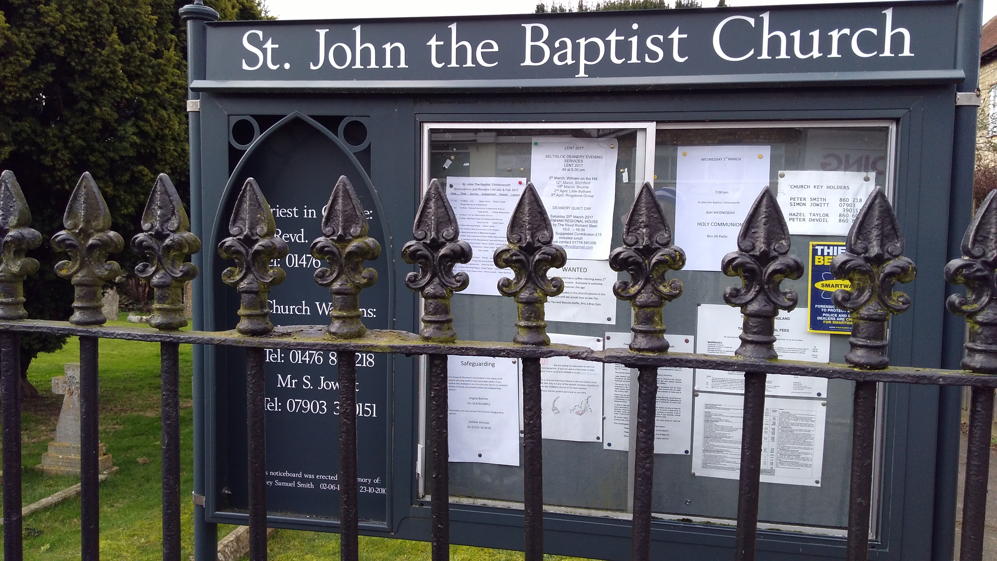
| Location | : | Colsterworth, South Kesteven District, England |
| Coordinate | : | 52.8069090, -0.6214400 |
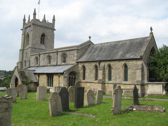
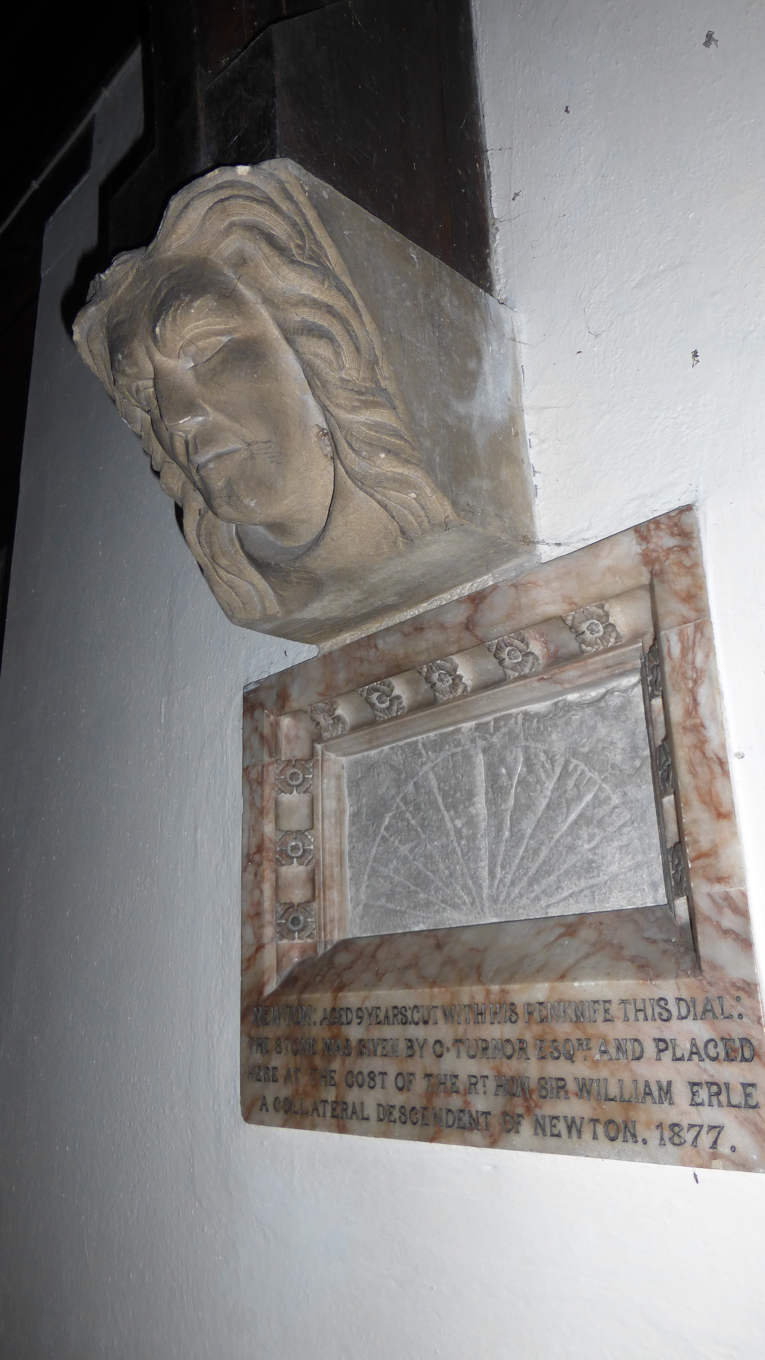
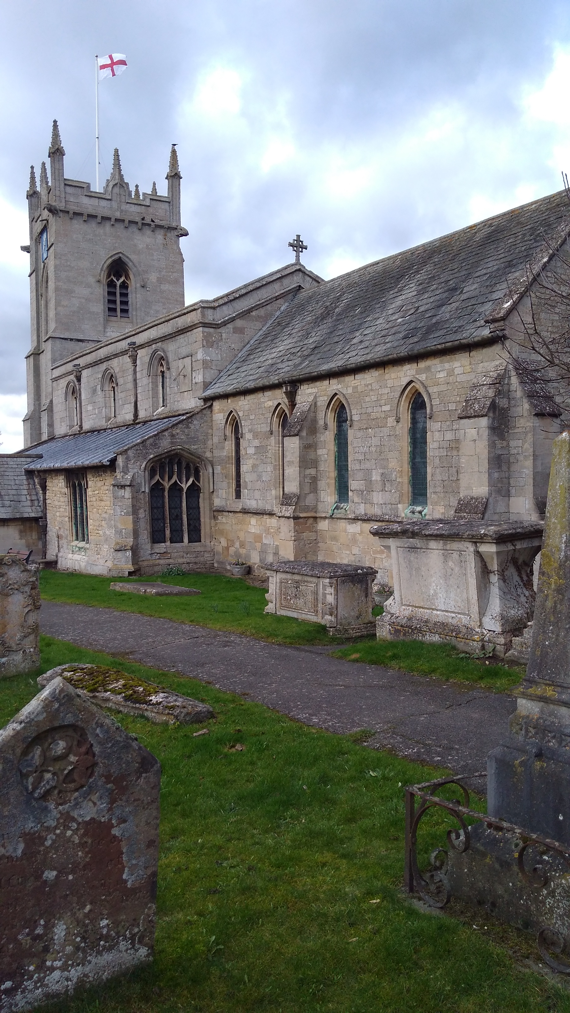
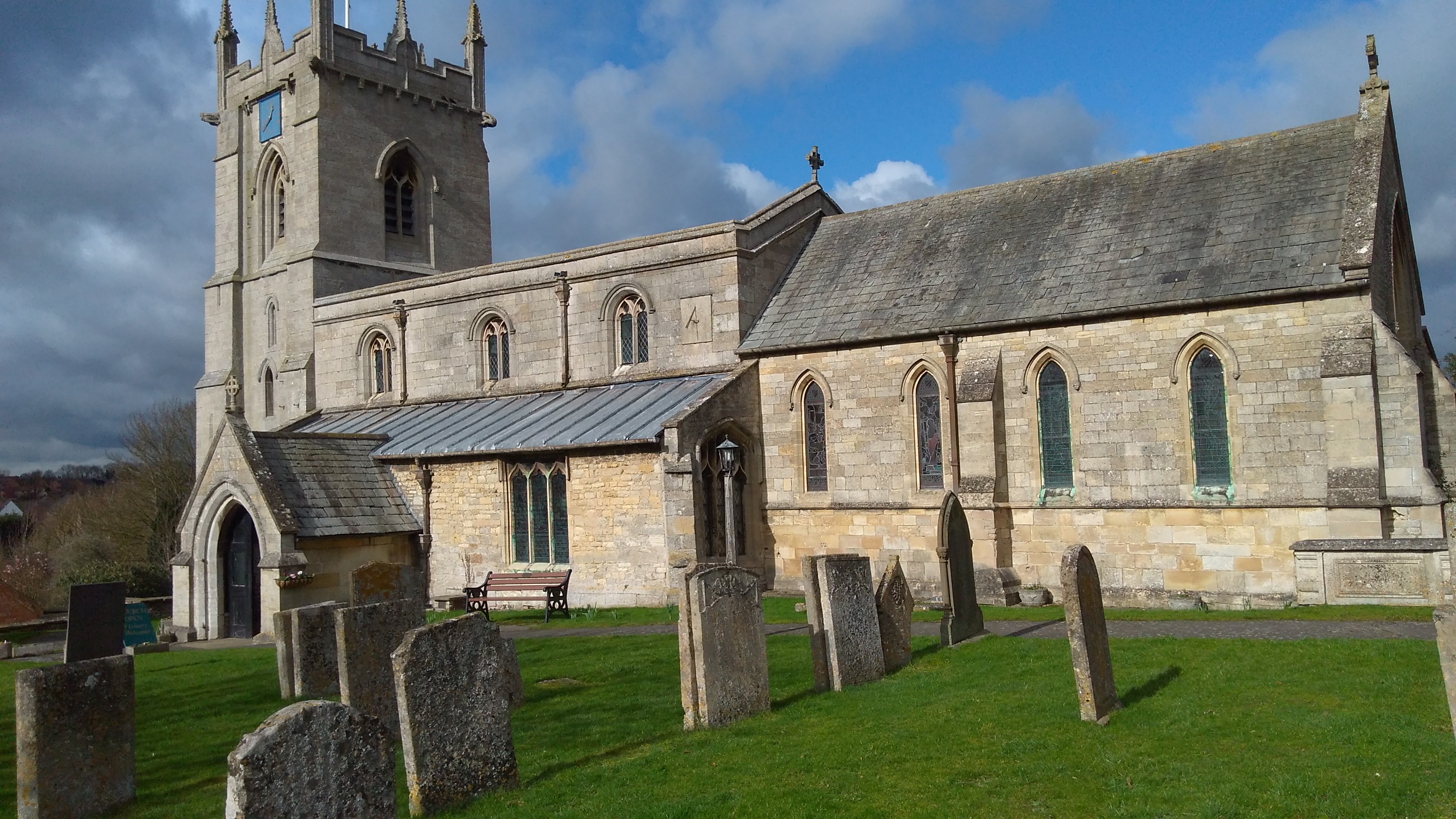
| Description | : | The north arcade of the nave is Norman but Saxon herringbone masonry can be seen above its arches.The south arcade is 13th century and the tower,aisles and porch are 14th century.The clerestory and several windows are 15th century.The chancel was rebuilt in 1770 and the porch in 1809. The church was restored in 1876.Sir Isaac Newton was baptised here 1st January 1643. |
frequently asked questions (FAQ):
-
Where is St. John the Baptist Churchyard?
St. John the Baptist Churchyard is located at Colsterworth, South Kesteven District ,Lincolnshire ,England.
-
St. John the Baptist Churchyard cemetery's updated grave count on graveviews.com?
38 memorials
-
Where are the coordinates of the St. John the Baptist Churchyard?
Latitude: 52.8069090
Longitude: -0.6214400
Nearby Cemetories:
1. St Mary's Churchyard
North Witham, South Kesteven District, England
Coordinate: 52.7864400, -0.6252800
2. St Peter Churchyard
Stainby, South Kesteven District, England
Coordinate: 52.7953390, -0.6587990
3. St. Peter's Churchyard
Gunby, East Lindsey District, England
Coordinate: 52.7840600, -0.6483000
4. St Nicholas Churchyard
Gunby, South Kesteven District, England
Coordinate: 52.7838800, -0.6481500
5. St James Churchyard
Skillington, South Kesteven District, England
Coordinate: 52.8231750, -0.6724600
6. St John the Baptist Churchyard
Buckminster, Melton Borough, England
Coordinate: 52.7981500, -0.6974900
7. St Thomas a Beckett Churchyard
Bassingthorpe, South Kesteven District, England
Coordinate: 52.8457500, -0.5669900
8. Holy Cross Churchyard
Great Ponton, South Kesteven District, England
Coordinate: 52.8638270, -0.6275570
9. St Nicholas Churchyard
Thistleton, Rutland Unitary Authority, England
Coordinate: 52.7516900, -0.6483100
10. St Nicholas Churchyard
Swayfield, South Kesteven District, England
Coordinate: 52.7922400, -0.5284400
11. St Mary Magdalene
Bitchfield, South Kesteven District, England
Coordinate: 52.8441000, -0.5418600
12. St John the Evangelist Churchyard
Corby Glen, South Kesteven District, England
Coordinate: 52.8132500, -0.5157630
13. St Bartholomew's Churchyard
Sproxton, Melton Borough, England
Coordinate: 52.8150500, -0.7307100
14. All Saints Churchyard
Stroxton, South Kesteven District, England
Coordinate: 52.8695300, -0.6609700
15. Saint Andrew Churchyard
Boothby Pagnell, South Kesteven District, England
Coordinate: 52.8660600, -0.5578600
16. St. Guthlac Churchyard
Little Ponton, South Kesteven District, England
Coordinate: 52.8796100, -0.6271200
17. St James Churchyard
Castle Bytham, South Kesteven District, England
Coordinate: 52.7537140, -0.5367360
18. St Peter's Churchyard
Saltby, Melton Borough, England
Coordinate: 52.8298400, -0.7378900
19. St Andrew Churchyard
Coston, Melton Borough, England
Coordinate: 52.7905590, -0.7439280
20. Saint Peter and Saint Paul's Churchyard
Market Overton, Rutland Unitary Authority, England
Coordinate: 52.7385000, -0.6893000
21. St Mary Churchyard
Swinstead, South Kesteven District, England
Coordinate: 52.7900380, -0.4909380
22. St Peter Churchyard
Creeton, South Kesteven District, England
Coordinate: 52.7669500, -0.4977300
23. St Mary the Virgin Churchyard
Greetham, Rutland Unitary Authority, England
Coordinate: 52.7216100, -0.6325650
24. St Peter Churchyard
Wymondham, Melton Borough, England
Coordinate: 52.7585970, -0.7395410