
| Memorials | : | 0 |
| Location | : | Pilton, Mendip District, England |
| Coordinate | : | 51.1650000, -2.5898000 |
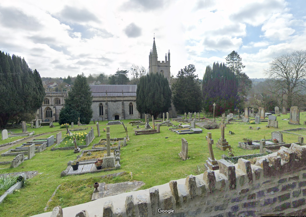
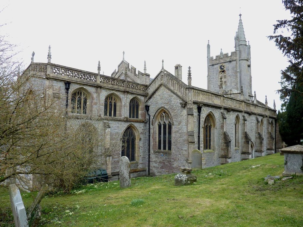
| Description | : | The Church of St John the Baptist in Pilton, Somerset, England dates from the 11th century and has been designated as a Grade I listed building. The present Norman and Medieval structure, may stand on the site of an earlier wattle and daub church built by the early missionaries. |
frequently asked questions (FAQ):
-
Where is St. John The Baptist Churchyard?
St. John The Baptist Churchyard is located at Pilton, Mendip District ,Somerset ,England.
-
St. John The Baptist Churchyard cemetery's updated grave count on graveviews.com?
0 memorials
-
Where are the coordinates of the St. John The Baptist Churchyard?
Latitude: 51.1650000
Longitude: -2.5898000
Nearby Cemetories:
1. St Peter Churchyard
North Wootton, Mendip District, England
Coordinate: 51.1738520, -2.6252470
2. Mendip crematorium
Mendip District, England
Coordinate: 51.1911487, -2.5797562
3. Church of St Thomas à Becket
Pylle, Mendip District, England
Coordinate: 51.1428350, -2.5630230
4. All Saints Churchyard
East Pennard, Mendip District, England
Coordinate: 51.1351890, -2.5773210
5. Saint Mary Churchyard
Croscombe, Mendip District, England
Coordinate: 51.1974000, -2.5872000
6. Saint Michael & All Angels Churchyard
Dinder, Mendip District, England
Coordinate: 51.1994600, -2.6094800
7. St Peter and St Paul Church
Shepton Mallet, Mendip District, England
Coordinate: 51.1908700, -2.5454300
8. Shepton Mallet Cemetery
Shepton Mallet, Mendip District, England
Coordinate: 51.1948900, -2.5483390
9. St Nicholas Churchyard
West Pennard, Mendip District, England
Coordinate: 51.1415596, -2.6413050
10. Saint James Churchyard
West Bradley, Mendip District, England
Coordinate: 51.1293030, -2.6332386
11. Mendip Hospital Cemetery
Wells, Mendip District, England
Coordinate: 51.2106490, -2.6262980
12. St Mary Magdalene Churchyard
Ditcheat, Mendip District, England
Coordinate: 51.1250270, -2.5362010
13. Saint John the Evangelist
East Horrington, Mendip District, England
Coordinate: 51.2180000, -2.6006900
14. St. Aldhelm Churchyard
Doulting, Mendip District, England
Coordinate: 51.1862880, -2.5077290
15. Wells Cathedral
Wells, Mendip District, England
Coordinate: 51.2103610, -2.6433940
16. St Thomas Churchyard
Wells, Mendip District, England
Coordinate: 51.2132380, -2.6370870
17. St. Cuthbert Churchyard
Wells, Mendip District, England
Coordinate: 51.2080930, -2.6502690
18. St Peter Churchyard
Evercreech, Mendip District, England
Coordinate: 51.1462670, -2.5025440
19. Coxley Methodist Churchyard
Coxley, Mendip District, England
Coordinate: 51.1918900, -2.6723700
20. Evercreech Cemetery
Evercreech, Mendip District, England
Coordinate: 51.1461300, -2.4989500
21. Christ Church
Coxley, Mendip District, England
Coordinate: 51.1869530, -2.6797580
22. St Peter's Church
Hornblotton, Mendip District, England
Coordinate: 51.1037752, -2.5846439
23. Wells Cemetery
Wells, Mendip District, England
Coordinate: 51.2088240, -2.6640120
24. St Mary's, Chesterblade
Evercreech, Mendip District, England
Coordinate: 51.1692610, -2.4861180