
| Memorials | : | 4 |
| Location | : | Wells, Mendip District, England |
| Coordinate | : | 51.2080930, -2.6502690 |
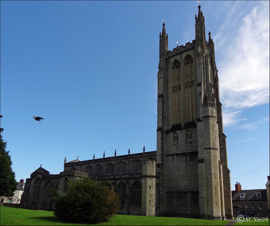
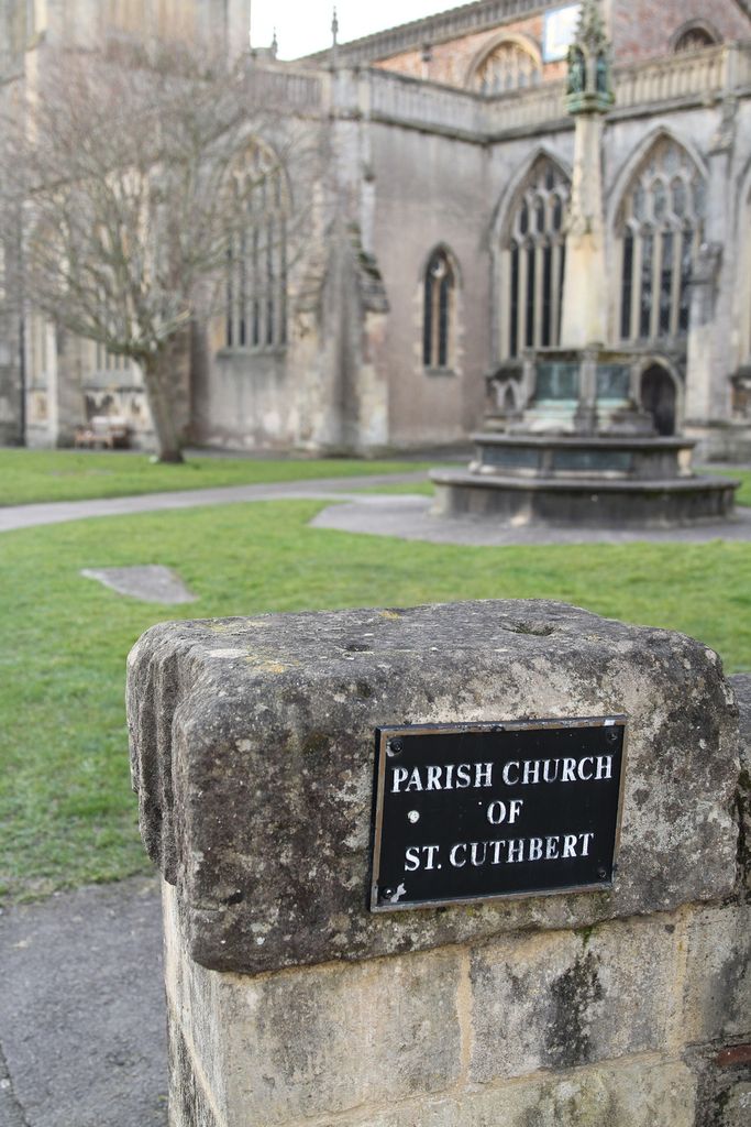
| Description | : | St Cuthbert's Church is the largest parish church in Somerset located in the heart of City of Wells. There has been a church on this site since the end of the 9th century. The first parish church is believed to have been a wooden edifice built in King Alfred's time, dedicated to St Cuthbert who was an illustrious Saxon Saint. The church was subsequently rebuilt in the 12th,13th and 15th centuries. There is an adjoining small mound which probably served as a burial ground even before the coming of Christianity. The church played an important role in the movie ‘Hot... Read More |
frequently asked questions (FAQ):
-
Where is St. Cuthbert Churchyard?
St. Cuthbert Churchyard is located at St Cuthbert Street Wells, Mendip District ,Somerset , BA5 2AWEngland.
-
St. Cuthbert Churchyard cemetery's updated grave count on graveviews.com?
4 memorials
-
Where are the coordinates of the St. Cuthbert Churchyard?
Latitude: 51.2080930
Longitude: -2.6502690
Nearby Cemetories:
1. Wells Cathedral
Wells, Mendip District, England
Coordinate: 51.2103610, -2.6433940
2. Wells Cemetery
Wells, Mendip District, England
Coordinate: 51.2088240, -2.6640120
3. St Thomas Churchyard
Wells, Mendip District, England
Coordinate: 51.2132380, -2.6370870
4. Mendip Hospital Cemetery
Wells, Mendip District, England
Coordinate: 51.2106490, -2.6262980
5. Coxley Methodist Churchyard
Coxley, Mendip District, England
Coordinate: 51.1918900, -2.6723700
6. St. Matthew Churchyard
Wookey, Mendip District, England
Coordinate: 51.2093000, -2.6893000
7. Saint Michael & All Angels Churchyard
Dinder, Mendip District, England
Coordinate: 51.1994600, -2.6094800
8. Christ Church
Coxley, Mendip District, England
Coordinate: 51.1869530, -2.6797580
9. Saint John the Evangelist
East Horrington, Mendip District, England
Coordinate: 51.2180000, -2.6006900
10. St Peter Churchyard
North Wootton, Mendip District, England
Coordinate: 51.1738520, -2.6252470
11. Saint Mary Churchyard
Croscombe, Mendip District, England
Coordinate: 51.1974000, -2.5872000
12. Christ Church Churchyard
Henton, Mendip District, England
Coordinate: 51.2056460, -2.7256380
13. Mendip crematorium
Mendip District, England
Coordinate: 51.1911487, -2.5797562
14. St Lawrence Churchyard
Westbury, Mendip District, England
Coordinate: 51.2354140, -2.7182630
15. St. Lawrence's Churchyard
Priddy, Mendip District, England
Coordinate: 51.2596770, -2.6777600
16. St. John The Baptist Churchyard
Pilton, Mendip District, England
Coordinate: 51.1650000, -2.5898000
17. Holy Trinity Church
Godney, Mendip District, England
Coordinate: 51.1793400, -2.7377400
18. Glastonbury Cemetery
Glastonbury, Mendip District, England
Coordinate: 51.1565160, -2.7132380
19. Shepton Mallet Cemetery
Shepton Mallet, Mendip District, England
Coordinate: 51.1948900, -2.5483390
20. St Nicholas Churchyard
West Pennard, Mendip District, England
Coordinate: 51.1415596, -2.6413050
21. St Peter and St Paul Church
Shepton Mallet, Mendip District, England
Coordinate: 51.1908700, -2.5454300
22. St. Leonard's Churchyard
Rodney Stoke, Mendip District, England
Coordinate: 51.2455140, -2.7431800
23. Holy Trinity Churchyard
Binegar, Mendip District, England
Coordinate: 51.2425530, -2.5524812
24. Christ Church Theale
Wedmore, Sedgemoor District, England
Coordinate: 51.2113720, -2.7631570