
| Memorials | : | 14 |
| Location | : | Ditcheat, Mendip District, England |
| Coordinate | : | 51.1250270, -2.5362010 |
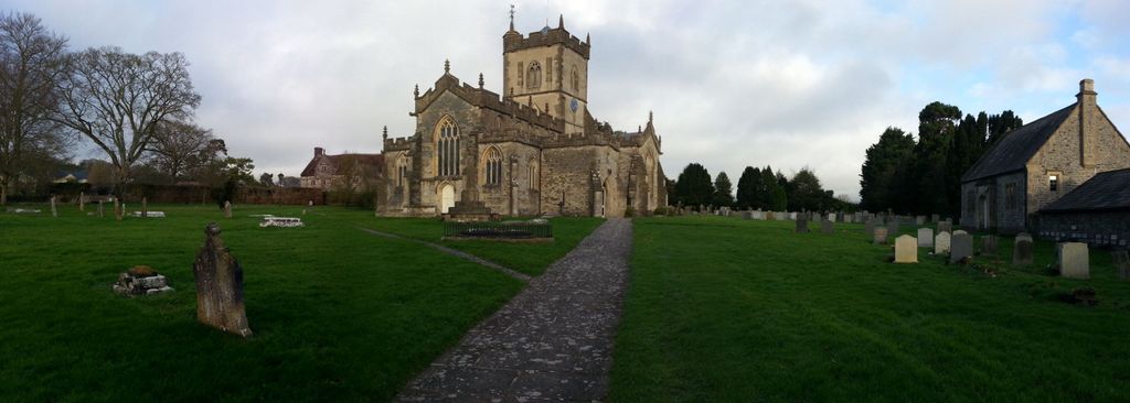
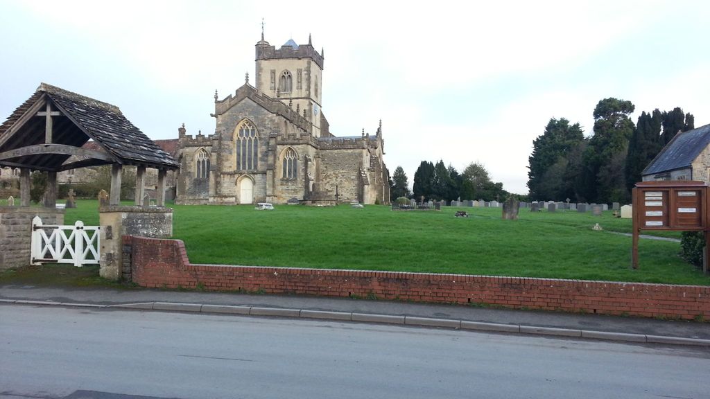
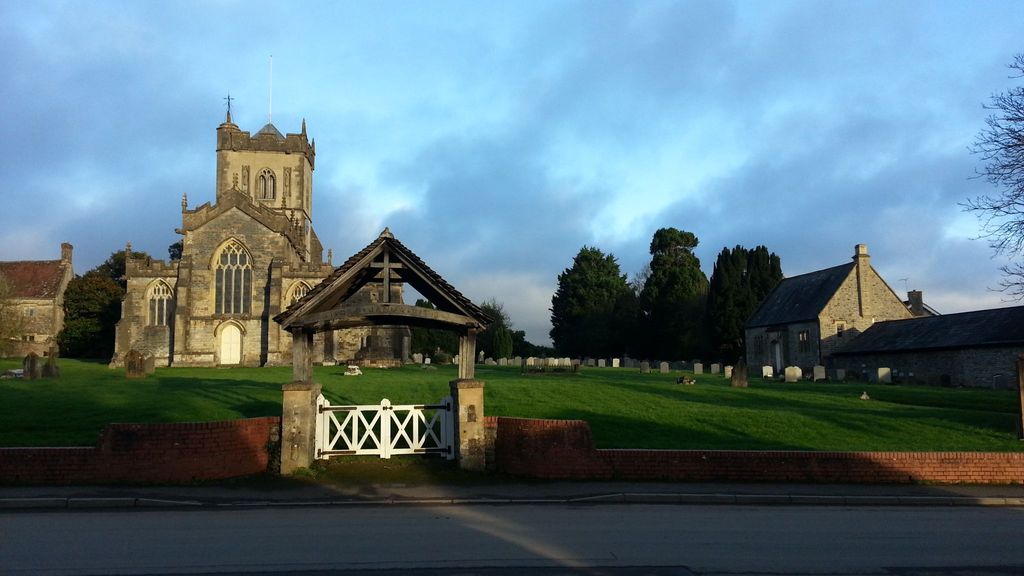
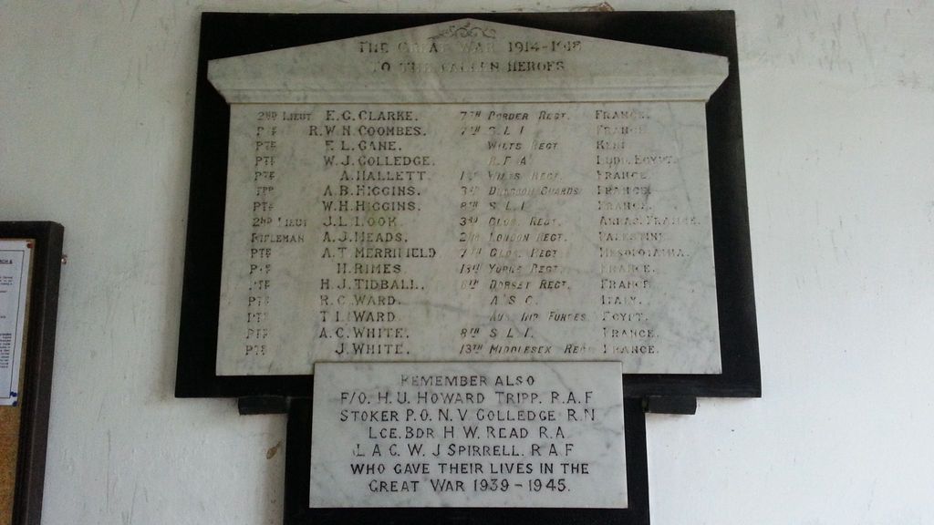
| Description | : | The church dedicated to St May Magdalene is in the early style of English Architecture and is built of blue lias stone. There is one WW1 and 2 WW11 burials in this churchyard |
frequently asked questions (FAQ):
-
Where is St Mary Magdalene Churchyard?
St Mary Magdalene Churchyard is located at SHEPTON MALLET Ditcheat, Mendip District ,Somerset , BA4 6RBEngland.
-
St Mary Magdalene Churchyard cemetery's updated grave count on graveviews.com?
13 memorials
-
Where are the coordinates of the St Mary Magdalene Churchyard?
Latitude: 51.1250270
Longitude: -2.5362010
Nearby Cemetories:
1. Church of St Thomas à Becket
Pylle, Mendip District, England
Coordinate: 51.1428350, -2.5630230
2. All Saints Churchyard
East Pennard, Mendip District, England
Coordinate: 51.1351890, -2.5773210
3. St Peter Churchyard
Evercreech, Mendip District, England
Coordinate: 51.1462670, -2.5025440
4. Evercreech Cemetery
Evercreech, Mendip District, England
Coordinate: 51.1461300, -2.4989500
5. St Andrew Churchyard
Ansford, South Somerset District, England
Coordinate: 51.0943350, -2.5180470
6. St Peter's Church
Hornblotton, Mendip District, England
Coordinate: 51.1037752, -2.5846439
7. St James Church
Milton Clevedon, Mendip District, England
Coordinate: 51.1381600, -2.4809000
8. Church of the Holy Trinity
Bruton, South Somerset District, England
Coordinate: 51.1070450, -2.4843710
9. All Saint's Church
Alford, South Somerset District, England
Coordinate: 51.0916210, -2.5659300
10. All Saints
Castle Cary, South Somerset District, England
Coordinate: 51.0865760, -2.5165400
11. Castle Cary Cemetery
Castle Cary, South Somerset District, England
Coordinate: 51.0803800, -2.5223600
12. St. John The Baptist Churchyard
Pilton, Mendip District, England
Coordinate: 51.1650000, -2.5898000
13. St Leonard Churchyard and Extension
Pitcombe, South Somerset District, England
Coordinate: 51.0925600, -2.4684600
14. Bruton Abbey
Bruton, South Somerset District, England
Coordinate: 51.1114890, -2.4530300
15. St Mary's, Chesterblade
Evercreech, Mendip District, England
Coordinate: 51.1692610, -2.4861180
16. Blessed Virgin Mary Churchyard
Bruton, South Somerset District, England
Coordinate: 51.1115790, -2.4520520
17. Church of St Thomas of Canterbury
Lovington, South Somerset District, England
Coordinate: 51.0754000, -2.5771000
18. Bruton Cemetery
Bruton, South Somerset District, England
Coordinate: 51.1208280, -2.4464270
19. Saint James Churchyard
West Bradley, Mendip District, England
Coordinate: 51.1293030, -2.6332386
20. Saint Mary The Virgin
Batcombe, Mendip District, England
Coordinate: 51.1495900, -2.4433900
21. St. Aldhelm Churchyard
Doulting, Mendip District, England
Coordinate: 51.1862880, -2.5077290
22. St Nicolas' Churchyard
North Barrow, South Somerset District, England
Coordinate: 51.0623705, -2.5605033
23. St Peters Churchyard
East Lydford, Mendip District, England
Coordinate: 51.0789840, -2.6116080
24. St Marys Churchyard
East Lydford, Mendip District, England
Coordinate: 51.0789890, -2.6116890