
| Memorials | : | 0 |
| Location | : | Lacey Green, Wycombe District, England |
| Coordinate | : | 51.6916100, -0.8081580 |
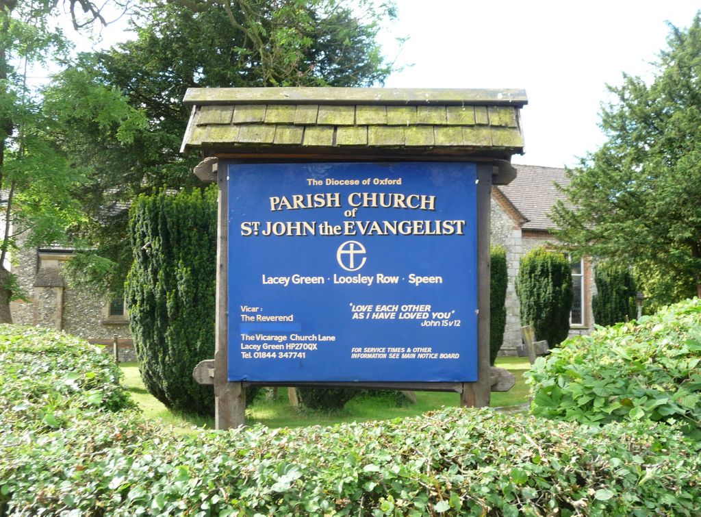
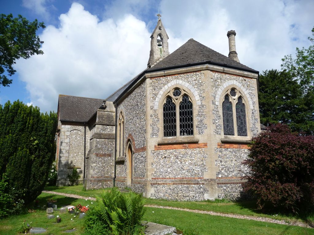
| Description | : | The church was built during the period May 1823 to May 1825 as a chapel of ease attached to the Parish Church of St Mary, Princes Risborough. The parish of Lacey Green was formed on August 1851 out of part of the parish of Princes Risborough. St. John continued to be known as a parochial chapel until 1868 when it officially became a church by direction of the Bishop of Oxford. In addition to Lacey Green, the church also serves the communities within the villages of Loosley Row and Speen. Extensive alterations took place in 1871. In recent years further... Read More |
frequently asked questions (FAQ):
-
Where is St John the Evangelist Churchyard?
St John the Evangelist Churchyard is located at Lacey Green, Wycombe District ,Buckinghamshire ,England.
-
St John the Evangelist Churchyard cemetery's updated grave count on graveviews.com?
0 memorials
-
Where are the coordinates of the St John the Evangelist Churchyard?
Latitude: 51.6916100
Longitude: -0.8081580
Nearby Cemetories:
1. Lacey Green Methodist Cemetery
Lacey Green, Wycombe District, England
Coordinate: 51.6962930, -0.8138030
2. Loosley Row Cemetery
Losley Row, Wycombe District, England
Coordinate: 51.6974200, -0.8190600
3. Speen Baptist Churchyard
Wycombe District, England
Coordinate: 51.6903980, -0.7796780
4. St. Botolph Churchyard
Bradenham, Wycombe District, England
Coordinate: 51.6668380, -0.8041850
5. St Mary Magdalene Churchyard
Great Hampden, Wycombe District, England
Coordinate: 51.7136220, -0.7732700
6. St Paul's Churchyard
Bledlow Ridge, Wycombe District, England
Coordinate: 51.6726230, -0.8484280
7. Ss. Mary and Nicholas Churchyard
Saunderton, Wycombe District, England
Coordinate: 51.7101051, -0.8499552
8. Baptist Church Cemetery
Princes Risborough, Wycombe District, England
Coordinate: 51.7220500, -0.8296700
9. St Mary Churchyard
Princes Risborough, Wycombe District, England
Coordinate: 51.7242980, -0.8340970
10. Stratton Memorial Gardens
Princes Risborough, Wycombe District, England
Coordinate: 51.7281320, -0.8247490
11. St Mary Churchyard
Radnage, Wycombe District, England
Coordinate: 51.6747990, -0.8647210
12. St. Michael's and All Angels Churchyard
Horsenden, Wycombe District, England
Coordinate: 51.7193800, -0.8527040
13. St Dunstan Churchyard
Monks Risborough, Wycombe District, England
Coordinate: 51.7320710, -0.8253050
14. St. Lawrence Churchyard
West Wycombe, Wycombe District, England
Coordinate: 51.6479900, -0.8060200
15. Holy Trinity Churchyard
Prestwood, Chiltern District, England
Coordinate: 51.6888000, -0.7367300
16. Dashwood Mausoleum
West Wycombe, Wycombe District, England
Coordinate: 51.6471210, -0.8047420
17. Little Hampden Churchyard
Little Hampden, Wycombe District, England
Coordinate: 51.7237241, -0.7556049
18. Holy Trinity New Churchyard
Bledlow, Wycombe District, England
Coordinate: 51.7136400, -0.8737800
19. Holy Trinity Churchyard
Bledlow, Wycombe District, England
Coordinate: 51.7127780, -0.8745720
20. Four Ashes Garden of Rest
Hughenden, Wycombe District, England
Coordinate: 51.6614724, -0.7389121
21. St. Michael and All Angels Churchyard
Hughenden, Wycombe District, England
Coordinate: 51.6518960, -0.7522470
22. Cryers Hill Methodist Cemetery
Cryers Hill, Wycombe District, England
Coordinate: 51.6646790, -0.7349370
23. St. Nicholas Churchyard
Great Kimble, Wycombe District, England
Coordinate: 51.7463600, -0.8053600
24. All Saints Churchyard
Little Kimble, Wycombe District, England
Coordinate: 51.7504600, -0.8042100