
| Memorials | : | 0 |
| Location | : | Bledlow, Wycombe District, England |
| Coordinate | : | 51.7127780, -0.8745720 |
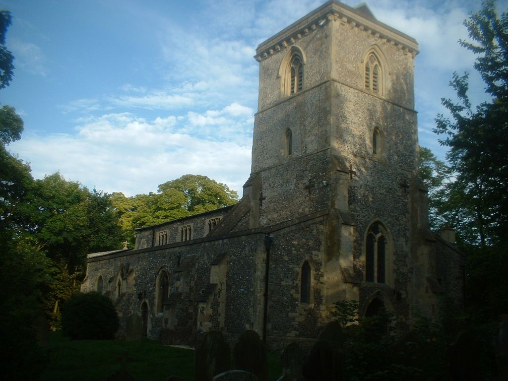
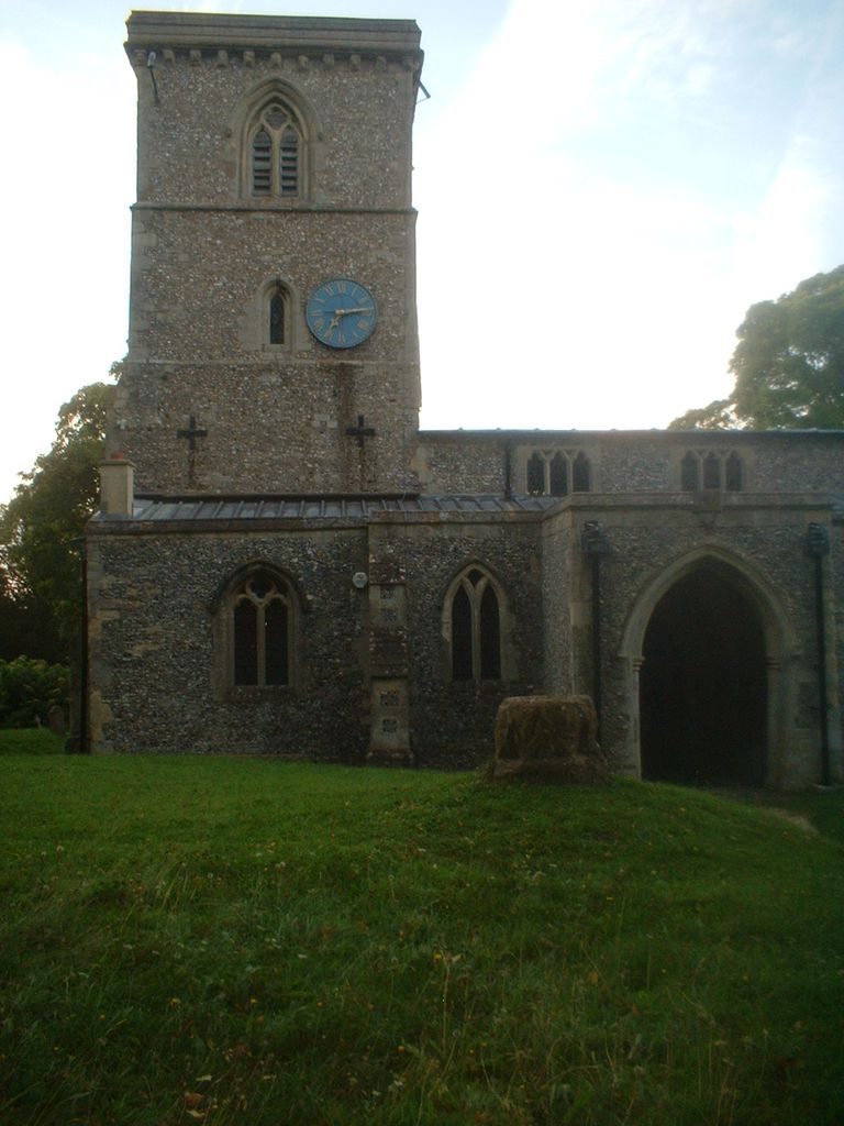
| Description | : | The church was built mostly during 12th and 13th centuries and is largely unchanged. It was featured in some episodes of "Midsomer Murders". The tower houses eight bells. The south porch leads to the the oldest working doors in Buckinghamshire, with strap hinges and a draw door. The burial ground surrounds the church. |
frequently asked questions (FAQ):
-
Where is Holy Trinity Churchyard?
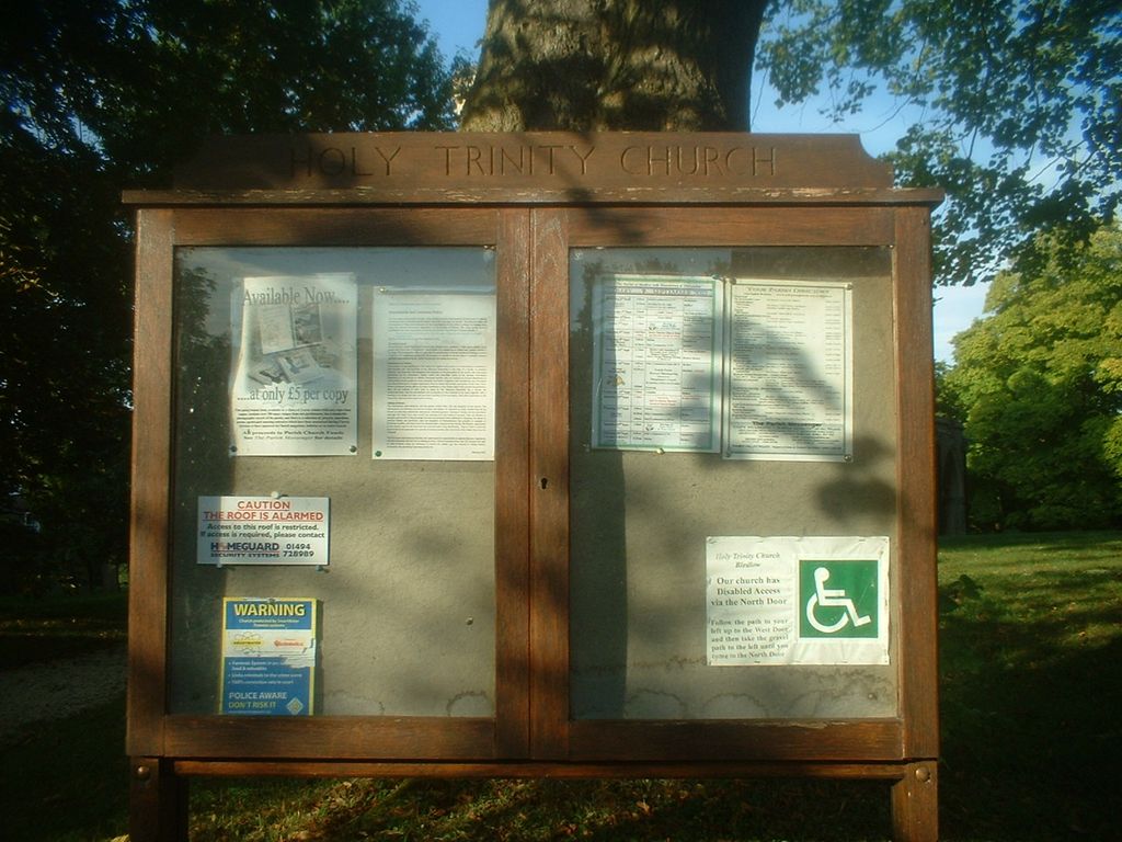
Holy Trinity Churchyard is located at Church End Bledlow, Wycombe District ,Buckinghamshire , HP27 9PDEngland.
-
Holy Trinity Churchyard cemetery's updated grave count on graveviews.com?
0 memorials
-
Where are the coordinates of the Holy Trinity Churchyard?
Latitude: 51.7127780
Longitude: -0.8745720
Nearby Cemetories:
1. Holy Trinity New Churchyard
Bledlow, Wycombe District, England
Coordinate: 51.7136400, -0.8737800
2. St. Michael's and All Angels Churchyard
Horsenden, Wycombe District, England
Coordinate: 51.7193800, -0.8527040
3. Ss. Mary and Nicholas Churchyard
Saunderton, Wycombe District, England
Coordinate: 51.7101051, -0.8499552
4. St Andrew's Church
Chinnor, South Oxfordshire District, England
Coordinate: 51.7016400, -0.9062790
5. St Mary Churchyard
Princes Risborough, Wycombe District, England
Coordinate: 51.7242980, -0.8340970
6. Baptist Church Cemetery
Princes Risborough, Wycombe District, England
Coordinate: 51.7220500, -0.8296700
7. St. Peter's Churchyard
Ilmer, Wycombe District, England
Coordinate: 51.7428914, -0.8873946
8. Stratton Memorial Gardens
Princes Risborough, Wycombe District, England
Coordinate: 51.7281320, -0.8247490
9. St Dunstan Churchyard
Monks Risborough, Wycombe District, England
Coordinate: 51.7320710, -0.8253050
10. Loosley Row Cemetery
Losley Row, Wycombe District, England
Coordinate: 51.6974200, -0.8190600
11. Nativity of the Blessed Virgin Mary Churchyard
Crowell, South Oxfordshire District, England
Coordinate: 51.6921610, -0.9268631
12. St Mary Churchyard
Radnage, Wycombe District, England
Coordinate: 51.6747990, -0.8647210
13. St Mary's Churchyard
Sydenham, South Oxfordshire District, England
Coordinate: 51.7112360, -0.9398460
14. Lacey Green Methodist Cemetery
Lacey Green, Wycombe District, England
Coordinate: 51.6962930, -0.8138030
15. St Paul's Churchyard
Bledlow Ridge, Wycombe District, England
Coordinate: 51.6726230, -0.8484280
16. St John the Evangelist Churchyard
Lacey Green, Wycombe District, England
Coordinate: 51.6916100, -0.8081580
17. St. Catherine Churchyard
Towersey, South Oxfordshire District, England
Coordinate: 51.7411700, -0.9360300
18. St Nicholas Churchyard
Kingsey, Aylesbury Vale District, England
Coordinate: 51.7545190, -0.9246110
19. St Peter and St Paul Churchyard
Stokenchurch, Wycombe District, England
Coordinate: 51.6615290, -0.9022940
20. St. Nicholas Churchyard
Great Kimble, Wycombe District, England
Coordinate: 51.7463600, -0.8053600
21. St. Peter and St. Paul's Church Cemetery
Aston Rowant, South Oxfordshire District, England
Coordinate: 51.6851100, -0.9502900
22. Aston Sandford St Michael and all Angels
Aston Sandford, Aylesbury Vale District, England
Coordinate: 51.7651962, -0.9024482
23. Stokenchurch Church Cemetery
Stokenchurch, Wycombe District, England
Coordinate: 51.6572200, -0.8960300
24. All Saints Churchyard
Little Kimble, Wycombe District, England
Coordinate: 51.7504600, -0.8042100