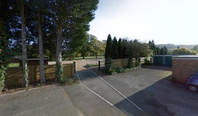
| Memorials | : | 0 |
| Location | : | Princes Risborough, Wycombe District, England |
| Website | : | www.princesrisboroughtowncouncil.gov.uk/Stratton_Memorial_Garden_19059.aspx |
| Coordinate | : | 51.7281320, -0.8247490 |
frequently asked questions (FAQ):
-
Where is Stratton Memorial Gardens?
Stratton Memorial Gardens is located at Princes Risborough, Wycombe District ,Buckinghamshire ,England.
-
Stratton Memorial Gardens cemetery's updated grave count on graveviews.com?
0 memorials
-
Where are the coordinates of the Stratton Memorial Gardens?
Latitude: 51.7281320
Longitude: -0.8247490
Nearby Cemetories:
1. St Dunstan Churchyard
Monks Risborough, Wycombe District, England
Coordinate: 51.7320710, -0.8253050
2. Baptist Church Cemetery
Princes Risborough, Wycombe District, England
Coordinate: 51.7220500, -0.8296700
3. St Mary Churchyard
Princes Risborough, Wycombe District, England
Coordinate: 51.7242980, -0.8340970
4. St. Michael's and All Angels Churchyard
Horsenden, Wycombe District, England
Coordinate: 51.7193800, -0.8527040
5. St. Nicholas Churchyard
Great Kimble, Wycombe District, England
Coordinate: 51.7463600, -0.8053600
6. Ss. Mary and Nicholas Churchyard
Saunderton, Wycombe District, England
Coordinate: 51.7101051, -0.8499552
7. All Saints Churchyard
Little Kimble, Wycombe District, England
Coordinate: 51.7504600, -0.8042100
8. Loosley Row Cemetery
Losley Row, Wycombe District, England
Coordinate: 51.6974200, -0.8190600
9. Lacey Green Methodist Cemetery
Lacey Green, Wycombe District, England
Coordinate: 51.6962930, -0.8138030
10. Ss. Peter and Paul Churchyard
Ellesborough, Wycombe District, England
Coordinate: 51.7528350, -0.7898410
11. Holy Trinity New Churchyard
Bledlow, Wycombe District, England
Coordinate: 51.7136400, -0.8737800
12. Holy Trinity Churchyard
Bledlow, Wycombe District, England
Coordinate: 51.7127780, -0.8745720
13. St Mary Magdalene Churchyard
Great Hampden, Wycombe District, England
Coordinate: 51.7136220, -0.7732700
14. St John the Evangelist Churchyard
Lacey Green, Wycombe District, England
Coordinate: 51.6916100, -0.8081580
15. Coombe Hill Second Boer War Monument
Wendover, Aylesbury Vale District, England
Coordinate: 51.7530340, -0.7716060
16. St. Peter's Churchyard
Ilmer, Wycombe District, England
Coordinate: 51.7428914, -0.8873946
17. Little Hampden Churchyard
Little Hampden, Wycombe District, England
Coordinate: 51.7237241, -0.7556049
18. Speen Baptist Churchyard
Wycombe District, England
Coordinate: 51.6903980, -0.7796780
19. St Andrew's Church
Chinnor, South Oxfordshire District, England
Coordinate: 51.7016400, -0.9062790
20. St Paul's Churchyard
Bledlow Ridge, Wycombe District, England
Coordinate: 51.6726230, -0.8484280
21. St Mary Churchyard
Radnage, Wycombe District, England
Coordinate: 51.6747990, -0.8647210
22. Aston Sandford St Michael and all Angels
Aston Sandford, Aylesbury Vale District, England
Coordinate: 51.7651962, -0.9024482
23. St Mary Churchyard
Wendover, Aylesbury Vale District, England
Coordinate: 51.7578360, -0.7390050
24. St. Mary the Virgin Churchyard
Stoke Mandeville, Aylesbury Vale District, England
Coordinate: 51.7861990, -0.7913990

