
| Memorials | : | 0 |
| Location | : | Condover, Shropshire Unitary Authority, England |
| Coordinate | : | 52.6356110, -2.7833220 |
frequently asked questions (FAQ):
-
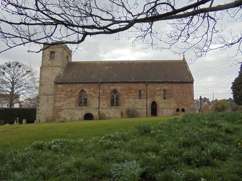
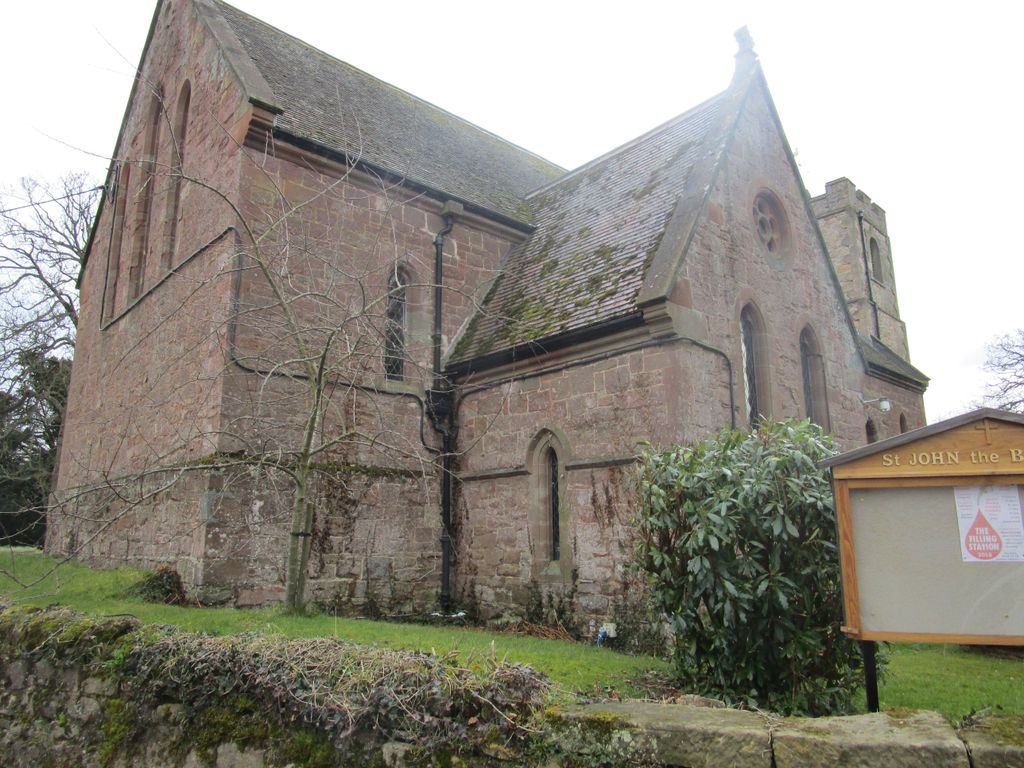
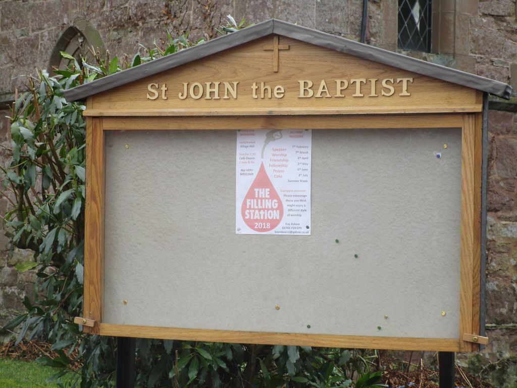
Where is St. John’s Churchyard?
St. John’s Churchyard is located at Stapleton Condover, Shropshire Unitary Authority ,Shropshire , SY5 7EHEngland.
-
St. John’s Churchyard cemetery's updated grave count on graveviews.com?
0 memorials
-
Where are the coordinates of the St. John’s Churchyard?
Latitude: 52.6356110
Longitude: -2.7833220
Nearby Cemetories:
1. St. Mary & St. Andrew Churchyard
Condover, Shropshire Unitary Authority, England
Coordinate: 52.6474199, -2.7484076
2. St. Edith's Churchyard
Church Pulverbatch, Shropshire Unitary Authority, England
Coordinate: 52.6210550, -2.8436610
3. St. Mark's Churchyard
Frodesley, Shropshire Unitary Authority, England
Coordinate: 52.6052775, -2.7166580
4. St Thomas Churchyard
Great Hanwood, Shropshire Unitary Authority, England
Coordinate: 52.6812150, -2.8242660
5. All Saints Churchyard
Berrington, Shropshire Unitary Authority, England
Coordinate: 52.6574020, -2.6957330
6. St. Mary's Churchyard
Acton Burnell, Shropshire Unitary Authority, England
Coordinate: 52.6131390, -2.6907390
7. Habberley St Mary's Church
Atcham, Shropshire Unitary Authority, England
Coordinate: 52.6266060, -2.8897140
8. St. Eata's Churchyard
Atcham, Shropshire Unitary Authority, England
Coordinate: 52.6785350, -2.6803958
9. St Peter's Church
Cound, Shropshire Unitary Authority, England
Coordinate: 52.6409160, -2.6542780
10. St. John the Baptist Churchyard
Church Preen, Shropshire Unitary Authority, England
Coordinate: 52.5792000, -2.6754000
11. St. John The Baptist Churchyard
Kenley, Shropshire Unitary Authority, England
Coordinate: 52.6030460, -2.6469840
12. St. James's Churchyard
Cardington, Shropshire Unitary Authority, England
Coordinate: 52.5520200, -2.7296220
13. Bicton Cemetery
Bicton, Shropshire Unitary Authority, England
Coordinate: 52.7284870, -2.8183830
14. St. Michael’s Churchyard
Cardeston, Shropshire Unitary Authority, England
Coordinate: 52.7050600, -2.8960090
15. St. Michael Churchyard
Ford, Shropshire Unitary Authority, England
Coordinate: 52.7184248, -2.8715080
16. St Laurence Churchyard
Church Stretton, Shropshire Unitary Authority, England
Coordinate: 52.5381750, -2.8087400
17. Church Stretton Cemetery
Church Stretton, Shropshire Unitary Authority, England
Coordinate: 52.5365590, -2.8097950
18. St. John’s Churchyard
Hughley, Shropshire Unitary Authority, England
Coordinate: 52.5774550, -2.6435850
19. Greenhills Cemetery
Church Stretton, Shropshire Unitary Authority, England
Coordinate: 52.5310170, -2.8142480
20. St. Andrew's Churchyard
Hope Bowdler, Shropshire Unitary Authority, England
Coordinate: 52.5271160, -2.7739830
21. Christ Church Churchyard
Cressage, Shropshire Unitary Authority, England
Coordinate: 52.6322770, -2.6040810
22. St. Mary's Churchyard
Harley, Shropshire Unitary Authority, England
Coordinate: 52.6094750, -2.5976600
23. Holy Trinity Churchyard
Hope, Shropshire Unitary Authority, England
Coordinate: 52.6070670, -2.9747750
24. St Peter's Churchyard
Easthope, Shropshire Unitary Authority, England
Coordinate: 52.5522350, -2.6413020