
| Memorials | : | 0 |
| Location | : | Cressage, Shropshire Unitary Authority, England |
| Coordinate | : | 52.6322770, -2.6040810 |
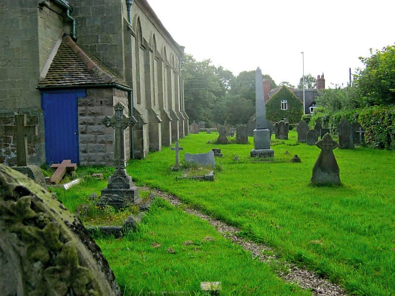
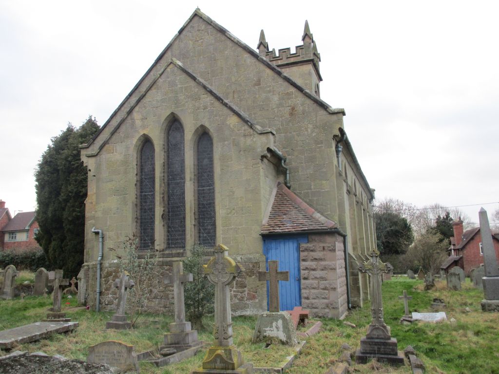
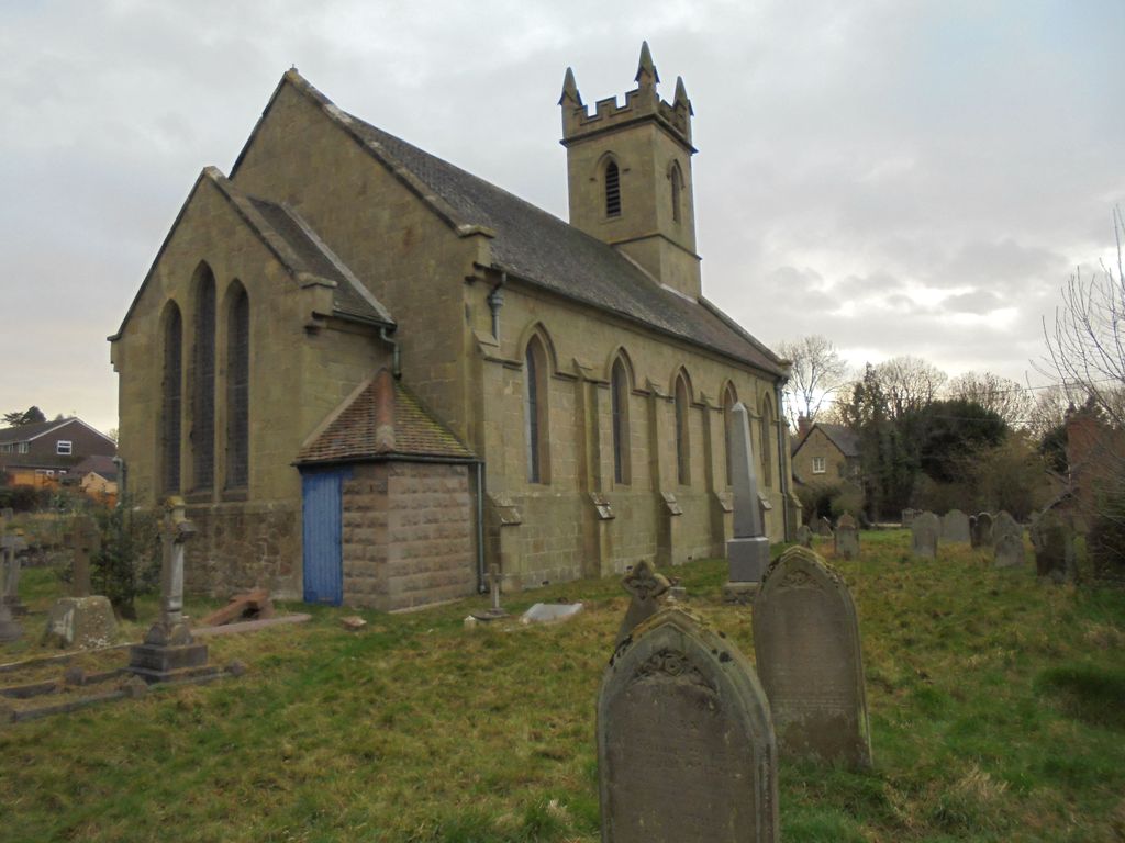
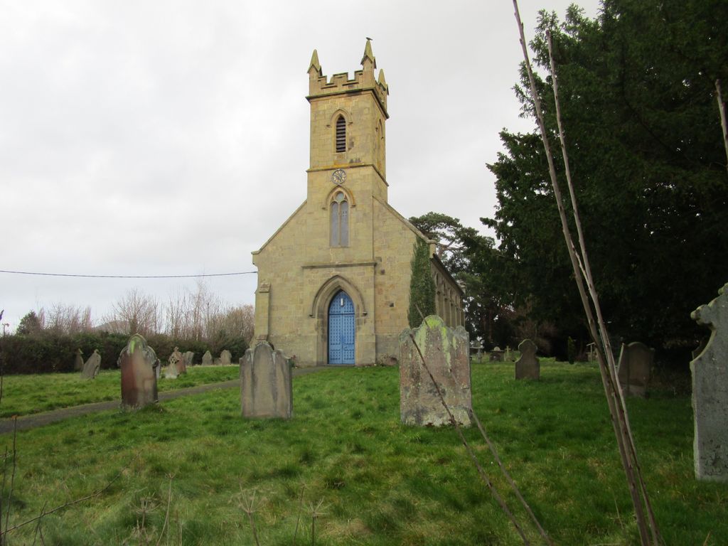
| Description | : | The ancient church in Cressage was a chapelry of Cound and was dedicated to St Sampson. Its position close to the river made it liable to flooding and so in 1841 it was replaced by this present building sited somewhat farther from the water. The exact whereabouts of the original church are lost. The church is normally locked. |
frequently asked questions (FAQ):
-
Where is Christ Church Churchyard?
Christ Church Churchyard is located at Cressage, Shropshire Unitary Authority ,Shropshire ,England.
-
Christ Church Churchyard cemetery's updated grave count on graveviews.com?
0 memorials
-
Where are the coordinates of the Christ Church Churchyard?
Latitude: 52.6322770
Longitude: -2.6040810


Nearby Cemetories:
1. St. Mary's Churchyard
Harley, Shropshire Unitary Authority, England
Coordinate: 52.6094750, -2.5976600
2. St Peter's Church
Cound, Shropshire Unitary Authority, England
Coordinate: 52.6409160, -2.6542780
3. St. John The Baptist Churchyard
Kenley, Shropshire Unitary Authority, England
Coordinate: 52.6030460, -2.6469840
4. Holy Trinity Churchyard
Buildwas, Shropshire Unitary Authority, England
Coordinate: 52.6393710, -2.5380180
5. St. Lawrence's Churchyard
Little Wenlock, Telford and Wrekin Unitary Authority, England
Coordinate: 52.6582070, -2.5234340
6. St. Mary's Churchyard
Acton Burnell, Shropshire Unitary Authority, England
Coordinate: 52.6131390, -2.6907390
7. St. John’s Churchyard
Hughley, Shropshire Unitary Authority, England
Coordinate: 52.5774550, -2.6435850
8. St. Bartholomew Churchyard
Benthall, Shropshire Unitary Authority, England
Coordinate: 52.6198230, -2.5068570
9. All Saints Churchyard
Berrington, Shropshire Unitary Authority, England
Coordinate: 52.6574020, -2.6957330
10. St. Eata's Churchyard
Atcham, Shropshire Unitary Authority, England
Coordinate: 52.6785350, -2.6803958
11. Coalbrookdale Quaker Burial Ground
Coalbrookdale, Telford and Wrekin Unitary Authority, England
Coordinate: 52.6417080, -2.4952200
12. St. John the Baptist Churchyard
Church Preen, Shropshire Unitary Authority, England
Coordinate: 52.5792000, -2.6754000
13. Holy Trinity Churchyard
Bourton, Shropshire Unitary Authority, England
Coordinate: 52.5636887, -2.5957174
14. St. Giles Church Cemetery
Barrow, Shropshire Unitary Authority, England
Coordinate: 52.5969300, -2.5065700
15. Holy Trinity Churchyard
Coalbrookdale, Telford and Wrekin Unitary Authority, England
Coordinate: 52.6375300, -2.4894000
16. Castle Green Cemetery
Ironbridge, Telford and Wrekin Unitary Authority, England
Coordinate: 52.6346434, -2.4851070
17. St. Luke's Churchyard
Ironbridge, Telford and Wrekin Unitary Authority, England
Coordinate: 52.6285830, -2.4851180
18. Broseley Baptist Church
Broseley, Shropshire Unitary Authority, England
Coordinate: 52.6135650, -2.4871190
19. St. Mark's Churchyard
Frodesley, Shropshire Unitary Authority, England
Coordinate: 52.6052775, -2.7166580
20. St. Peter's Churchyard
Wrockwardine, Telford and Wrekin Unitary Authority, England
Coordinate: 52.7047350, -2.5569500
21. The Red Church
Broseley, Shropshire Unitary Authority, England
Coordinate: 52.6205367, -2.4753955
22. St Johns Church
Lawley, Telford and Wrekin Unitary Authority, England
Coordinate: 52.6751550, -2.4932670
23. Wellington Cemetery
Wellington, Telford and Wrekin Unitary Authority, England
Coordinate: 52.6958280, -2.5246020
24. St. Luke's Churchyard
Doseley, Telford and Wrekin Unitary Authority, England
Coordinate: 52.6560410, -2.4775480