
| Memorials | : | 0 |
| Location | : | Wolston, Rugby Borough, England |
| Coordinate | : | 52.3783460, -1.3996960 |
frequently asked questions (FAQ):
-
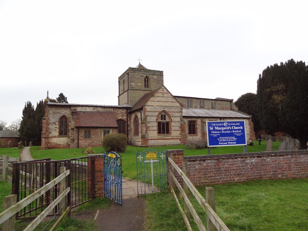
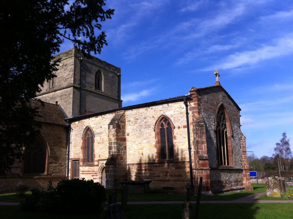
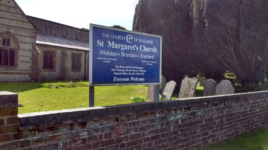
Where is St Margaret's Churchyard?
St Margaret's Churchyard is located at Main St Wolston, Rugby Borough ,Warwickshire ,England.
-
St Margaret's Churchyard cemetery's updated grave count on graveviews.com?
0 memorials
-
Where are the coordinates of the St Margaret's Churchyard?
Latitude: 52.3783460
Longitude: -1.3996960
Nearby Cemetories:
1. Dyers Lane Cemetery
Wolston, Rugby Borough, England
Coordinate: 52.3742591, -1.3921321
2. St Leonard's Churchyard
Ryton-on-Dunsmore, Rugby Borough, England
Coordinate: 52.3674940, -1.4338580
3. All Saints Churchyard
Stretton-on-Dunsmore, Rugby Borough, England
Coordinate: 52.3495500, -1.4042900
4. St Bartholomew Churchyard
Binley, Metropolitan Borough of Coventry, England
Coordinate: 52.4031820, -1.4468110
5. St Peter's Churchyard
Church Lawford, Rugby Borough, England
Coordinate: 52.3832600, -1.3355600
6. St John the Baptist Churchyard
Brinklow, Rugby Borough, England
Coordinate: 52.4130320, -1.3590600
7. Princethorpe Priory Nun's Cemetery
Princethorpe, Rugby Borough, England
Coordinate: 52.3360620, -1.4216400
8. Brinklow Cemetery
Brinklow, Rugby Borough, England
Coordinate: 52.4161320, -1.3556710
9. Princethorpe Cemetery
Princethorpe, Rugby Borough, England
Coordinate: 52.3340670, -1.4232840
10. St. Nicholas Churchyard
Frankton, Rugby Borough, England
Coordinate: 52.3277230, -1.3796870
11. St Giles Churchyard
Bubbenhall, Warwick District, England
Coordinate: 52.3501940, -1.4730830
12. St Peters Churchyard
Bourton on Dunsmore, Rugby Borough, England
Coordinate: 52.3285270, -1.3612930
13. St Michael Churchyard
Coventry, Metropolitan Borough of Coventry, England
Coordinate: 52.4115820, -1.4747430
14. St. John's Churchyard
Long Lawford, Rugby Borough, England
Coordinate: 52.3835940, -1.3071930
15. St Mary Magdalene Wyken
Coventry, Metropolitan Borough of Coventry, England
Coordinate: 52.4236580, -1.4620770
16. St Mary Magdalen
Coventry, Metropolitan Borough of Coventry, England
Coordinate: 52.4236750, -1.4621960
17. Saint John the Baptist Church
Baginton, Warwick District, England
Coordinate: 52.3698000, -1.4969000
18. St Esprit Churchyard
Marton, Rugby Borough, England
Coordinate: 52.3167730, -1.4043900
19. London Road Cemetery
Coventry, Metropolitan Borough of Coventry, England
Coordinate: 52.3975420, -1.4966730
20. Congregational Chapel Burial Ground
Stretton under Fosse, Rugby Borough, England
Coordinate: 52.4290070, -1.3381370
21. St John the Baptist Churchyard
Wappenbury, Warwick District, England
Coordinate: 52.3204330, -1.4467410
22. Saint Anne Churchyard
Wappenbury, Warwick District, England
Coordinate: 52.3200340, -1.4458580
23. Harborough Magna Cemetery
Harborough Magna, Rugby Borough, England
Coordinate: 52.4094260, -1.3021660
24. St Leonard's Churchyard
Birdingbury, Rugby Borough, England
Coordinate: 52.3141340, -1.3675630