
| Memorials | : | 1 |
| Location | : | Hinton Waldrist, Vale of White Horse District, England |
| Website | : | cherbury-gainfield.org.uk/ |
| Coordinate | : | 51.6911016, -1.4589705 |
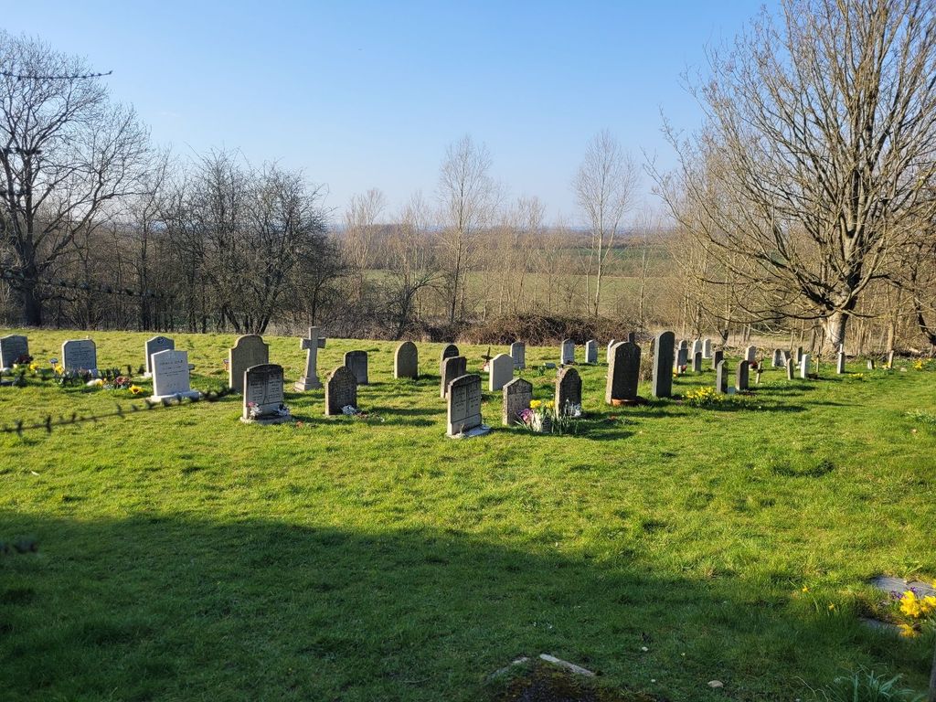
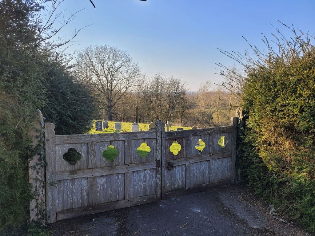
| Description | : | The Churchyard Extension is approximately 50 meters from St Margarets Church. Facing the church, turn right and walk down the hill, and it's on the bend on the right hand side. |
frequently asked questions (FAQ):
-
Where is St Margaret of Antioch Churchyard Extension?
St Margaret of Antioch Churchyard Extension is located at Church Road, Hinton Waldrist, Oxfordshire Hinton Waldrist, Vale of White Horse District ,Oxfordshire ,England.
-
St Margaret of Antioch Churchyard Extension cemetery's updated grave count on graveviews.com?
1 memorials
-
Where are the coordinates of the St Margaret of Antioch Churchyard Extension?
Latitude: 51.6911016
Longitude: -1.4589705
Nearby Cemetories:
1. St. Margaret Churchyard
Hinton Waldrist, Vale of White Horse District, England
Coordinate: 51.6894380, -1.4587200
2. Saint Mary Churchyard
Longworth, Vale of White Horse District, England
Coordinate: 51.6926577, -1.4457428
3. St Marys Churchyard
Shifford, West Oxfordshire District, England
Coordinate: 51.7151440, -1.4631340
4. All Saints Church
Pusey, Vale of White Horse District, England
Coordinate: 51.6663890, -1.4801330
5. St. John the Baptist Churchyard
Kingston Bagpuize, Vale of White Horse District, England
Coordinate: 51.6820690, -1.4127410
6. St Mary Churchyard
Buckland, Vale of White Horse District, England
Coordinate: 51.6819730, -1.5060150
7. St George Roman Catholic Churchyard
Buckland, Vale of White Horse District, England
Coordinate: 51.6804300, -1.5068720
8. Cote Baptist Chapel
Cote, West Oxfordshire District, England
Coordinate: 51.7254430, -1.4929510
9. St Nicholas Churchyard
Fyfield, Vale of White Horse District, England
Coordinate: 51.6871100, -1.3888600
10. St. Giles' Churchyard
Standlake, West Oxfordshire District, England
Coordinate: 51.7299550, -1.4262300
11. St. Peter Churchyard
Charney Bassett, Vale of White Horse District, England
Coordinate: 51.6472944, -1.4501905
12. St. James the Great Churchyard
Aston, West Oxfordshire District, England
Coordinate: 51.7252620, -1.5059510
13. St Mary's Churchyard
Lyford, Vale of White Horse District, England
Coordinate: 51.6456433, -1.4371256
14. St George's Parish Church
Hatford, Vale of White Horse District, England
Coordinate: 51.6510000, -1.5120000
15. St. Denys' Churchyard
Northmoor, West Oxfordshire District, England
Coordinate: 51.7230000, -1.3918000
16. St. Lawrence Churchyard
Tubney, Vale of White Horse District, England
Coordinate: 51.6903100, -1.3712600
17. St. Luke's Churchyard
Garford, Vale of White Horse District, England
Coordinate: 51.6637514, -1.3815467
18. St Deny's Churchyard
Stanford-in-the-Vale, Vale of White Horse District, England
Coordinate: 51.6399960, -1.5062800
19. Littleworth Cemetery
Littleworth, Vale of White Horse District, England
Coordinate: 51.6722500, -1.5492500
20. South Oxfordshire Memorial Park and Crematorium
Garford, Vale of White Horse District, England
Coordinate: 51.6535980, -1.3767840
21. St. James The Great Churchyard
West Hanney, Vale of White Horse District, England
Coordinate: 51.6325030, -1.4144360
22. St Laurence Church
Appleton, Vale of White Horse District, England
Coordinate: 51.7110290, -1.3588780
23. St. Mary the Virgin Churchyard
Bampton, West Oxfordshire District, England
Coordinate: 51.7278250, -1.5487270
24. Bampton Cemetery
Bampton, West Oxfordshire District, England
Coordinate: 51.7296400, -1.5490200