
| Memorials | : | 4 |
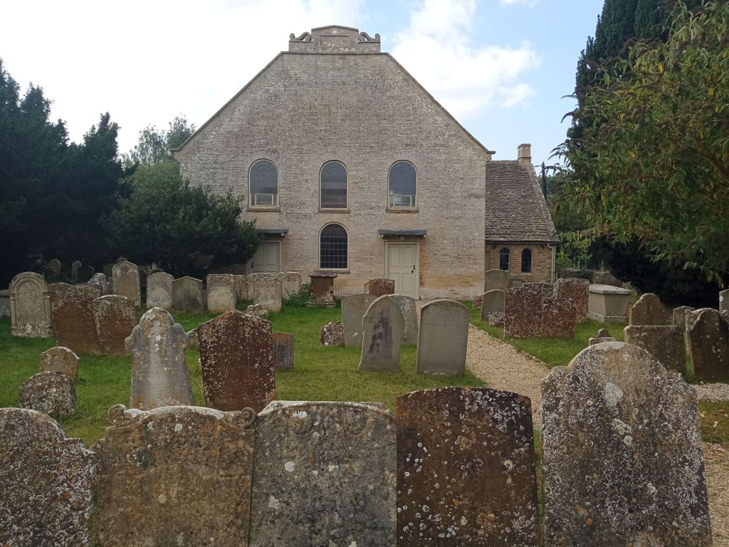
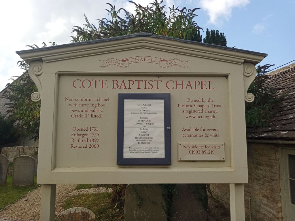
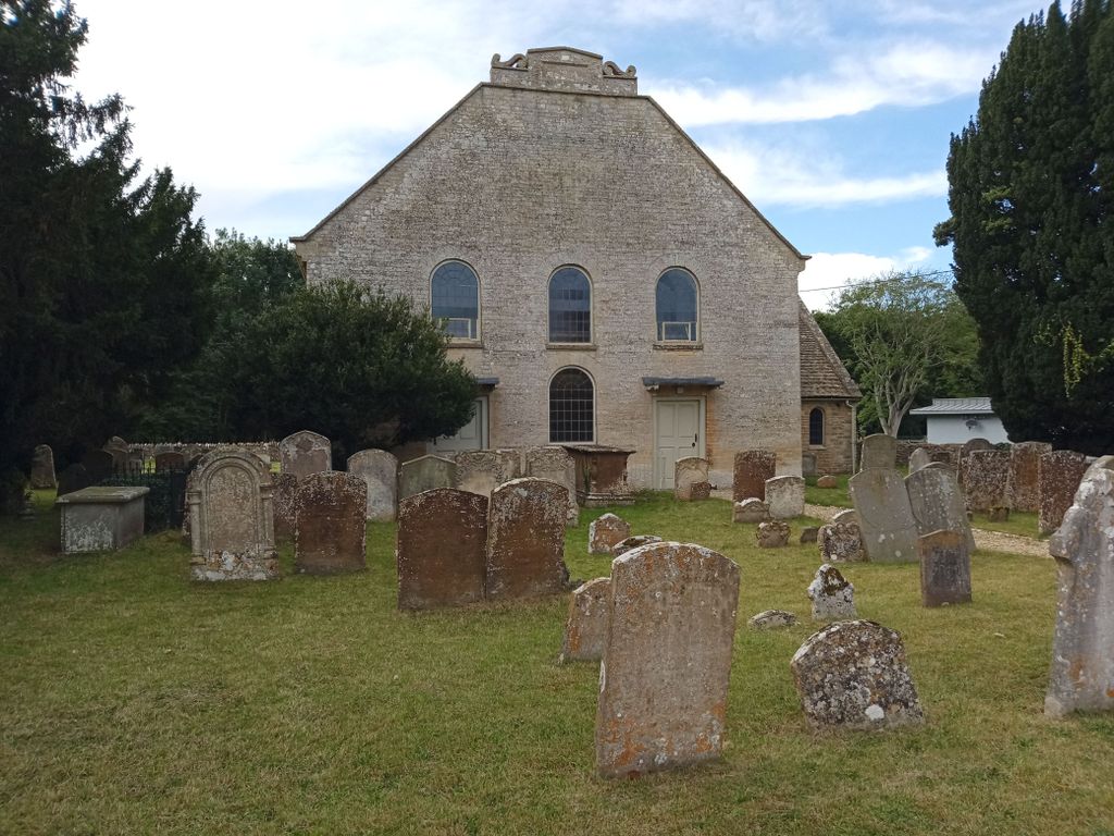
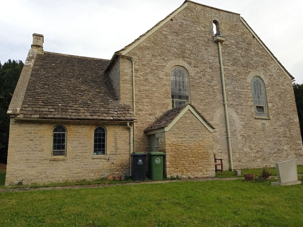
| Location | : | Cote, West Oxfordshire District, England |
| Website | : | hct.org.uk/cote-baptist-chapel/ |
| Coordinate | : | 51.7254430, -1.4929510 |
frequently asked questions (FAQ):
-
Where is Cote Baptist Chapel?
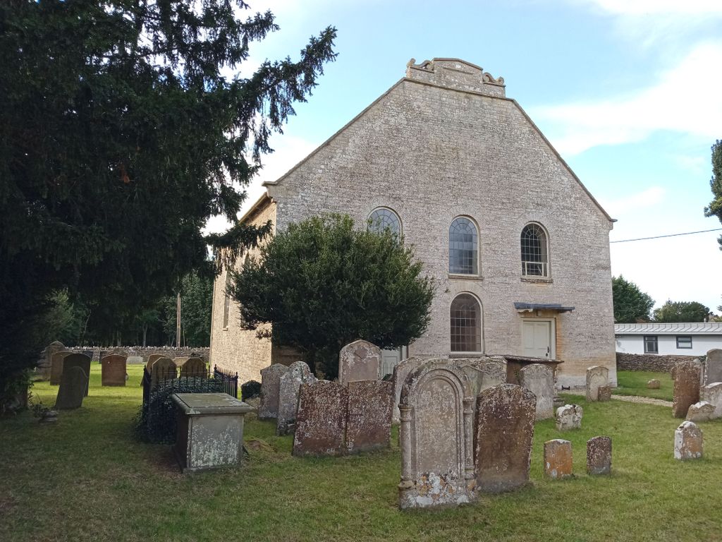
Cote Baptist Chapel is located at Cote, West Oxfordshire District ,Oxfordshire , OX18 2EFEngland.
-
Cote Baptist Chapel cemetery's updated grave count on graveviews.com?
2 memorials
-
Where are the coordinates of the Cote Baptist Chapel?
Latitude: 51.7254430
Longitude: -1.4929510
Nearby Cemetories:
1. St. James the Great Churchyard
Aston, West Oxfordshire District, England
Coordinate: 51.7252620, -1.5059510
2. St Marys Churchyard
Shifford, West Oxfordshire District, England
Coordinate: 51.7151440, -1.4631340
3. St. Mary the Virgin Churchyard
Bampton, West Oxfordshire District, England
Coordinate: 51.7278250, -1.5487270
4. Bampton Cemetery
Bampton, West Oxfordshire District, England
Coordinate: 51.7296400, -1.5490200
5. St Margaret of Antioch Churchyard Extension
Hinton Waldrist, Vale of White Horse District, England
Coordinate: 51.6911016, -1.4589705
6. St. Bartholomew Churchyard
Ducklington, West Oxfordshire District, England
Coordinate: 51.7658689, -1.4810340
7. St. Giles' Churchyard
Standlake, West Oxfordshire District, England
Coordinate: 51.7299550, -1.4262300
8. St. Margaret Churchyard
Hinton Waldrist, Vale of White Horse District, England
Coordinate: 51.6894380, -1.4587200
9. Saint Mary Churchyard
Longworth, Vale of White Horse District, England
Coordinate: 51.6926577, -1.4457428
10. St Mary Churchyard
Buckland, Vale of White Horse District, England
Coordinate: 51.6819730, -1.5060150
11. St George Roman Catholic Churchyard
Buckland, Vale of White Horse District, England
Coordinate: 51.6804300, -1.5068720
12. St John The Baptist
Curbridge, West Oxfordshire District, England
Coordinate: 51.7764570, -1.5203140
13. St. Mary's Churchyard
Witney, West Oxfordshire District, England
Coordinate: 51.7807116, -1.4850508
14. Saint Mary's Churchyard
Black Bourton, West Oxfordshire District, England
Coordinate: 51.7360520, -1.5864600
15. St Mary Churchyard
Cogges, West Oxfordshire District, England
Coordinate: 51.7839280, -1.4782010
16. All Saints Church
Pusey, Vale of White Horse District, England
Coordinate: 51.6663890, -1.4801330
17. Tower Hill Cemetery
Witney, West Oxfordshire District, England
Coordinate: 51.7852950, -1.4999610
18. St. Britius Churchyard Extension
Brize Norton, West Oxfordshire District, England
Coordinate: 51.7660800, -1.5662600
19. St. Britius Churchyard
Brize Norton, West Oxfordshire District, England
Coordinate: 51.7662000, -1.5667000
20. St. Stephen's Churchyard
Clanfield, West Oxfordshire District, England
Coordinate: 51.7174060, -1.5911740
21. St. Denys' Churchyard
Northmoor, West Oxfordshire District, England
Coordinate: 51.7230000, -1.3918000
22. St Michael's Churchyard
Stanton Harcourt, West Oxfordshire District, England
Coordinate: 51.7480000, -1.3977000
23. Littleworth Cemetery
Littleworth, Vale of White Horse District, England
Coordinate: 51.6722500, -1.5492500
24. St. James the Great Churchyard
South Leigh, West Oxfordshire District, England
Coordinate: 51.7781050, -1.4298950