
| Memorials | : | 4 |
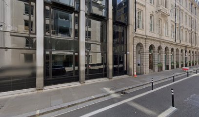
| Location | : | Cheap, City of London, England |
| Coordinate | : | 51.5145830, -0.0918610 |
| Description | : | The church is first recorded in what purports to be a charter of Henry II dateable from the witnesses to between 1175 and 1179. In about 1200, the church of St. Martin stood within a cemetery. To the E. this adjoined the cemetery of the church of St. Olave, which is recorded at about the same time and extended a little further to the S. At some time a public way now represented by Church Passage, was established through these two cemeteries. It is first mentioned in 1330 as the little lane between Ironmonger Lane and Colechurch Street where there... Read More |
frequently asked questions (FAQ):
-
Where is St. Martin Pomary Churchyard?
St. Martin Pomary Churchyard is located at Cheap, City of London ,Greater London ,England.
-
St. Martin Pomary Churchyard cemetery's updated grave count on graveviews.com?
4 memorials
-
Where are the coordinates of the St. Martin Pomary Churchyard?
Latitude: 51.5145830
Longitude: -0.0918610
Nearby Cemetories:
1. Mercers Chapel
London, City of London, England
Coordinate: 51.5141490, -0.0919390
2. All Hallows Churchyard
City of London, England
Coordinate: 51.5143760, -0.0930270
3. St. Lawrence Jewry Churchyard
London, City of London, England
Coordinate: 51.5152340, -0.0924910
4. St Mary Colechurch (Defunct)
London, City of London, England
Coordinate: 51.5136110, -0.0911110
5. Church of Saint Mary Magdalen Milk Street
London, City of London, England
Coordinate: 51.5136110, -0.0930560
6. Saint Pancras Soper Lane (Defunct)
London, City of London, England
Coordinate: 51.5132830, -0.0918850
7. Guildhall
London, City of London, England
Coordinate: 51.5158200, -0.0911380
8. St Mary-le-Bow
London, City of London, England
Coordinate: 51.5137100, -0.0935517
9. St. Benet Sherehog Churchyard (Defunct)
London, City of London, England
Coordinate: 51.5132700, -0.0912020
10. St Antholin's Church
London, City of London, England
Coordinate: 51.5126895, -0.0915805
11. St Mary Aldermary
London, City of London, England
Coordinate: 51.5127900, -0.0933800
12. St Mary Aldermanbury Churchyard
London, City of London, England
Coordinate: 51.5164830, -0.0930720
13. St Christopher le Stocks
London, City of London, England
Coordinate: 51.5142000, -0.0886000
14. All Hallows Churchyard
London, City of London, England
Coordinate: 51.5131130, -0.0948140
15. St Albans Churchyard (Defunct)
London, City of London, England
Coordinate: 51.5166460, -0.0940880
16. St Vedast Churchyard
London, City of London, England
Coordinate: 51.5149110, -0.0962350
17. St Mary Woolnoth Churchyard
London, City of London, England
Coordinate: 51.5127650, -0.0881070
18. St Mildred Bread Street Church Demolished
London, City of London, England
Coordinate: 51.5123790, -0.0950740
19. St. Leonard's Churchyard
Aldgate, City of London, England
Coordinate: 51.5152950, -0.0966580
20. St. John the Evangelist Churchyard
Bread Street, City of London, England
Coordinate: 51.5124910, -0.0954840
21. Holy Trinity the Less Churchyard (Defunct)
London, City of London, England
Coordinate: 51.5119670, -0.0944820
22. St Anne and St Agnes Churchyard
London, City of London, England
Coordinate: 51.5164490, -0.0963390
23. Saint Swithin London Stone Churchyard
London, City of London, England
Coordinate: 51.5115800, -0.0894340
24. Saint Mary Bothaw (Defunct)
London, City of London, England
Coordinate: 51.5114000, -0.0900800