
| Memorials | : | 4 |
| Location | : | Nottingham, Nottingham Unitary Authority, England |
| Coordinate | : | 52.9527860, -1.1419160 |
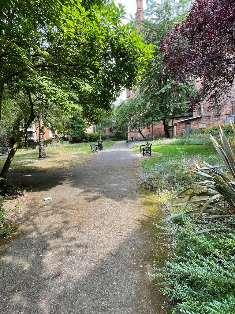
| Description | : | Burial Ground associated with St. Mary's Church, Nottingham On the 30th of June 1786 a new burial ground on the north side of Barker Gate was consecrated by Dr William Markham, Archbishop of York. It came to be known locally as Top Bury. In 1826 it was the scene of disturbances after Milnes and Smith were hanged for robbery. Milnes a soldier from Wiltshire was buried in the churchyard and Smith, who lived on Barker Gate, was buried in this graveyard watched by a very large crowd. Part of this burial ground, now a Rest Garden, is still to be found behind... Read More |
frequently asked questions (FAQ):
-
Where is St Mary's Burial Grounds?
St Mary's Burial Grounds is located at Barker Gate Nottingham, Nottingham Unitary Authority ,Nottinghamshire , NG1 1JSEngland.
-
St Mary's Burial Grounds cemetery's updated grave count on graveviews.com?
4 memorials
-
Where are the coordinates of the St Mary's Burial Grounds?
Latitude: 52.9527860
Longitude: -1.1419160

Nearby Cemetories:
1. National Ice Centre
Nottingham, Nottingham Unitary Authority, England
Coordinate: 52.9527790, -1.1394460
2. National Justice Museum High Pavement Nottingham
Nottingham Unitary Authority, England
Coordinate: 52.9510680, -1.1443050
3. St Peters Church Yard
Nottingham, Nottingham Unitary Authority, England
Coordinate: 52.9522800, -1.1486940
4. St. Mary Rest Ground
Nottingham, Nottingham Unitary Authority, England
Coordinate: 52.9568310, -1.1406580
5. St Nicholas Churchyard
Nottingham, Nottingham Unitary Authority, England
Coordinate: 52.9504780, -1.1509220
6. Cathedral Church of St. Barnabas
Nottingham, Nottingham Unitary Authority, England
Coordinate: 52.9546750, -1.1570460
7. Nottingham General Cemetery
Nottingham, Nottingham Unitary Authority, England
Coordinate: 52.9575370, -1.1594236
8. General Cemetery
Nottingham, Nottingham Unitary Authority, England
Coordinate: 52.9561430, -1.1615420
9. Nottingham Church Cemetery
Nottingham, Nottingham Unitary Authority, England
Coordinate: 52.9649830, -1.1558070
10. Hardy Street Jewish Cemetery
Nottingham, Nottingham Unitary Authority, England
Coordinate: 52.9619500, -1.1665900
11. St. Paul's Churchyard
Nottingham Unitary Authority, England
Coordinate: 52.9667590, -1.1172140
12. Holy Trinity Churchyard
Lenton, Nottingham Unitary Authority, England
Coordinate: 52.9485630, -1.1753148
13. St. Wilfrid Churchyard
Wilford, Nottingham Unitary Authority, England
Coordinate: 52.9346290, -1.1587770
14. Wilford Village Cemetery
Wilford, Nottingham Unitary Authority, England
Coordinate: 52.9338540, -1.1591170
15. St. Giles's Church & Churchyard
West Bridgford, Rushcliffe Borough, England
Coordinate: 52.9316460, -1.1288450
16. St. John's Carrington Churchyard
Nottingham, Nottingham Unitary Authority, England
Coordinate: 52.9755350, -1.1506790
17. St. Peter Churchyard Old Radford
Nottingham, Nottingham Unitary Authority, England
Coordinate: 52.9601830, -1.1789620
18. Basford Cemetery
Old Basford, Nottingham Unitary Authority, England
Coordinate: 52.9799700, -1.1725900
19. St. Leodegarius Churchyard
Old Basford, Nottingham Unitary Authority, England
Coordinate: 52.9794240, -1.1778650
20. Carlton Cemetery
Nottingham, Nottingham Unitary Authority, England
Coordinate: 52.9682820, -1.0900230
21. Jewish Cemetery
Nottingham, Nottingham Unitary Authority, England
Coordinate: 52.9123890, -1.1372670
22. Southern Cemetery and Crematorium
West Bridgford, Rushcliffe Borough, England
Coordinate: 52.9113900, -1.1408500
23. Gedling Cemetery
Gedling, Gedling Borough, England
Coordinate: 52.9806930, -1.0870670
24. All Hallows Churchyard
Gedling, Gedling Borough, England
Coordinate: 52.9769400, -1.0805130