
| Memorials | : | 8 |
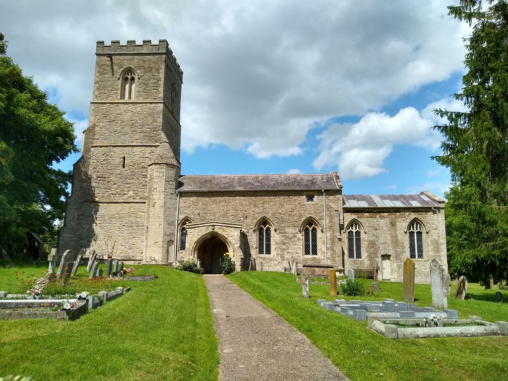
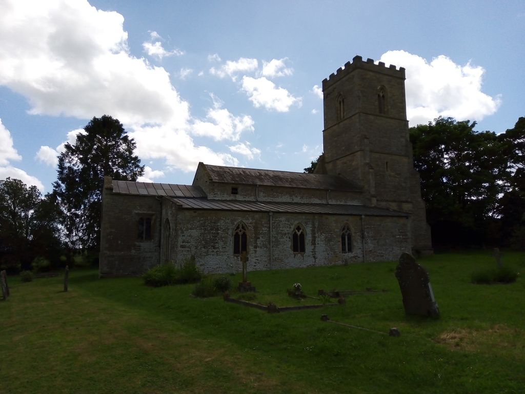
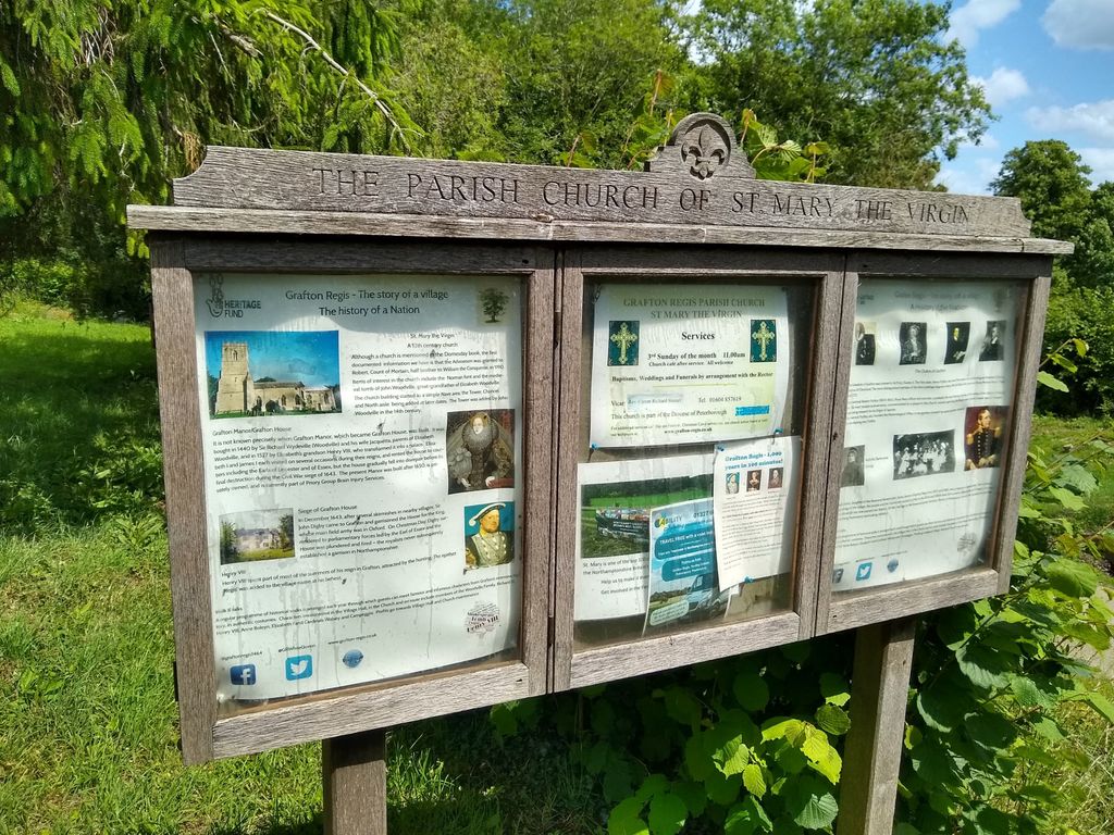
| Location | : | Grafton Regis, South Northamptonshire Borough, England |
| Coordinate | : | 52.1154430, -0.8931010 |
| Description | : | The original building on the site of St Mary the Virgin was built in the Norman times and is recorded as early as 1189. Very little remains of the original building as it has been extended, built up and generally tinkered with through the centuries. Sir John Woodville, great grandfather of Elizabeth Woodville, rose to the rank of Sheriff of Northampton and built the tower at the west end of the church. His altar tomb of freestone is St Mary’s most important monument. Deeply incised in the alabaster top is the figure of a man in full armour, his... Read More |
frequently asked questions (FAQ):
-
Where is St Mary's Church?
St Mary's Church is located at Grafton Regis, South Northamptonshire Borough ,Northamptonshire ,England.
-
St Mary's Church cemetery's updated grave count on graveviews.com?
8 memorials
-
Where are the coordinates of the St Mary's Church?
Latitude: 52.1154430
Longitude: -0.8931010
Nearby Cemetories:
1. St Leonards Church
Yardley Gobion, South Northamptonshire Borough, England
Coordinate: 52.0962081, -0.8844584
2. United Reformed Church
Potterspury, South Northamptonshire Borough, England
Coordinate: 52.0836703, -0.8887879
3. Potterspury Cemetery
Potterspury, South Northamptonshire Borough, England
Coordinate: 52.0803020, -0.8898052
4. St James the Great Churchyard
Hanslope, Milton Keynes Borough, England
Coordinate: 52.1129940, -0.8274720
5. St James the Great Churchyard
Paulerspury, South Northamptonshire Borough, England
Coordinate: 52.1032000, -0.9565000
6. St. Simon & St. Jude Churchyard
Castlethorpe, Milton Keynes Borough, England
Coordinate: 52.0931117, -0.8349450
7. St. Peter & St. Paul's Parish Churchyard
Cosgrove, South Northamptonshire Borough, England
Coordinate: 52.0748600, -0.8474600
8. Courteenhall
Courteenhall, South Northamptonshire Borough, England
Coordinate: 52.1695200, -0.8834900
9. St. Mary's Churchyard
Easton Neston, South Northamptonshire Borough, England
Coordinate: 52.1363720, -0.9756590
10. St Mary Magdalen Churchyard
Stony Stratford, Milton Keynes Borough, England
Coordinate: 52.0587470, -0.8550560
11. St. Mary and St. Giles Churchyard
Stony Stratford, Milton Keynes Borough, England
Coordinate: 52.0569580, -0.8535910
12. Holy Trinity Churchyard
Wolverton, Milton Keynes Borough, England
Coordinate: 52.0642500, -0.8297700
13. Holy Trinity Churchyard
Deanshanger, South Northamptonshire Borough, England
Coordinate: 52.0493600, -0.8907600
14. Blisworth
Blisworth, South Northamptonshire Borough, England
Coordinate: 52.1751366, -0.9416729
15. Brackley Road Cemetery
Towcester, South Northamptonshire Borough, England
Coordinate: 52.1294010, -0.9997560
16. Calverton Road Cemetery
Stony Stratford, Milton Keynes Borough, England
Coordinate: 52.0534300, -0.8511800
17. St John the Evangelist Churchyard
Wicken, South Northamptonshire Borough, England
Coordinate: 52.0489000, -0.9149000
18. St. Peter's Churchyard
Stoke Goldington, Milton Keynes Borough, England
Coordinate: 52.1348000, -0.7865000
19. St. John the Baptist Churchyard
Tiffield, South Northamptonshire Borough, England
Coordinate: 52.1586117, -0.9794450
20. London Road Cemetery
Stony Stratford, Milton Keynes Borough, England
Coordinate: 52.0529290, -0.8439400
21. St. Guthlac's Churchyard
Milton Keynes Borough, England
Coordinate: 52.0483770, -0.8634780
22. St Guthlac's Church Passenham
Old Stratford, South Northamptonshire Borough, England
Coordinate: 52.0481170, -0.8634000
23. Lillingstone Lovell Cemetery
Lillingstone Lovell, Aylesbury Vale District, England
Coordinate: 52.0584600, -0.9619000
24. Parish Church of the Assumption
Lillingstone Lovell, Aylesbury Vale District, England
Coordinate: 52.0582400, -0.9621460