| Memorials | : | 1 |
| Location | : | Hampton Lovett, Wychavon District, England |
| Coordinate | : | 52.2885000, -2.1641400 |
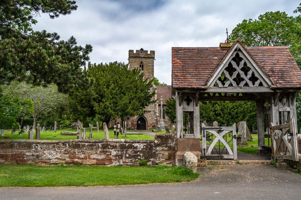
| Description | : | Click for Directions and Contact Information. Just north of Droitwich, Hampton Lovett was the site of a manor house which belonged to the Lovett and then Blount families, and was rebuilt in grand style by Pakingtons, under whose ownership it was destroyed in the Civil War. That house was located east of the parish church, which has existed since the conquest. A Grade-I listed building, the church of St Mary & All Saints is chiefly medieval, although the nave, chancel, and both north and south doorways are Norman. The north chancel was added in 1414 as a chantry... Read More |
frequently asked questions (FAQ):
-
Where is St. Mary & All Saints Churchyard?
St. Mary & All Saints Churchyard is located at The ForestLane Hampton Lovett, Wychavon District ,Worcestershire , WR9 0LUEngland.
-
St. Mary & All Saints Churchyard cemetery's updated grave count on graveviews.com?
1 memorials
-
Where are the coordinates of the St. Mary & All Saints Churchyard?
Latitude: 52.2885000
Longitude: -2.1641400
Nearby Cemetories:
1. St. Augustine Churchyard
Droitwich Spa, Wychavon District, England
Coordinate: 52.2709800, -2.1457700
2. St Nicholas Churchyard
Droitwich Spa, Wychavon District, England
Coordinate: 52.2676400, -2.1573700
3. St Andrew's Church
Droitwich Spa, Wychavon District, England
Coordinate: 52.2683700, -2.1486900
4. St. Mary's Churchyard
Elmbridge, Wychavon District, England
Coordinate: 52.3088400, -2.1490800
5. St. Mary's Churchyard
Droitwich Spa, Wychavon District, England
Coordinate: 52.2637900, -2.1505600
6. St. Mary's Churchyard
Doverdale, Wychavon District, England
Coordinate: 52.2922300, -2.2064500
7. Sacred Heart & Saint Catherine Churchyard
Droitwich Spa, Wychavon District, England
Coordinate: 52.2588639, -2.1551795
8. St Peters Churchyard
Droitwich Spa, Wychavon District, England
Coordinate: 52.2605200, -2.1446400
9. St. Michael's Churchyard
Salwarpe, Wychavon District, England
Coordinate: 52.2567600, -2.1850900
10. St John the Baptist Churchyard
Hadzor, Wychavon District, England
Coordinate: 52.2612700, -2.1253600
11. St. Mary de Wyche Churchyard
Wychbold, Wychavon District, England
Coordinate: 52.2910500, -2.1047300
12. St. Richard & St. Hubert Churchyard
Hadzor, Wychavon District, England
Coordinate: 52.2590340, -2.1279577
13. St. Michael's Churchyard
Elmley Lovett, Wychavon District, England
Coordinate: 52.3192835, -2.2031819
14. St. Michael's Churchyard
Upton Warren, Wychavon District, England
Coordinate: 52.3053500, -2.1030600
15. St Andrews Churchyard
Ombersley, Wychavon District, England
Coordinate: 52.2699600, -2.2294600
16. St. Michael's Churchyard
Rushock, Wyre Forest District, England
Coordinate: 52.3386730, -2.1708700
17. St. Mary's Churchyard
Crossway Green, Wychavon District, England
Coordinate: 52.3167100, -2.2368100
18. St Michael and All Angels Churchyard
Martin Hussingtree, Wychavon District, England
Coordinate: 52.2364000, -2.1819030
19. St. Michaels & All Angels Churchyard
Stoke Prior, Bromsgrove District, England
Coordinate: 52.3073925, -2.0757422
20. St. Mary the Virgin Churchyard
Hanbury, Wychavon District, England
Coordinate: 52.2772778, -2.0684032
21. St. Martin's Churchyard
Holt, Malvern Hills District, England
Coordinate: 52.2609800, -2.2510900
22. St James Churchyard
Oddingley, Wychavon District, England
Coordinate: 52.2295031, -2.1265901
23. St. James Churchyard
Hindlip, Wychavon District, England
Coordinate: 52.2254059, -2.1767057
24. St James Churchyard
Hartlebury, Wychavon District, England
Coordinate: 52.3358770, -2.2353530


