
| Memorials | : | 0 |
| Location | : | Amesbury, Wiltshire Unitary Authority, England |
| Coordinate | : | 51.1717890, -1.7841730 |
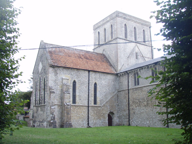
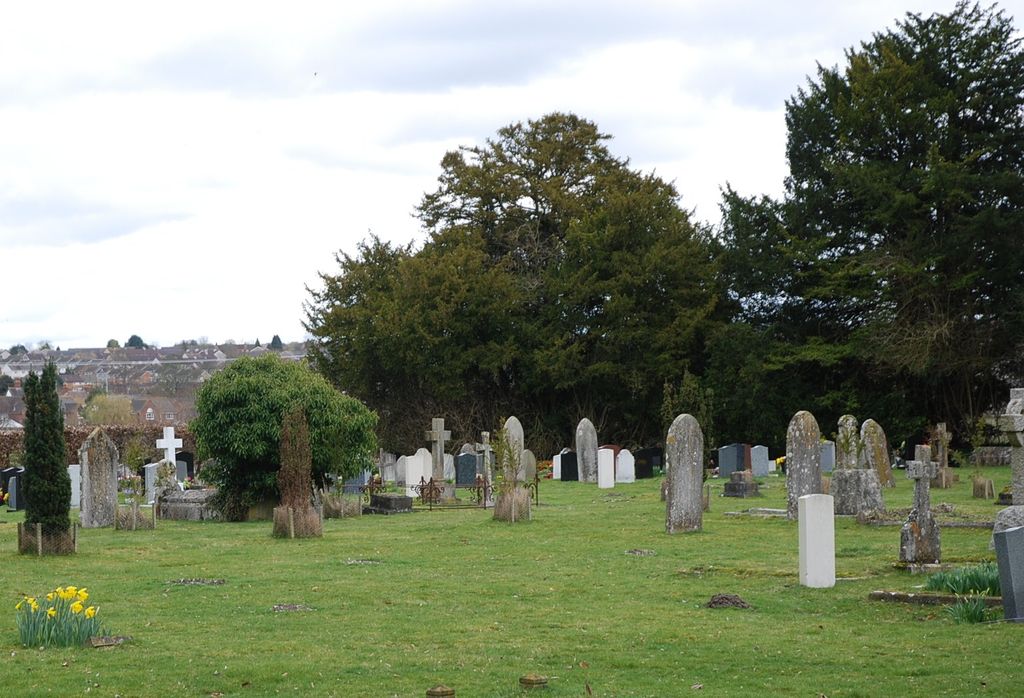
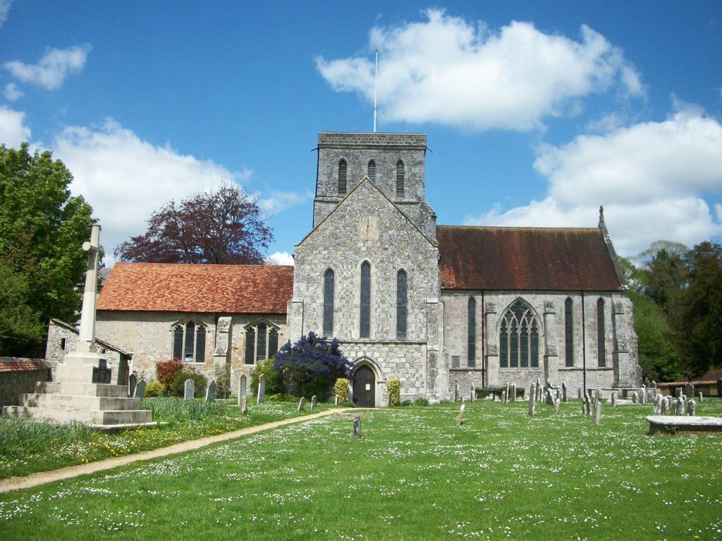
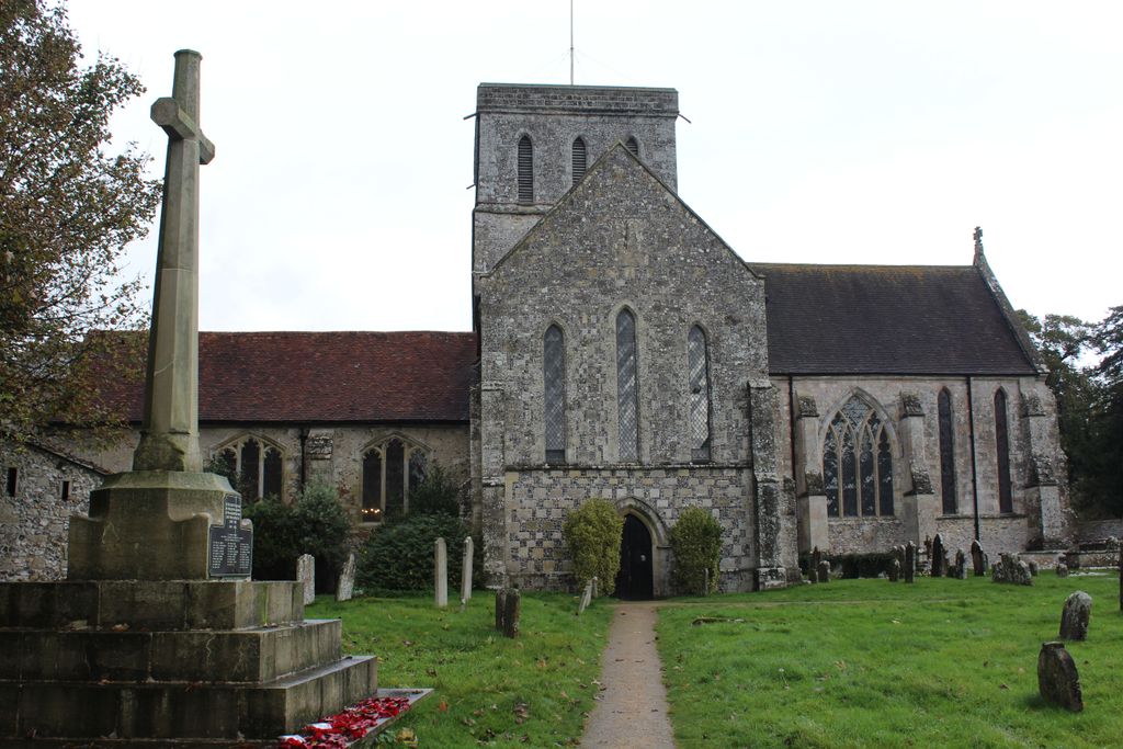
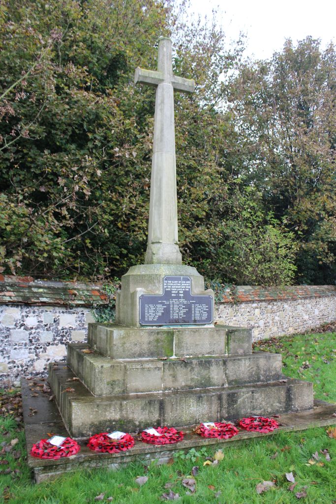
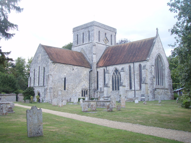
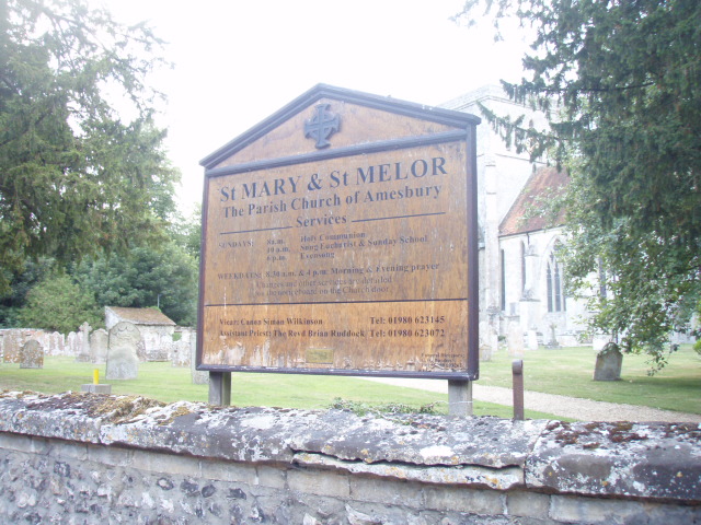
| Description | : | Church of St. Mary and St. Melor, Amesbury Nearby is Amesbury Cemetery . There was a church at Amesbury from the foundation of the abbey in 979 and it is possible that there may have been a church before that. It is thought that the dedication of the church was to St. Mary and that it became a joint dedication when the relics of St. Melor were brought to the abbey. The abbey church itself would have been open to all inhabitants as there would not have been any other church. The abbey was dissolved in 1177 and the church was... Read More |
frequently asked questions (FAQ):
-
Where is St Mary & St Melor Churchyard?
St Mary & St Melor Churchyard is located at Church St Amesbury, Wiltshire Unitary Authority ,Wiltshire , SP4 7EUEngland.
-
St Mary & St Melor Churchyard cemetery's updated grave count on graveviews.com?
0 memorials
-
Where are the coordinates of the St Mary & St Melor Churchyard?
Latitude: 51.1717890
Longitude: -1.7841730
Nearby Cemetories:
1. Amesbury Cemetery
Amesbury, Wiltshire Unitary Authority, England
Coordinate: 51.1697730, -1.7869410
2. Stockport Avenue Cemetery
Amesbury, Wiltshire Unitary Authority, England
Coordinate: 51.1576900, -1.7644900
3. Bulford Church Cemetery
Bulford, Wiltshire Unitary Authority, England
Coordinate: 51.1935931, -1.7629870
4. Saint Andrew's Churchyard
Durnford, Wiltshire Unitary Authority, England
Coordinate: 51.1438930, -1.8063690
5. All Saints Churchyard
Durrington, Wiltshire Unitary Authority, England
Coordinate: 51.2027460, -1.7766740
6. Durrington Cemetery
Durrington, Wiltshire Unitary Authority, England
Coordinate: 51.2064970, -1.7827420
7. St John the Baptist
Allington, Wiltshire Unitary Authority, England
Coordinate: 51.1533200, -1.7094250
8. St Andrews Churchyard
Allington, Wiltshire Unitary Authority, England
Coordinate: 51.1459710, -1.7149400
9. St. Nicholas Churchyard
Cholderton, Wiltshire Unitary Authority, England
Coordinate: 51.1811320, -1.6764660
10. St Peter Churchyard
Shipton Bellinger, Test Valley Borough, England
Coordinate: 51.2076010, -1.6681930
11. Bemerton St John
Bemerton, Wiltshire Unitary Authority, England
Coordinate: 51.0759324, -1.8333699
12. St Andrew Churchyard
Bemerton, Wiltshire Unitary Authority, England
Coordinate: 51.0740580, -1.8252960
13. St Michael and All Angels Churchyard
Quarley, Test Valley Borough, England
Coordinate: 51.1944330, -1.6109670
14. St Leonard Churchyard
Grateley, Test Valley Borough, England
Coordinate: 51.1764630, -1.6065760
15. St. Peter's Churchyard
Britford, Wiltshire Unitary Authority, England
Coordinate: 51.0551650, -1.7689880
16. Barford St Martin Church Cemetery
Barford St Martin, Wiltshire Unitary Authority, England
Coordinate: 51.0837860, -1.9186010
17. St Peter Churchyard
Over Wallop, Test Valley Borough, England
Coordinate: 51.1428400, -1.5950900
18. Saint Martin Churchyard
Barford St Martin, Wiltshire Unitary Authority, England
Coordinate: 51.0818400, -1.9210400
19. St Peter and St Paul Churchyard
Kimpton, Test Valley Borough, England
Coordinate: 51.2180470, -1.5988270
20. Kimpton Cemetery
Kimpton, Test Valley Borough, England
Coordinate: 51.2185900, -1.5970400
21. St Peter and St Paul Churchyard
Thruxton, Test Valley Borough, England
Coordinate: 51.2087890, -1.5875460
22. Broad Chalke Congregational Chapelyard
Broad Chalke, Wiltshire Unitary Authority, England
Coordinate: 51.0523805, -1.7071162
23. St Mary's Churchyard
Alderbury, Wiltshire Unitary Authority, England
Coordinate: 51.0413780, -1.7413140
24. St Mary Churchyard
Amport, Test Valley Borough, England
Coordinate: 51.1962480, -1.5728800