
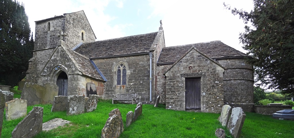
| Memorials | : | 38 |
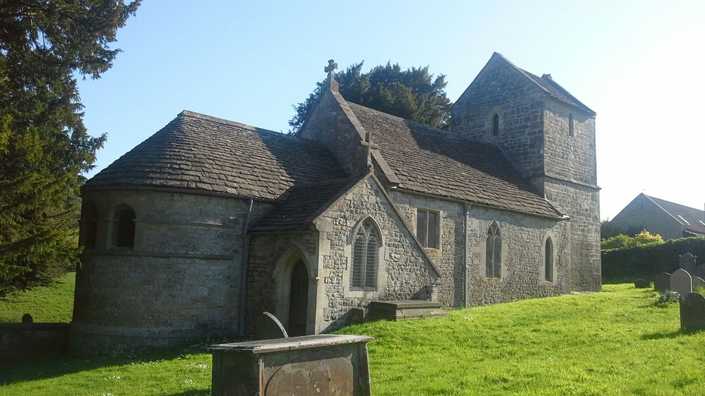
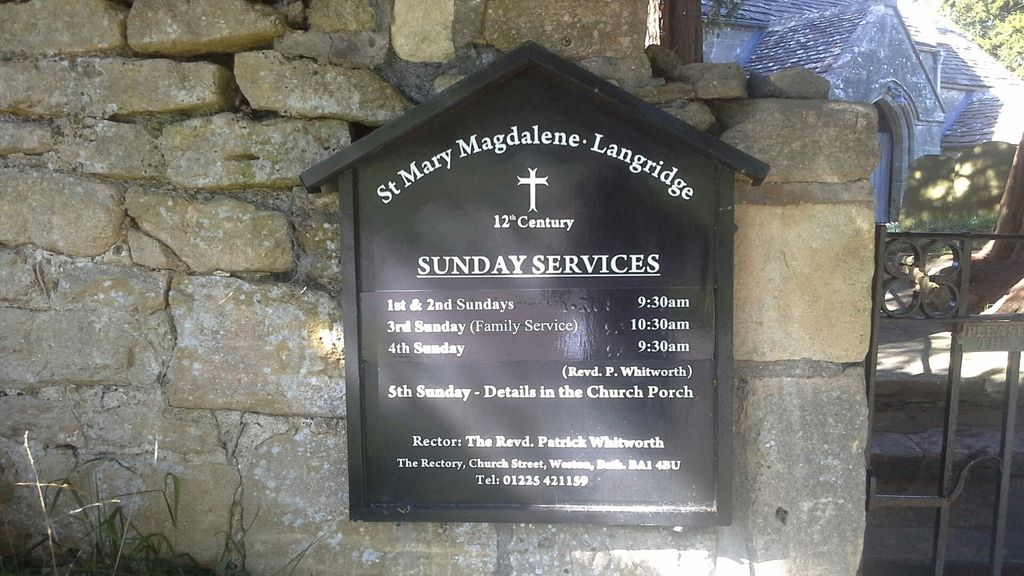
| Location | : | Langridge, Bath and North East Somerset Unitary Authority, England |
| Coordinate | : | 51.4242860, -2.3750640 |
| Description | : | At Lansdown, Bath, take the lane E to Langridge. Go down the lane for about a mile. Church is on a bank on the left, below Court Farm. |
frequently asked questions (FAQ):
-
Where is St Mary Magdalene?
St Mary Magdalene is located at Langridge Lane Langridge, Bath and North East Somerset Unitary Authority ,Somerset , BA1 8AJEngland.
-
St Mary Magdalene cemetery's updated grave count on graveviews.com?
38 memorials
-
Where are the coordinates of the St Mary Magdalene?
Latitude: 51.4242860
Longitude: -2.3750640
Nearby Cemetories:
1. All Saints Churchyard
Woolley, Bath and North East Somerset Unitary Authority, England
Coordinate: 51.4149600, -2.3612130
2. St. Mary the Blessed Virgin Churchyard
Swainswick, Bath and North East Somerset Unitary Authority, England
Coordinate: 51.4142080, -2.3514370
3. Landsdowne Hill Burial Ground
Lansdown, Bath and North East Somerset Unitary Authority, England
Coordinate: 51.4314290, -2.4014230
4. Lansdown Cemetery
Lansdown, Bath and North East Somerset Unitary Authority, England
Coordinate: 51.4063620, -2.3780520
5. Blessed Virgin Mary Churchyard
Charlcombe, Bath and North East Somerset Unitary Authority, England
Coordinate: 51.4046040, -2.3629440
6. Countess of Huntingdon's Chapel
Walcot, Bath and North East Somerset Unitary Authority, England
Coordinate: 51.3967020, -2.3907434
7. All Saints Churchyard
Weston, Bath and North East Somerset Unitary Authority, England
Coordinate: 51.3956850, -2.3881320
8. Holy Trinity Churchyard
Cold Ashton, South Gloucestershire Unitary Authority, England
Coordinate: 51.4530440, -2.3597430
9. St. Martin Churchyard
Northstoke, Bath and North East Somerset Unitary Authority, England
Coordinate: 51.4202400, -2.4273800
10. St Saviour's Church Crypt
Larkhall, Bath and North East Somerset Unitary Authority, England
Coordinate: 51.3956300, -2.3465100
11. Church of St Catherine
St Catherine, Bath and North East Somerset Unitary Authority, England
Coordinate: 51.4308200, -2.3212100
12. St Catherine Churchyard
Batheaston, Bath and North East Somerset Unitary Authority, England
Coordinate: 51.4307700, -2.3209500
13. Independent Burial Ground Argyle Chapel
Bath, Bath and North East Somerset Unitary Authority, England
Coordinate: 51.3925420, -2.3536920
14. Moravian Burial Ground
Bath, Bath and North East Somerset Unitary Authority, England
Coordinate: 51.3894150, -2.3798150
15. Walcot Methodist Chapel Burial Ground
Bath, Bath and North East Somerset Unitary Authority, England
Coordinate: 51.3897080, -2.3579610
16. St John the Baptist Churchyard
Batheaston, Bath and North East Somerset Unitary Authority, England
Coordinate: 51.4097940, -2.3213520
17. St. Swithin Churchyard
Bath, Bath and North East Somerset Unitary Authority, England
Coordinate: 51.3885480, -2.3594500
18. St. John the Baptist Churchyard
Bathwick, Bath and North East Somerset Unitary Authority, England
Coordinate: 51.3886890, -2.3547030
19. Locksbrook St Saviour's Cemetery
Bath and North East Somerset Unitary Authority, England
Coordinate: 51.3867880, -2.3863380
20. St. Michael's Cemetery
Bath, Bath and North East Somerset Unitary Authority, England
Coordinate: 51.3859700, -2.3814500
21. St. Mary's Churchyard
Bathwick, Bath and North East Somerset Unitary Authority, England
Coordinate: 51.3876120, -2.3543540
22. Locksbrook Cemetery
Lower Weston, Bath and North East Somerset Unitary Authority, England
Coordinate: 51.3845180, -2.3850300
23. St. Michael's Burial Ground
Bath, Bath and North East Somerset Unitary Authority, England
Coordinate: 51.3838810, -2.3594090
24. Ss Michael & Paul Churchyard
Bath, Bath and North East Somerset Unitary Authority, England
Coordinate: 51.3834970, -2.3596980