| Memorials | : | 0 |
| Location | : | Stoke Bishop, Bristol Unitary Authority, England |
| Coordinate | : | 51.4767100, -2.6356800 |
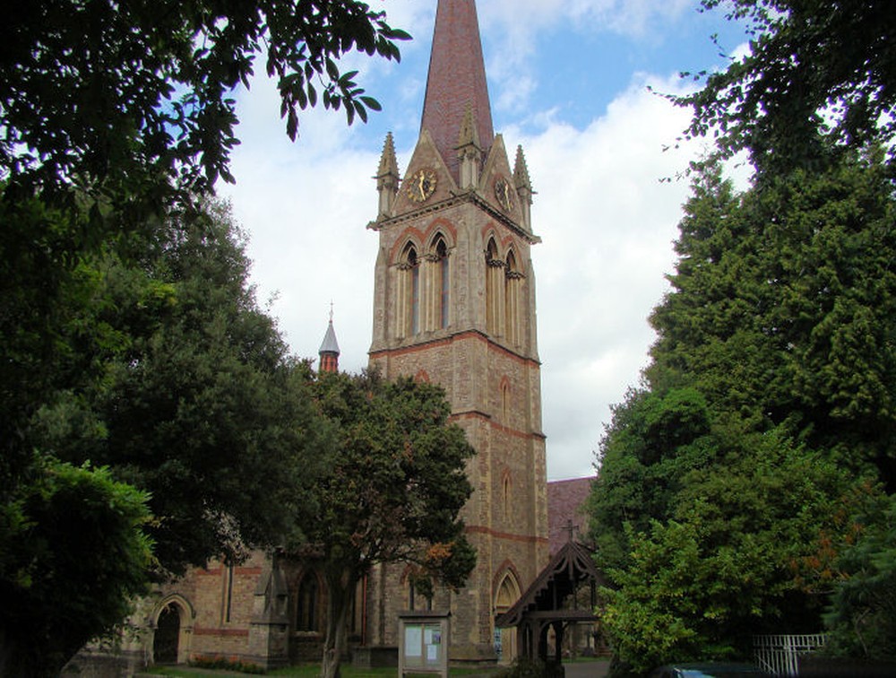
| Description | : | The parish of Stoke Bishop was created in 1857 by splitting up the parish of Westbury-on-Try, and plans made for the building a church to be be designed by architect John Norton. Construction took place in stages, and began on August 5th, 1858 when the foundation stone was laid. The chancel, parts of some of the aisles, and the base of the tower were completed by March 13, 1860, when the building was consecrated. The church was nearly finished in December 1871 when a huge gust of wind toppled the tower and delayed completion until the following year. The church... Read More |
frequently asked questions (FAQ):
-
Where is St. Mary Magdalene Churchyard?
St. Mary Magdalene Churchyard is located at Mariners Drive Stoke Bishop, Bristol Unitary Authority ,Bristol , Bs9 1QJEngland.
-
St. Mary Magdalene Churchyard cemetery's updated grave count on graveviews.com?
0 memorials
-
Where are the coordinates of the St. Mary Magdalene Churchyard?
Latitude: 51.4767100
Longitude: -2.6356800
Nearby Cemetories:
1. Canford Cemetery and Crematorium
Westbury-on-Trym, Bristol Unitary Authority, England
Coordinate: 51.4946810, -2.6269490
2. Redland Parish Churchyard
Redland, Bristol Unitary Authority, England
Coordinate: 51.4722100, -2.6064130
3. Holy Trinity Churchyard
Abbots Leigh, North Somerset Unitary Authority, England
Coordinate: 51.4631600, -2.6573300
4. Clifton Cathedral
Clifton, Bristol Unitary Authority, England
Coordinate: 51.4596870, -2.6163140
5. Holy Trinity Churchyard
Westbury-on-Trym, Bristol Unitary Authority, England
Coordinate: 51.4939840, -2.6160070
6. Christ Church Cemetery
Clifton, Bristol Unitary Authority, England
Coordinate: 51.4576220, -2.6200000
7. St. Andrew's Churchyard
Clifton, Bristol Unitary Authority, England
Coordinate: 51.4543810, -2.6147460
8. Hope Chapel
Clifton, Bristol Unitary Authority, England
Coordinate: 51.4512800, -2.6216000
9. Henbury Cemetery
Henbury, Bristol Unitary Authority, England
Coordinate: 51.5044590, -2.6414560
10. St Mary the Virgin Churchyard
Henbury, Bristol Unitary Authority, England
Coordinate: 51.5063210, -2.6306320
11. Shirehampton Cemetery
Shirehampton, Bristol Unitary Authority, England
Coordinate: 51.4895290, -2.6797050
12. St. Michael on the Mount Without Churchyard
Bristol, Bristol Unitary Authority, England
Coordinate: 51.4571510, -2.5984070
13. Holy Trinity Churchyard
Horfield, Bristol Unitary Authority, England
Coordinate: 51.4879930, -2.5893570
14. St. James Priory
Bristol, Bristol Unitary Authority, England
Coordinate: 51.4585220, -2.5936690
15. St. James Churchyard
Bristol, Bristol Unitary Authority, England
Coordinate: 51.4585510, -2.5932310
16. St. Mark's Church
Bristol, Bristol Unitary Authority, England
Coordinate: 51.4528770, -2.5999610
17. Church of St John the Baptist
Bristol, Bristol Unitary Authority, England
Coordinate: 51.4559460, -2.5950320
18. Bristol Cathedral
Bristol, Bristol Unitary Authority, England
Coordinate: 51.4517059, -2.6007321
19. Broadmead Baptist Church
Bristol, Bristol Unitary Authority, England
Coordinate: 51.4575500, -2.5915500
20. Brunswick Square Unitarian Burying Ground
Bristol, Bristol Unitary Authority, England
Coordinate: 51.4605400, -2.5877800
21. All Saints Church
Bristol, Bristol Unitary Authority, England
Coordinate: 51.4546990, -2.5932550
22. Holy Trinity Church
Bristol, Bristol Unitary Authority, England
Coordinate: 51.4559548, -2.5915587
23. St Stephen's Churchyard
Bristol, Bristol Unitary Authority, England
Coordinate: 51.4535380, -2.5937270
24. St Nicholas Churchyard
Bristol, Bristol Unitary Authority, England
Coordinate: 51.4539170, -2.5923050


