
| Memorials | : | 0 |
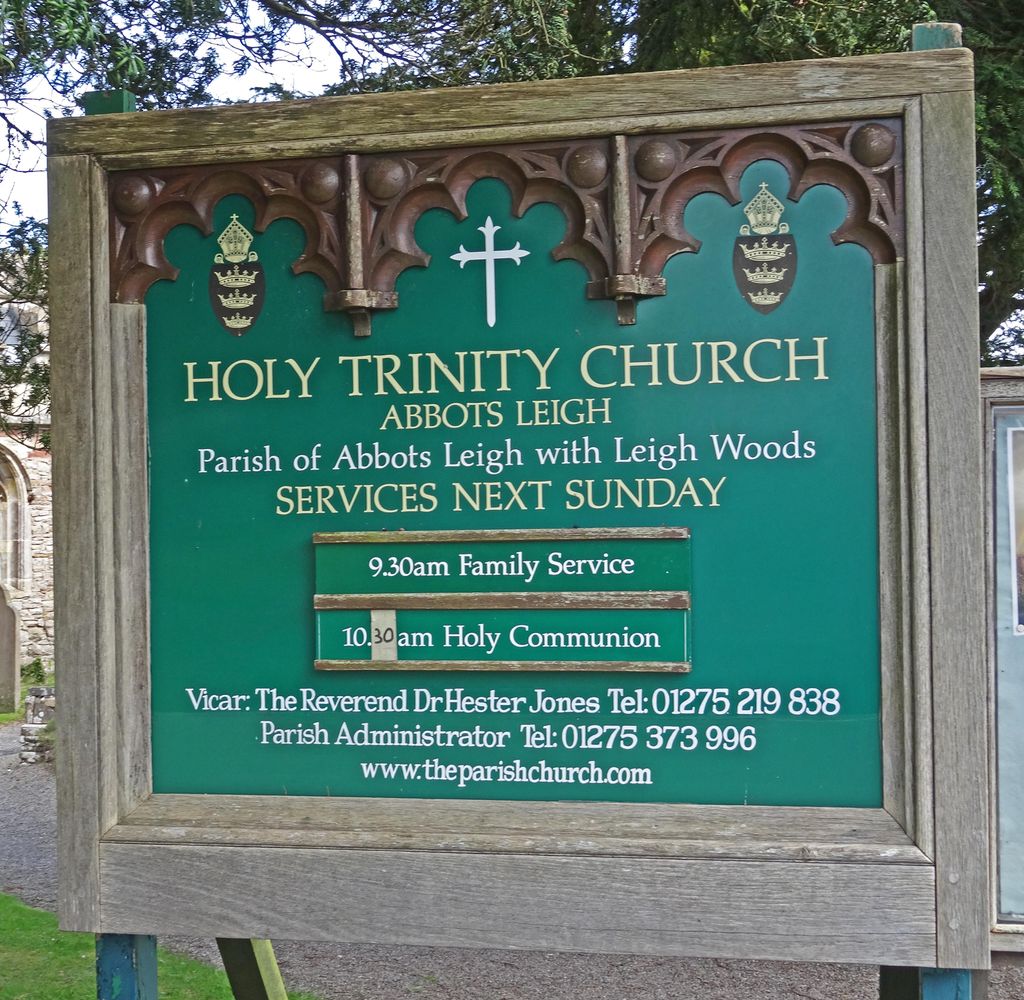
| Location | : | Abbots Leigh, North Somerset Unitary Authority, England |
| Coordinate | : | 51.4631600, -2.6573300 |
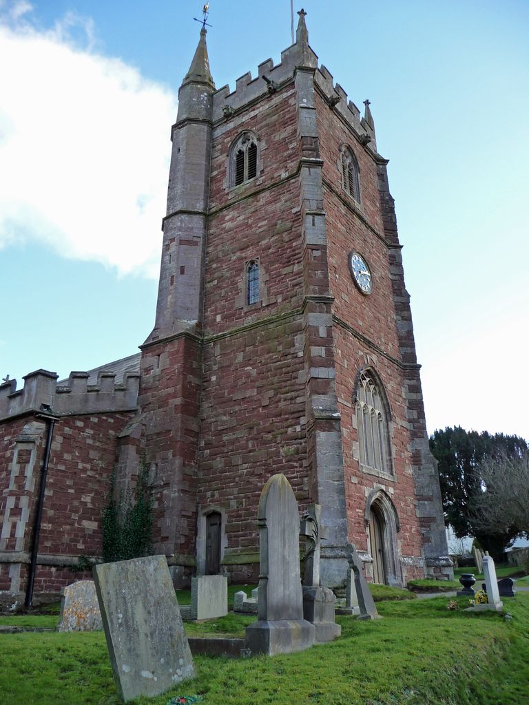
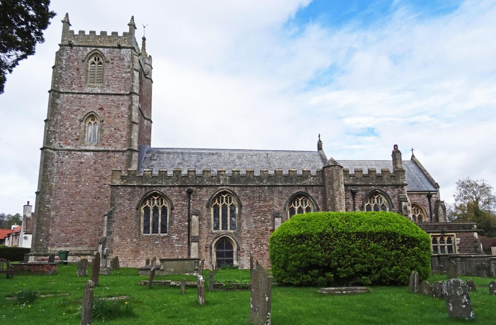
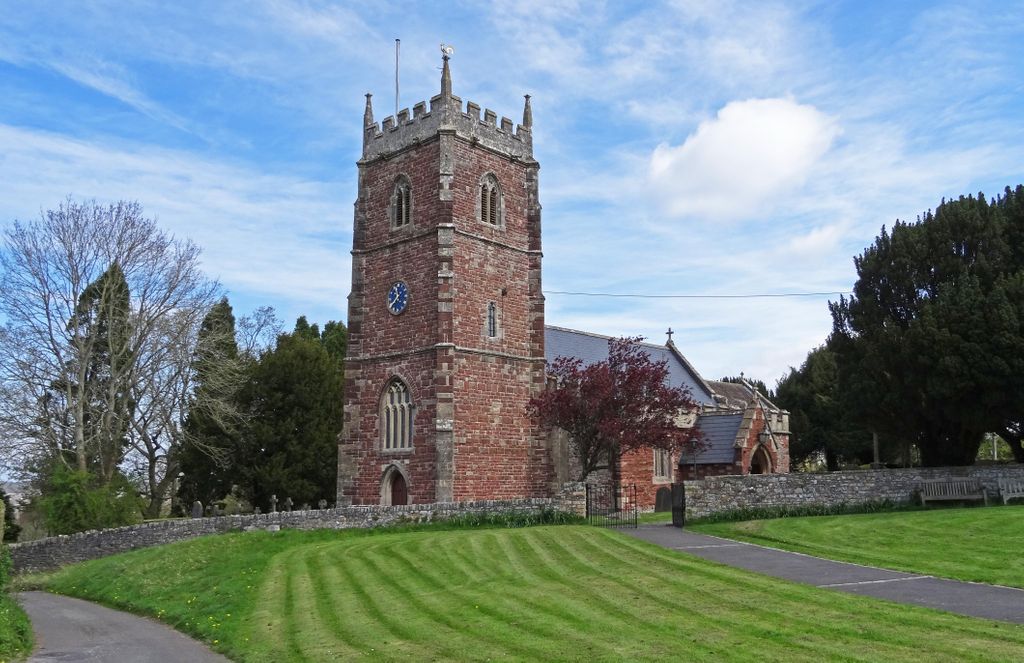
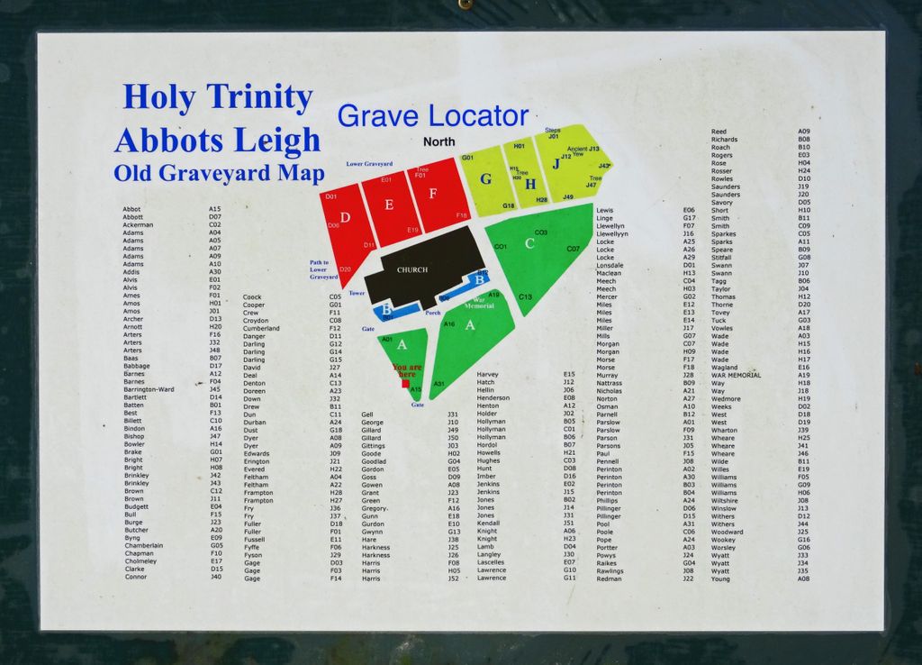
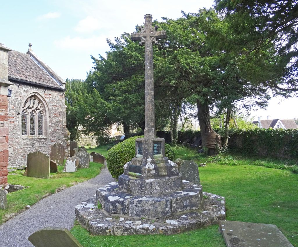
| Description | : | Standing on the hillside in a peaceful location with views across the Bristol Channel to the Welsh Hills, is the parish church of the Holy Trinity. It is a 15th-century Perpendicular Gothic building, restored and partially rebuilt in 1847–48 after a fire. Another fire occurred in the church in 1972. By a coincidence the date was the same as the previous fire, February 21st. The consequence of this fire was not nearly so serious; the organ was destroyed and one or two pews; the roof was badly scorched. Inside the church the oldest monument is The Norton Canopy Monument in the... Read More |
frequently asked questions (FAQ):
-
Where is Holy Trinity Churchyard?
Holy Trinity Churchyard is located at Church Road Abbots Leigh, North Somerset Unitary Authority ,Somerset , BS8 3QTEngland.
-
Holy Trinity Churchyard cemetery's updated grave count on graveviews.com?
0 memorials
-
Where are the coordinates of the Holy Trinity Churchyard?
Latitude: 51.4631600
Longitude: -2.6573300
Nearby Cemetories:
1. St. Mary Magdalene Churchyard
Stoke Bishop, Bristol Unitary Authority, England
Coordinate: 51.4767100, -2.6356800
2. Christ Church Cemetery
Clifton, Bristol Unitary Authority, England
Coordinate: 51.4576220, -2.6200000
3. Hope Chapel
Clifton, Bristol Unitary Authority, England
Coordinate: 51.4512800, -2.6216000
4. Clifton Cathedral
Clifton, Bristol Unitary Authority, England
Coordinate: 51.4596870, -2.6163140
5. St. Bartholomew's Churchyard
Failand, North Somerset Unitary Authority, England
Coordinate: 51.4584000, -2.7000000
6. St. Andrew's Churchyard
Clifton, Bristol Unitary Authority, England
Coordinate: 51.4543810, -2.6147460
7. All Saints Churchyard
Long Ashton, North Somerset Unitary Authority, England
Coordinate: 51.4358100, -2.6439400
8. Shirehampton Cemetery
Shirehampton, Bristol Unitary Authority, England
Coordinate: 51.4895290, -2.6797050
9. Saint George Churchyard
Easton-in-Gordano, North Somerset Unitary Authority, England
Coordinate: 51.4785490, -2.7013400
10. Redland Parish Churchyard
Redland, Bristol Unitary Authority, England
Coordinate: 51.4722100, -2.6064130
11. Canford Cemetery and Crematorium
Westbury-on-Trym, Bristol Unitary Authority, England
Coordinate: 51.4946810, -2.6269490
12. Bristol Cathedral
Bristol, Bristol Unitary Authority, England
Coordinate: 51.4517059, -2.6007321
13. St. Mark's Church
Bristol, Bristol Unitary Authority, England
Coordinate: 51.4528770, -2.5999610
14. St. Michael on the Mount Without Churchyard
Bristol, Bristol Unitary Authority, England
Coordinate: 51.4571510, -2.5984070
15. Saint Mary's the Virgin Churchyard
Portbury, North Somerset Unitary Authority, England
Coordinate: 51.4756000, -2.7173000
16. Church of St John the Baptist
Bristol, Bristol Unitary Authority, England
Coordinate: 51.4559460, -2.5950320
17. St. James Priory
Bristol, Bristol Unitary Authority, England
Coordinate: 51.4585220, -2.5936690
18. Holy Trinity Churchyard
Westbury-on-Trym, Bristol Unitary Authority, England
Coordinate: 51.4939840, -2.6160070
19. St. James Churchyard
Bristol, Bristol Unitary Authority, England
Coordinate: 51.4585510, -2.5932310
20. Tyntesfield House Chapel
Wraxall, North Somerset Unitary Authority, England
Coordinate: 51.4407400, -2.7110500
21. Hebron Road Burial Ground
Bristol, Bristol Unitary Authority, England
Coordinate: 51.4400610, -2.6041020
22. St Paul's Churchyard
Bedminster, Bristol Unitary Authority, England
Coordinate: 51.4452800, -2.5989500
23. St Stephen's Churchyard
Bristol, Bristol Unitary Authority, England
Coordinate: 51.4535380, -2.5937270
24. All Saints Church
Bristol, Bristol Unitary Authority, England
Coordinate: 51.4546990, -2.5932550